Over the last 2 weeks we have had some chilly temperatures. In fact a large portion of the country has been cooler than average. Some of our days we were well below average.
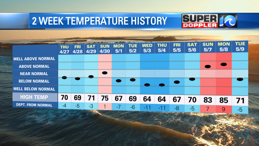
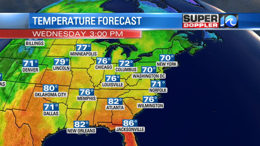
There were two warm days recently. We were above average on Sunday and Monday. But then a cold front dropped in and kept the high at 71 in Norfolk yesterday. It was a chilly evening as the breeze picked up out of the northeast.
Today the front is to our south, and it is dropping farther south. High pressure is building in from the north.
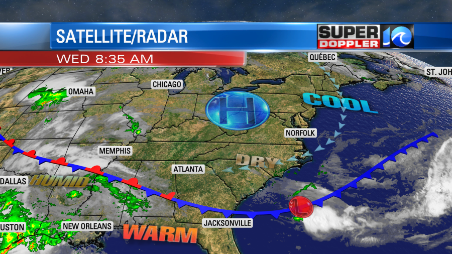
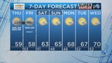
We’ll have a lot of sunshine today, but the northeast breeze will be cool at times. High temps will be near 70 in the metro with some upper 60s near the shore and some mid 70s inland.
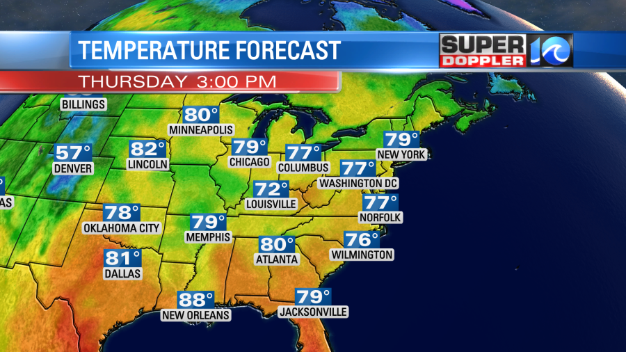
We’ll warm things up tomorrow as the wind turns out of the south. High temps will rise to the upper 70s.
We’ll have another mostly sunny day, and it should be very nice out. We’ll warm it up to the low 80s on Friday with partly cloudy skies. The next chance for rain will be on Saturday. We’ll be partly cloudy, but some scattered showers and storms will be possible later in the day. At least it looks drier for Mother’s Day. I only see some isolated showers on that day. Stay tuned for updates if you have plans. High temps will be in the 70s.
In world news… NASA recently launched a couple of satellites that are intended to monitor and study tropical systems. The “Cubesat” satellites are expected to stay in low-earth orbit, and they will be able to take shots of the tropics more often. It’s no accident that their acronym is TROPICS. It stands for “Time-Resolved Observations of Precipitation structure and storm Intensity with a Constellation of Smallsats”. Two more satellites are expected to launch in the next couple of weeks. More frequent imaging will hopefully help forecasting in the years ahead. Here is the article with more information: NASA launches Cubesat Satellites.
Meteorologist: Jeremy Wheeler