Boy it really was a nice day yesterday! High temps were in the low-to-mid 80s with low humidity. We had a nice northeast breeze that really helped out in the comfort levels. Today we’ll have more of a light east/southeast wind. This will start to pull in a little more humidity, and it will warm us up a bit more. We have high pressure shifting around a bit. It is now to our northeast.
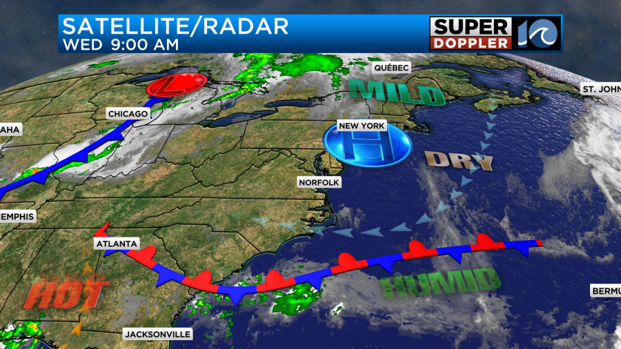
We’ll have partly cloudy skies. With the moisture increasing there may be some isolated showers or storms, but the chance is low. High temps will rise to the mid 80s this afternoon.
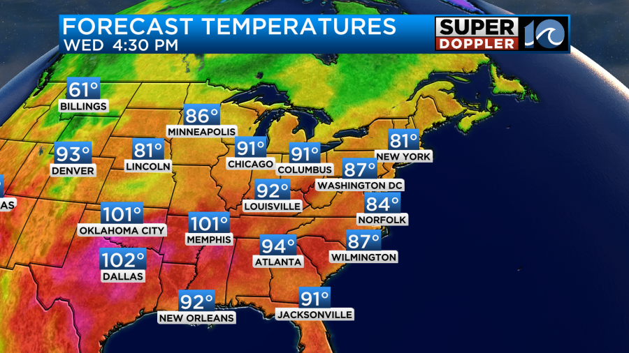
It will be a pretty good day locally. The weather across much of the country should be good for travel today.
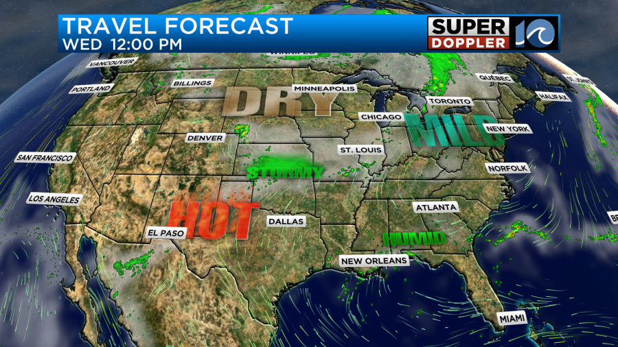
There will be some strong storms over the central U.S.
Tomorrow the high will push offshore a bit more. This will let the surface winds turn more out of the southwest. This will be able to pull up even more heat and humidity for the 4th of July. High temps will aim for the low 90s. However, the heat index will be in the upper 90s.

We’ll be partly cloudy through the day. No rain is forecast. However, some scattered showers and storms will form to our west. As they move east in the evening they should mostly fall apart. However, a couple may survive by the time the fireworks start.
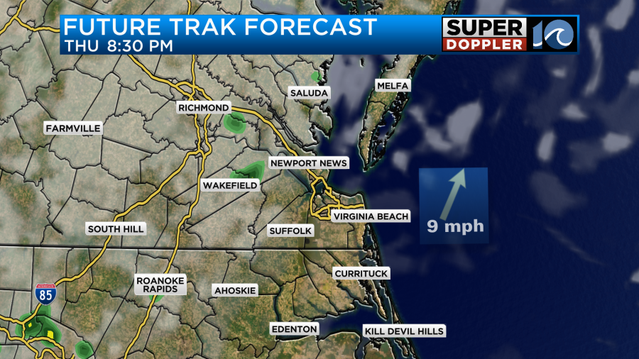
I’m optimistic for now, but check back for updates on that.
As you can see from the earlier graphic things are going to heat up for the weekend. High temps will be in the mid 90s Friday and Saturday. We’ll be partly cloudy with a few showers and storms possible. Most of them should be in the afternoons and evenings, but there could be a couple at other times. The heat index for both of those days will be over 100. We’ll cool down slightly on Sunday with high temps near 90, but it will still be muggy. I think we’ll have some more clouds with a little better chance for rain. This as a cool front stalls out over the area. If the front stalls out sooner, then the rain chances will drop, and temps will be higher.
In the tropics we are tracking hurricane Beryl. This morning the eye was covered up by some high level clouds, but the eye was still physically present.

As of this writing the hurricane had not weakened much in the last 12 hours. It was a category 4 storm with winds of 145mph sustained. The storm is aiming for a path just to the south of Jamaica or right along the southern coast.
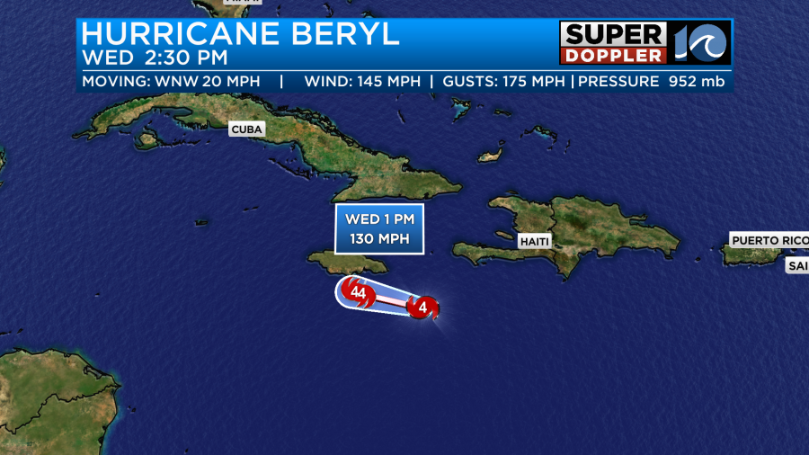
This will affect the island this afternoon. Sustained winds near the core of the storm could run at 130mph sustained with higher gusts. Rainfall could be between 4 and 8″. The storm surge will likely be up to 6 to 9ft. There is some wind shear working on the system. So it’s possible that it will weaken a little before that time.
After that point it will move quickly to the west/northwest. It will indirectly impact the Cayman islands. Then it will aim for the Yucatan Peninsula. The official forecast has it crossing the Yucatan, and then getting into the Gulf of Mexico. The National Hurricane Center has it restrengthening into a hurricane in a few days.

However, there are some models which have been trending more northward over time. There is even a model or two which have it barely touching the north end of the peninsula.
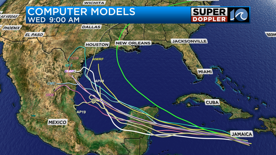
The more north it tracks-the stronger it will be over the Gulf. It could also affect more of Texas in the end. We’ll have a better idea of the strength and track after it interacts with Jamaica.
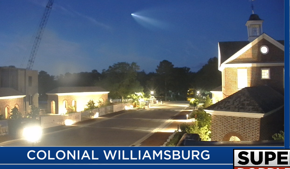
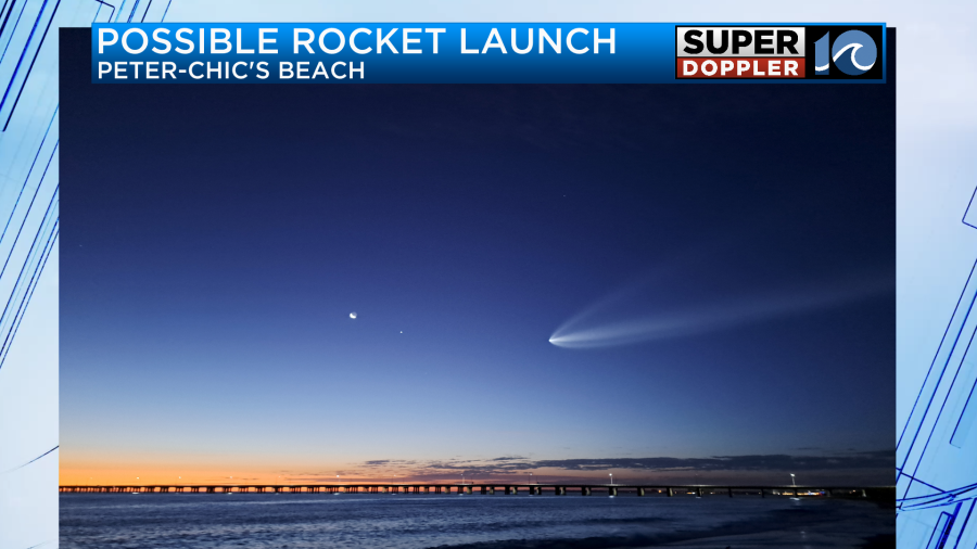
Before I go… This morning we caught the Falcon 9 rocket launch out of Florida on-air, but we didn’t know it at the time. There were some great pics sent in.
Meteorologist: Jeremy Wheeler


