
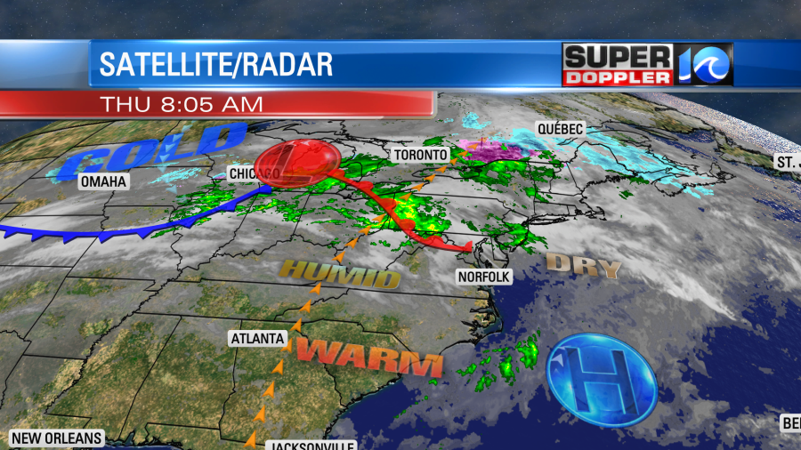
Today’s weather is looking good, but tomorrow’s forecast still looks tricky. High pressure is to our southeast today with a warm front lifting to our north.
We had some beautiful shots this morning on our tower cams! Here is one of them.

We’ll be partly cloudy for most of the day. There will only be an isolated shower well north of the metro. One nuisance will be the wind gusts up to 25mph out of the southwest. This should be a minor speed bump on the road to a really nice day. High temps will climb to the upper 70s with a few 80s this afternoon.
Ok…there will be one more speed bump. The pollen levels are climbing along with the temperatures.
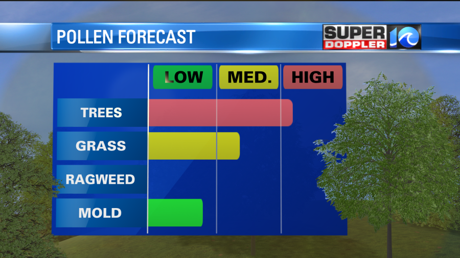
So allergy sufferers (like myself) will have to take that into account. Especially if you are doing yard work today (like myself).
So why is tomorrow tricky? Well, a cold front is expected to drop in from the north/northeast and stall out.
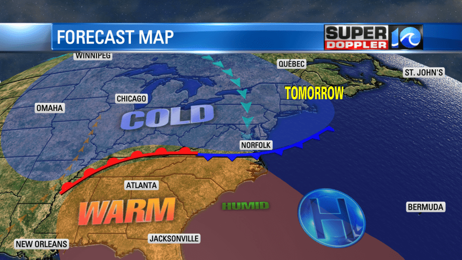
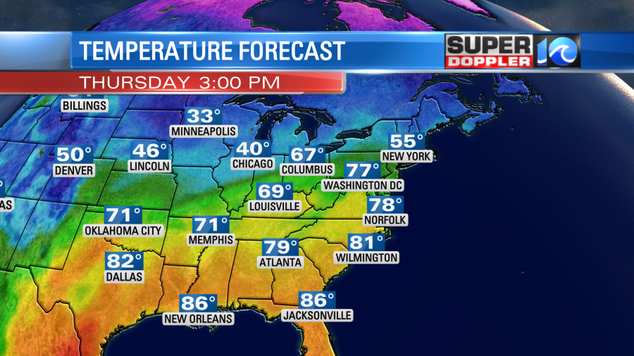
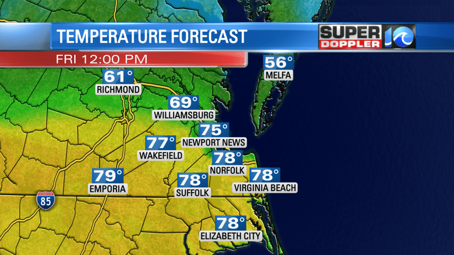
There is some very warm air south of the front and some very chilly air north of it. So we’ll be right on that dividing line for (part) of tomorrow. The latest theme is that we’ll likely warm up through midday. We’ll probably make the 70s over most of the region.
By the early afternoon the front is forecast to slide in from the north/northeast. We call this a back-door cold front as it comes from a rarer direction. Anyway, surface winds will turn from southwesterly to northeasterly. So temps will probably drop down to the 60s in the metro. However, it will be tough as there may be some 80s to the south and 50s and 60s on the Eastern Shore.
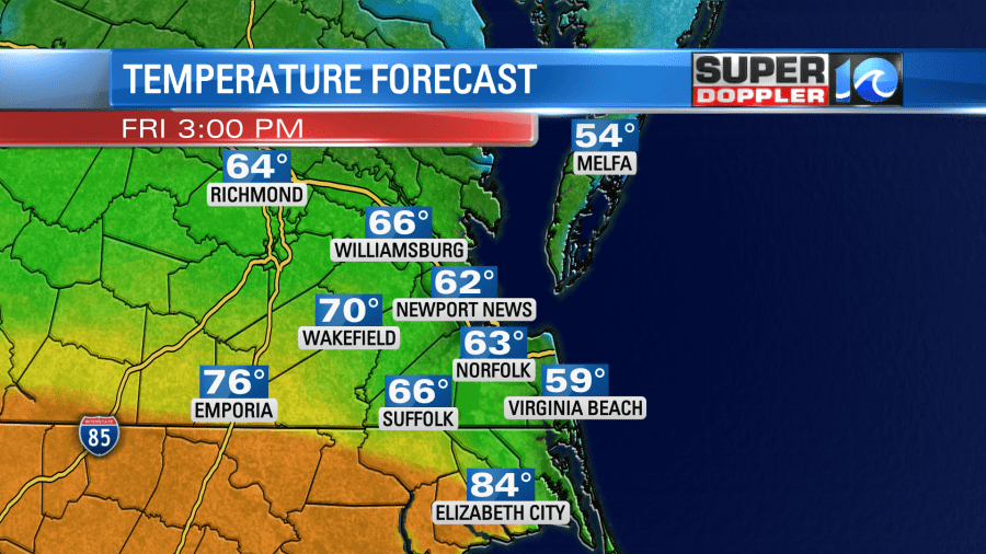
So I recommend taking a light to medium jacket for the pending afternoon cool down, but dress in layers as it may get pretty warm by noon. You may be in shorts in Elizabeth City while you may need the thick jacket on the Eastern Shore.
We’ll be partly cloudy for most of the day, but clouds will increase a bit in the afternoon. A couple of spotty showers could fall along the front.
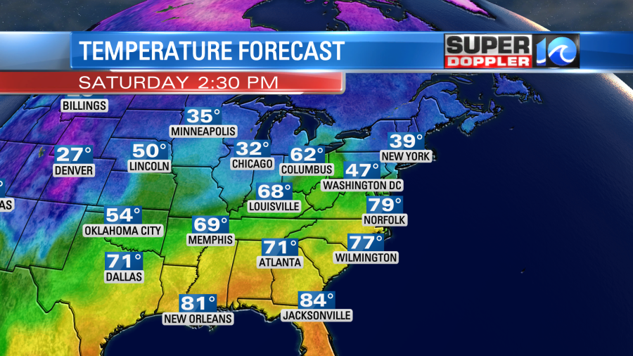
Ironically, the front will move back north as a warm front on Saturday. We are going to warm up again with high temps in the upper 70s.
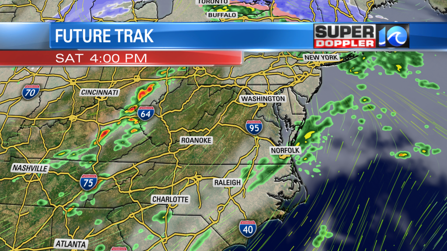
However, another cold front will swipe in from the west during the late afternoon, and that may give us a few showers between the late afternoon and evening.
We’ll have some nice weather on Sunday. It will be cooler, but not bad at all. High temps will be in the low 70s with partly cloudy skies. Then we’ll be cool and dry going into early next week.
One thing I didn’t talk too much about is the humidity.
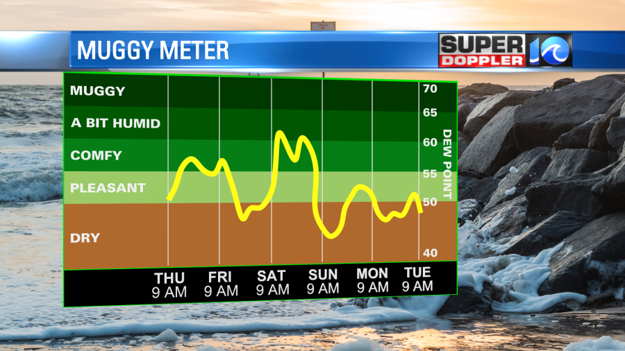
It will be up a bit over the next couple of days. Dew points will be in the upper 50s to low 60s. With temps in the upper 70s to low 80s on a couple of the days you may need to run the A.C.s
In national news…A big headline came out yesterday about a tornado….In L.A. How often does that happen? Very rarely. There was some damage. Here is the article with more information: L.A. Tornado.
Meteorologist: Jeremy Wheeler


