The forecast for today Looks pretty good in our region. However, it looks like we are still going to have a fairly wet weekend. Let’s take a look:
Today we have high pressure edging offshore. We have a cold front to our northwest.
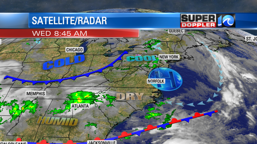
Winds around the high pressure system will create a light east/southeast wind today. While it won’t be strong. It will be a warming breeze compared to yesterday. High temps will aim for the upper 60s this afternoon.
We’ll be mostly sunny to partly cloudy. There will be a couple of stray showers north of the metro in the evening, but it’s a low chance.
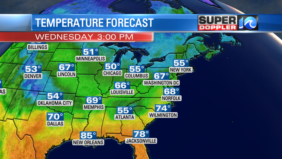
Tomorrow high pressure will slide a little more offshore. We’ll pull in a little more moisture into the area with a light southeast wind continuing. Clouds will also increase. A cold front will stall out to our northwest during the day. Temperatures will be able to warm to near 70 degrees. However, there will be enough moisture for a handful of showers in the region.
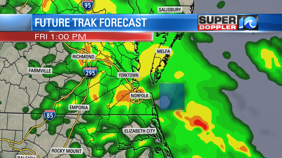
The models are still in good agreement on the Thursday-Friday time frame. They still have a weak area of low pressure forming near the region on Friday. This in-turn creates a lot of rain over the area. Our Future Trak model has a lot of rain during the commute Friday morning.
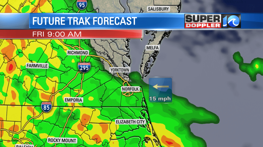
It then has on and off showers Friday afternoon into Friday evening.
The GFS, Euro, and NAM models all also have rain for the day though they differ on the coverage. The NAM is drier overall with more in the way of (scattered) rain showers. The GFS has less rain than yesterday as it has the low forming more to the south.
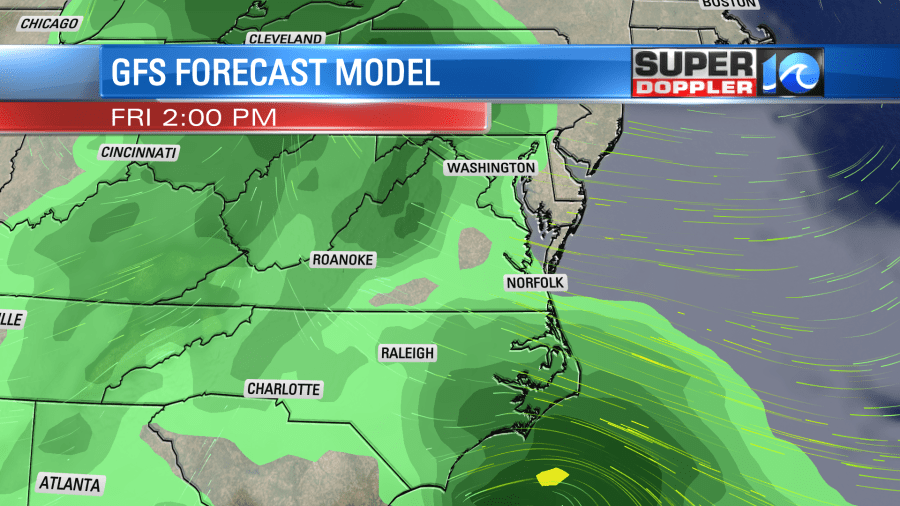
The rain will probably continue into the evening. High temps will be in near 70. The Saturday forecast is where things get tricky!
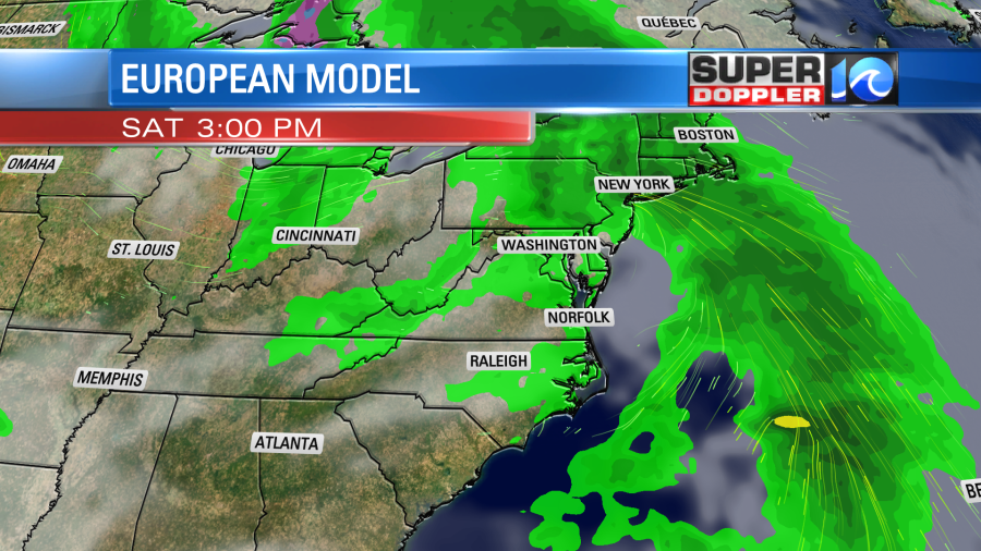
Yesterday, the models were all showing some scattered showers early in the morning with drying in the afternoon. The European model still has a “drier” forecast overall on Saturday, but it does have a few showers in the afternoon. This morning’s run of the GFS model now drags the rain from the morning to the afternoon.
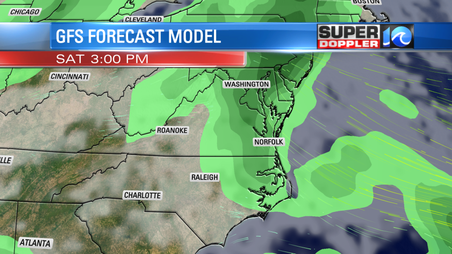
This is a dramatic shift between model runs. Hopefully, it’s just a quirk in the model, and it dries it out in the next update. We’ll see. I did mention yesterday that there would likely be some changes to the weekend forecast. The models are still drier for Sunday morning, but they do bring rain back later in the day. It’s still questionable whether the rain comes back in during the afternoon or the evening. High temps will be near 70 both days, but I may go back to 60s on Saturday if this afternoon rain holds.
So I’ll stop it there since that covers the Something In The Water festival. I’ll talk more details about Sunday and Monday in tomorrow’s weather blog.
Hopefully, by tomorrow the models will come into better agreement about Saturday and Sunday. Of course we’ve basically had a drought and needed rain for months. Then the S.I.T.W. festival comes to town and this mess arrives….Sheesh!
In National News… There are a couple of regions that are watching for flooding due to melting snow. The first one is obvious…Out in California the historic snowfall is just ready to melt and cause major problems. However, the more recent (and less obvious) area is along the Mississippi River. Recent snow is likely to melt soon. Some flooding is already occurring. Here is the article with more information: Flooding from melting snow.
Meteorologist: Jeremy Wheeler