There has definitely been some wild weather around the world lately. I could probably do a long weather blog about that by itself. Hmmmm
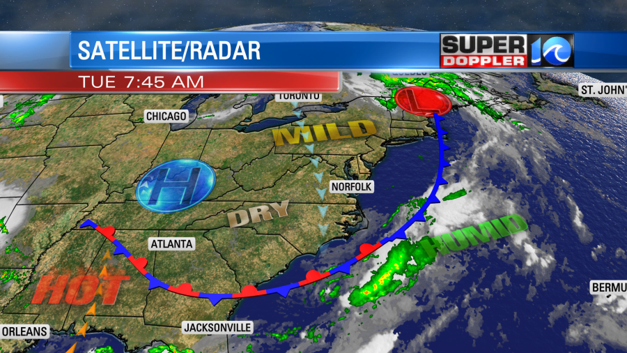
But no… I do want to talk about our local weather too. Today we will have some nice conditions. A cool front has drifted a little more offshore. High pressure is edging in from the west.
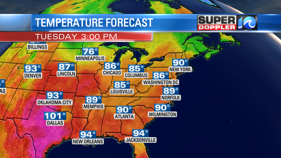
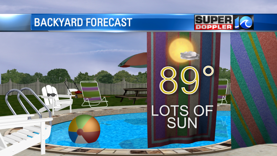
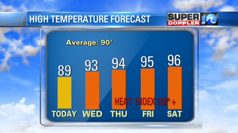
We’ll have lots of sun today with moderate humidity. High temps will be in the upper 80s to near 90 degrees.
We’ll have a steady north breeze at about 10mph. So the weather will be nice today.
It will still be pretty good tomorrow. The front will fall apart to our southeast. High pressure will hang out just to our west. We’ll have a more southerly wind though overall. Plus, we’ll be mostly to partly sunny through the day. So high temps will rise to the low 90s. The humidity still shouldn’t be too bad with dew points mainly in the 60s. So the heat index will be in the mid-upper 90s. However, the heat and humidity will both build from Friday into the weekend. High temps will run up into the mid 90s. The heat index will be over 100.
At least the weather looks quiet through Friday. There may be some isolated showers or storms on Friday. Then we’ll have a few scattered afternoon showers or storms on Saturday and Sunday.
Meanwhile, things have been pretty crazy up in the northeast over the past 48 hours. They have had extreme flooding, and it has spread to more states.
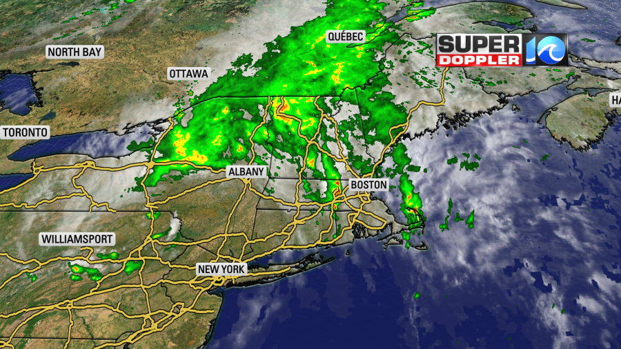
An area of low pressure has been rolling through there. It was wrapped up in a large amount of deep moisture, and that has created historic flooding. I mentioned New York state in yesterday’s weather blog. Now places like Vermont and New Hampshire are making the headlines. Our radar has estimated about 7-10 inches of rain has fallen up there in the last 48 hours.
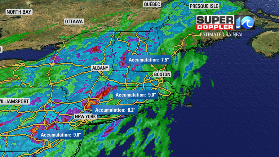
Streets had briefly turned into rivers over a huge part of that region. Thousands of homes have water damage. Luckily the low is going to move out through the day. So residents will be able to focus on recovery and relief today.
Another story that is making headlines is the heat. Not only have there been numerous heat waves on land, but there have also been some heat waves on the water. I recently read an article about a marine heat wave over the Florida Keys. Water temps down there are in the upper 80s to low 90s. Yes…water temps!
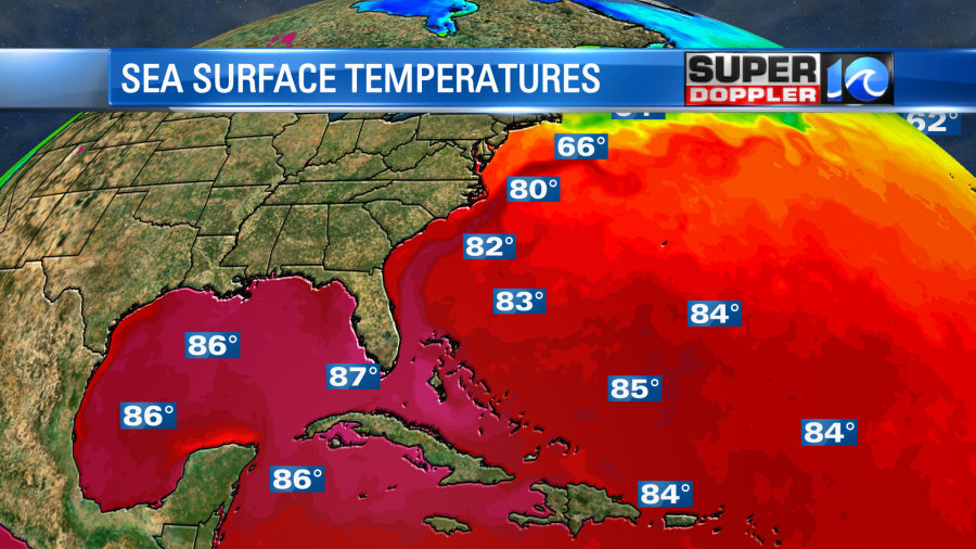
That is incredible heat! You need water temps near 80 or higher in order to create tropical weather systems. While an El Nino in the Pacific tends to lessen activity in the Atlantic (through increased trade winds), I’ve got an increasing feeling that the super warm waters are going to overcome that this year. Things may really amp up in the Atlantic basin over the next couple of months. At least in the Gulf of Mexico. We’ll see. Water temps will probably get even warmer through that time. It could become a scary scenario as super warm water (especially deep warm water) can contribute to explosive growth in the right environment.
Right now there is a weak disturbance in the central Atlantic that has a medium chance of formation.
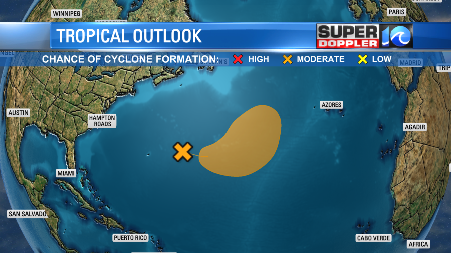
Even if it forms, then it should head east and stay away from the U.S.
Meteorologist: Jeremy Wheeler