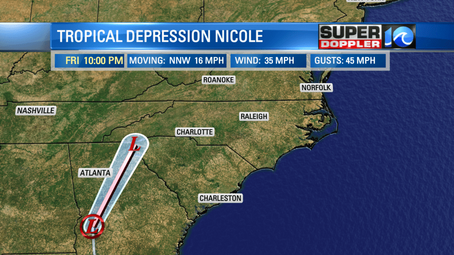
Since Thursday, Nicole has weakened from a tropical storm to a depression.
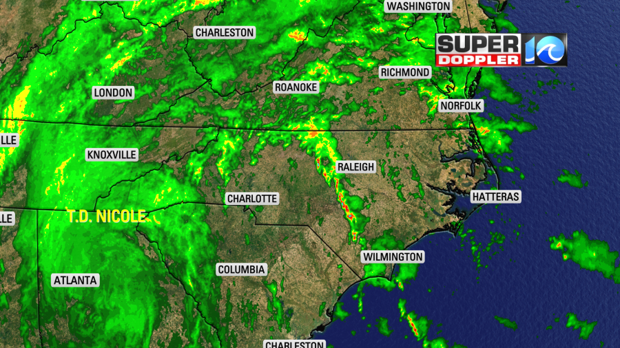
The system is becoming mainly a rainmaker today as it moves to the northeast. It shouldn’t be a tropical system much longer.
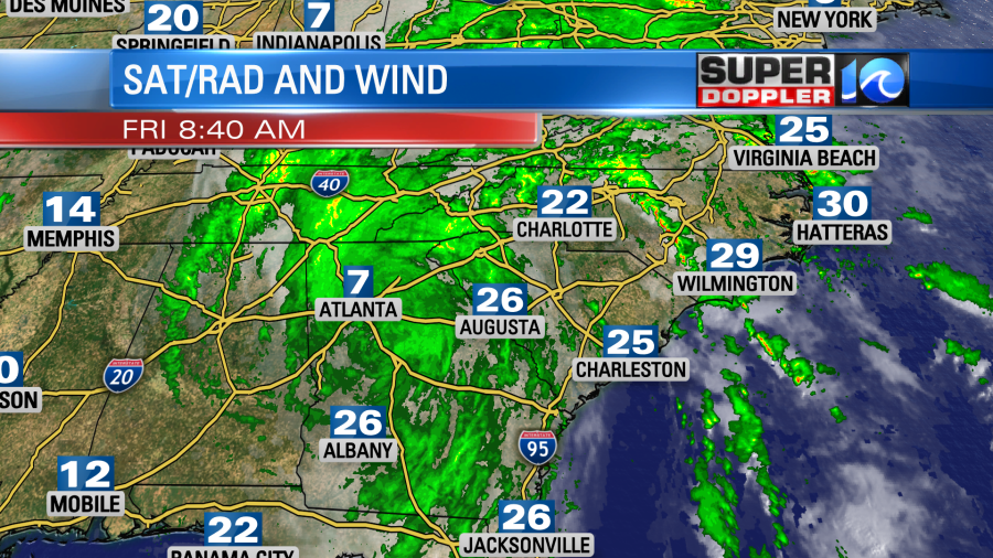
However, there are some strong wind gusts stretching far from the storms. We are even seeing gusts 20-25mph up this way. These are coming from some of the rain bands that stretch away from Nicole.
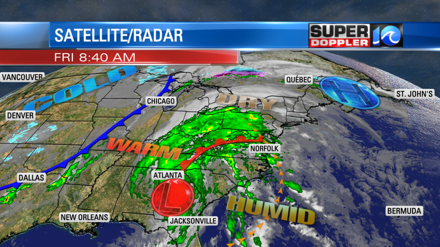
So high pressure has moved away from here off to the northeast. A warm front has lifted through the region, and Nicole is to our southwest over Georgia.
The steady breeze out of the southeast will pull up a tropical air mass into the Mid-Atlantic. Winds will run at 10-20mph with gusts to 30mph. That is outside of any thunderstorms that form. High temps will rise to the mid-upper 70s despite lots of clouds and on-and-off rain showers.
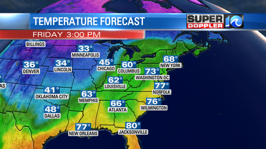
This is well above average, but it won’t be a record. However, that warm/humid air will be some fuel for strong to severe thunderstorms later today.
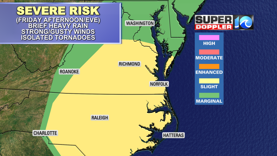
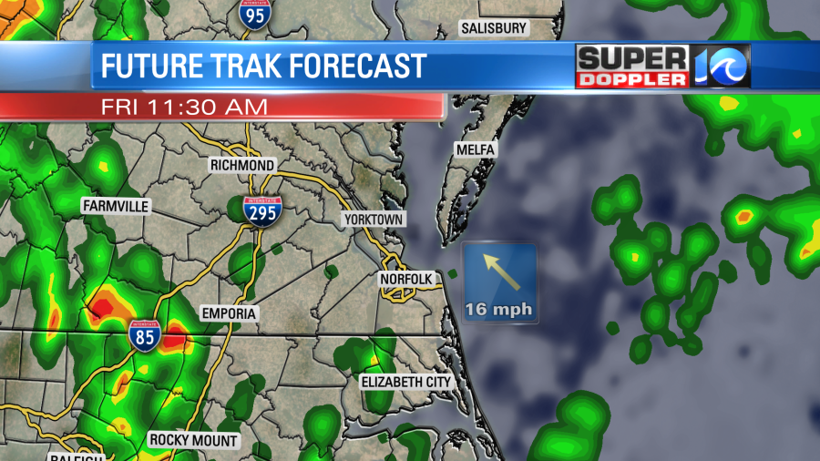
Strong gusty winds and heavy rain will be the main threats. However, there are also some ingredients for isolated tornadoes. This includes deep/rich moisture, low clouds, warm air, a broad spin in the atmosphere, and some decent speed and directional wind shear. The question is… will we warm up enough (brief sunshine???) for some low or moderate instability. There is a tornado watch for the area until 3 p.m., but this could get extended further out in time. Check wavy.com for updates.
There is a very low chance for storms and isolated tornadoes later this morning through midday, but the chance increases a bit this afternoon into the evening.
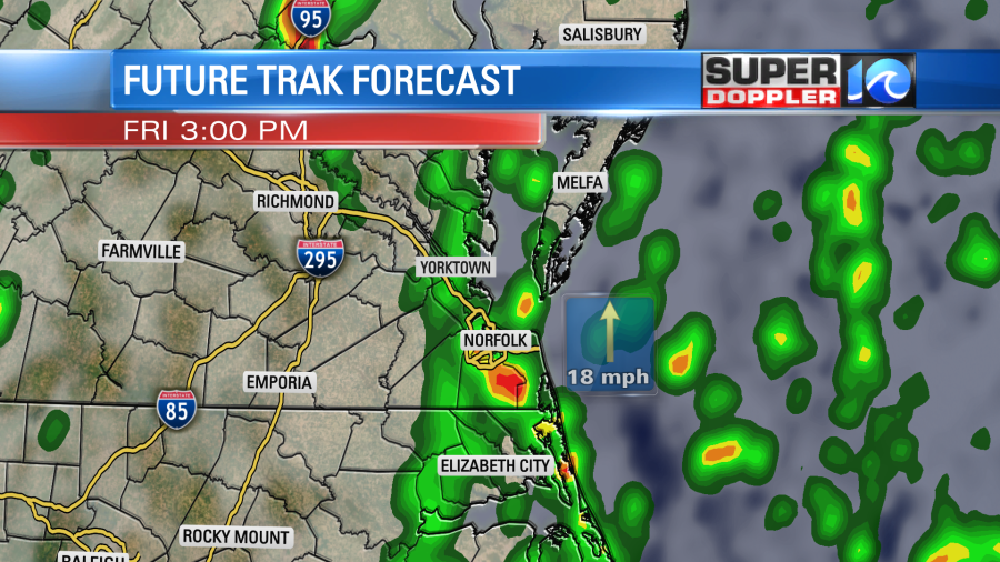
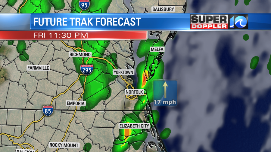
We may have a lull in the activity for a bit this evening. Then later this evening into the overnight there will be one more swath of rain that could be heavy.
After that time, a punch of drier air will move in from the southwest. So our rain chances will drop going into Saturday morning to a slight chance. This won’t be the cold front moving through yet. The cold front will actually move through during the late afternoon.
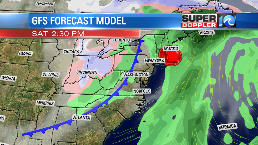
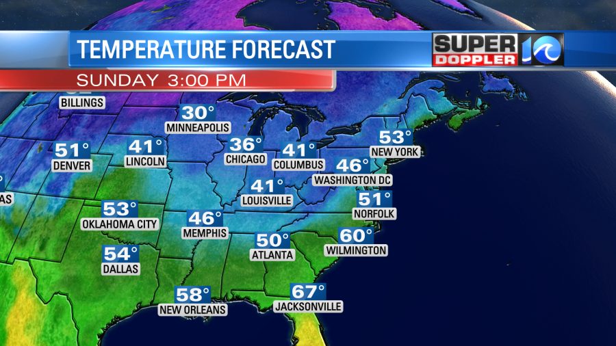
We’ll have a mix of sun and clouds with some isolated showers possible during the afternoon Saturday. It will still be warm tomorrow with high temps in the upper 70s. Winds will be out of the southwest. However, it will be a different story on Sunday behind that front. High temps will only be in the low-mid 50s.
We’ll have a mix of sun and clouds with some isolated showers. Then, we’ll stay cool into early next week.
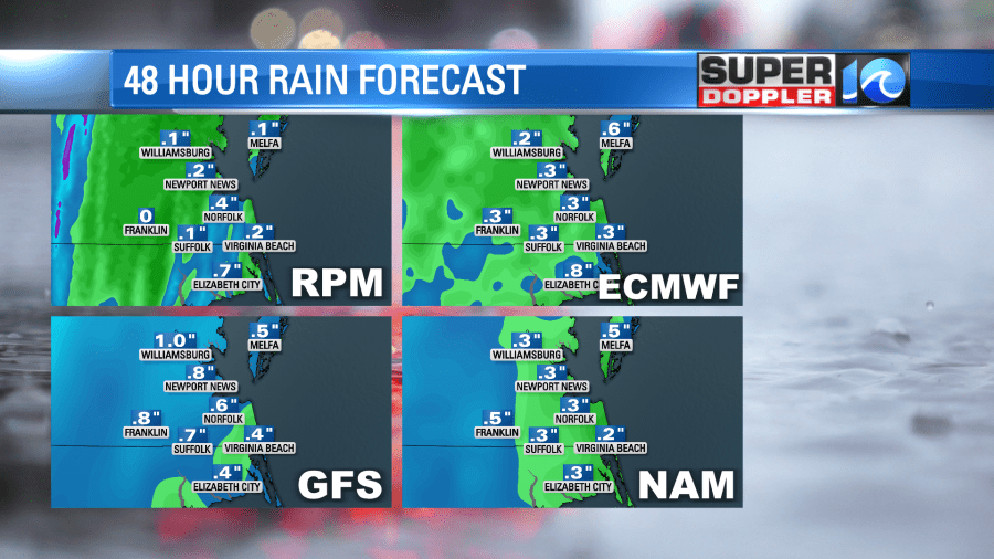
While there will be some isolated downpours over the region they will all be on the move. So I’m not expecting flooding with the exception of some brief puddling and maybe some standing water in a few back yards…or front yards. Here is the rain forecast from 4 of our models:
One last thing before I go. This article is going around the internet about an eerie coincidence pertaining to 2 hurricanes from this year versus 2 in 2004. he paths and timing of hurricanes Charley and Jeanne in 2004 were very similar in track and timing compared to Ian and Nicole this year. The landfalls of both sets of hurricanes were 43 days apart. Here is the article with more information and some graphics: Eerily similar hurricane tracks 2004 and 2022.
Meteorologist: Jeremy Wheeler