PORTSMOUTH, Va. (WAVY) – I would say that today is the quiet before the storm. However, I wouldn’t want to mislead folks. Nicole is not going to move through our area. However, the remnants of Nicole and a strong cold front will bring us a chance for some strong thunderstorms tomorrow.
Here’s the latest:
Nicole made landfall near Vero Beach, FL as a hurricane early Thursday morning. This was around 3 a.m.
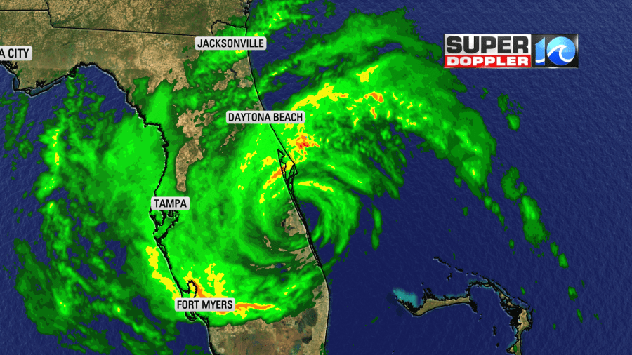
As the storm moved inland, it quickly weakened to a tropical storm. However, there were several gusts to over 60 mph around the system.
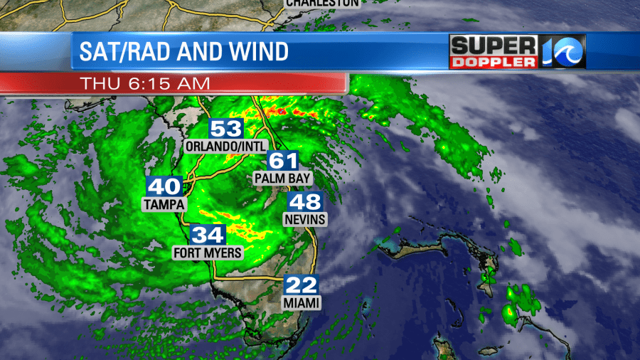
Nicole will move northwest today, and it may brush up along the Gulf of Mexico. However, it shouldn’t re-strengthen. It will then get into the Florida panhandle this afternoon. Then, it will move up into southern Georgia. It will be over Georgia during the morning Friday. It will likely fall apart over western South Carolina by the afternoon.

This will be as a strong cold front moves in from the west and interacts with the storm. Also, upper-level winds (wind shear) will increase.
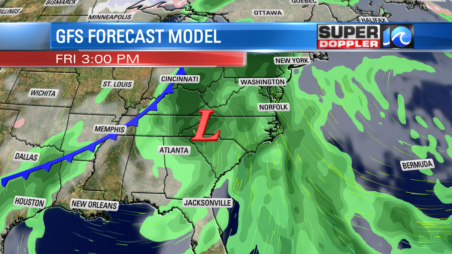
It will produce some strong winds over Florida today, but it should become more of a rainmaker tomorrow into tomorrow night. The rain forecast is highest to our south and west. Around Hampton Roads, I think we’ll see about a half inch up to an inch and a half depending on which model you believe.
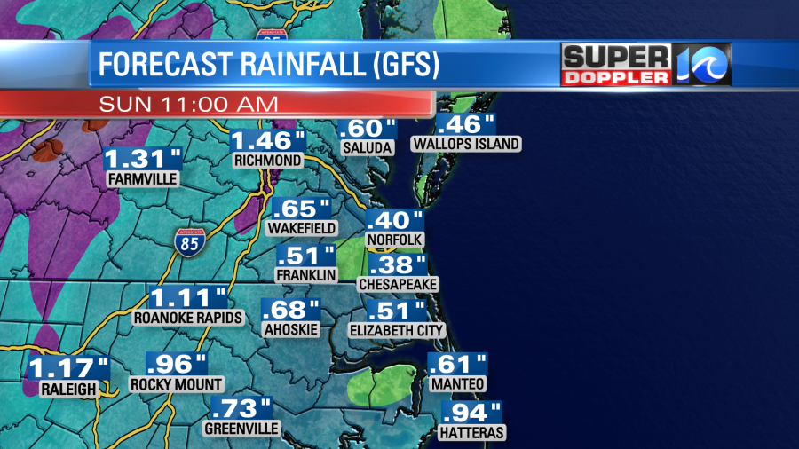
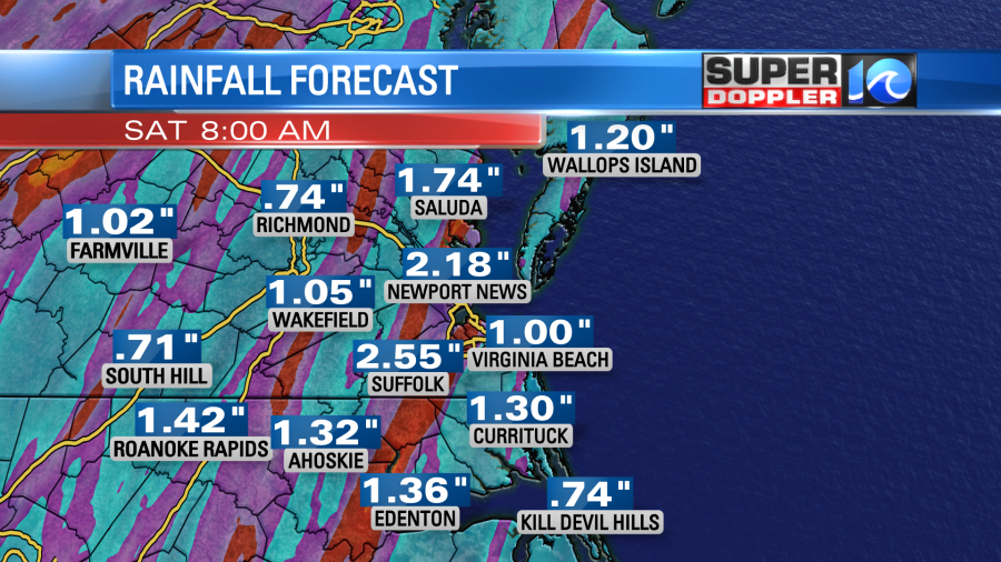
Locally, we’ll have some quiet weather today with high pressure to our north/northeast and Nicole well to our south.

We’ll have a mix of sun and clouds today. There may be a couple of sprinkles (there were a few this morning), but the chance for any rain is low. We’ll have a lighter easterly wind through the day compared to the last couple of days. This should allow temps to warm to the low 70s this afternoon.
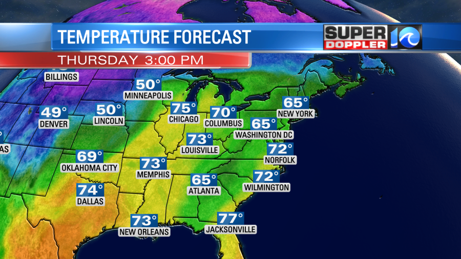
A lot of high school football games were rescheduled for this evening. The weather should be fine. Temps will be mainly in the 60s. There might be a couple of sprinkles, but no big rain showers. Overnight there will be some scattered rain showers coming up from the south. The will basically be some outer rain bands that will stretch far away from Nicole.
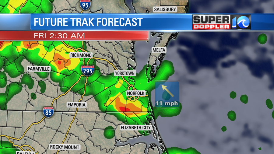
Some of these rain bands will move through tomorrow morning. Keep that in mind if you are headed to any Veteran’s Day events or ceremonies.
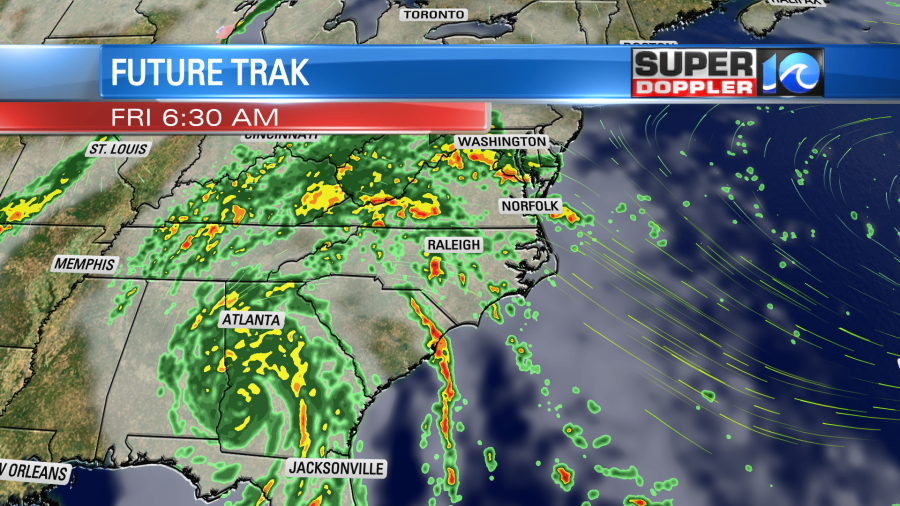
Remember through the day Friday Nicole will be off to our southwest. However, we’ll have a warm front (not shown) lift through our region. We’ll have a breezy south/southeast wind that will pull up a lot of warm/humid air. This unstable air will be fuel for some thunderstorms. As more of those outer bands move up this way they could produce some brief downpours.
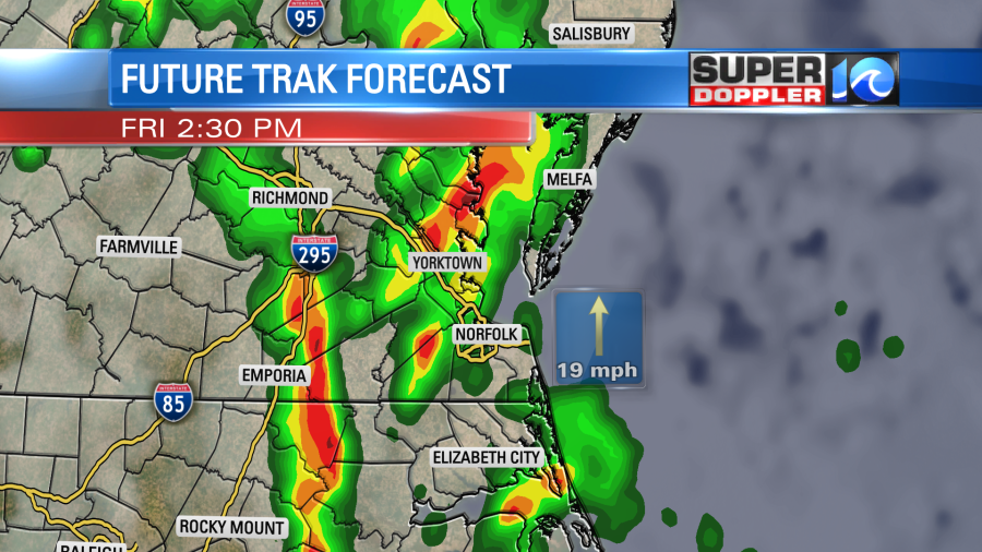
There could be some strong to severe storms between the afternoon and evening. As I write this there is a slight risk for severe weather over most of the region for Friday afternoon and Friday night.
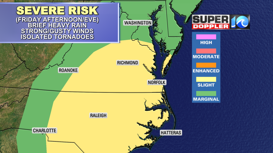
Brief heavy rain and gusty winds will be the main threats. However, there will be some broad rotation in the atmosphere. Surface winds will be out of the southeast. Plus, we’ll have some deep moisture and decent wind shear. This will give us a chance for isolated tornadoes in the area. Remember, wind shear weakens tropical systems, but it is an ingredient for possible tornado formation.
The remnants of Nicole will move to our north by Saturday morning. The cold front will be swiping through the region during that time.
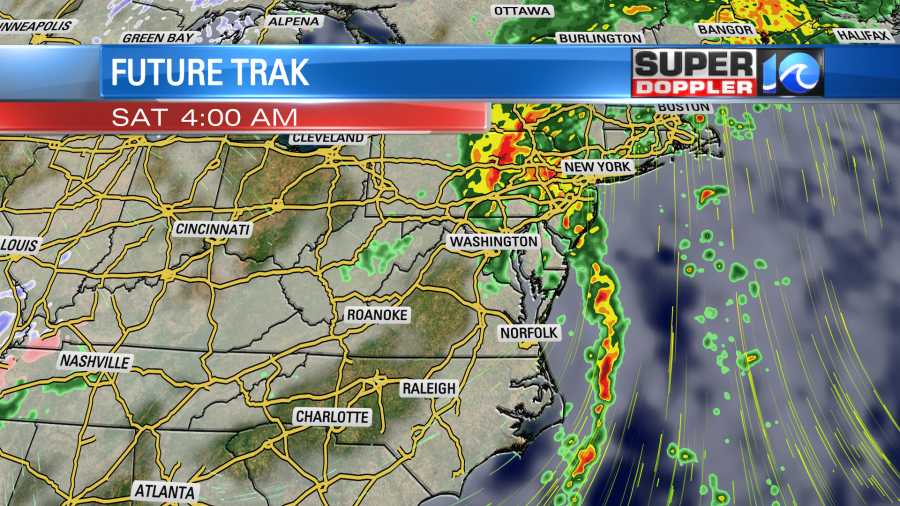
There will be a north-south line of showers and a few storms early Saturday. This should move out by the mid morning. Then we’ll be dry for the rest of the day. High temps will still be in the 70s on Saturday. Then on Sunday high temps will only be in the upper 50s. Highs will be in the low 50s on Monday. Low temps will be in the 30s and 40s.
We won’t have any tidal flooding from this storm system. However, there might be a little water rise on the north end of the Albemarle sound up into Knotts Island. This could create a little nuisance flooding in southern Virginia Beach. This will be on Friday into Friday night, but should subside by Saturday.
Stay tuned for updates on all of this!
Meteorologist; Jeremy Wheeler


