Some folks over the last couple of weeks may have stated how “hot and humid” it is outside. Truthfully though…Temps haven’t been too bad lately. The humidity has stayed high most of the time, but temps have actually been below average for the last week and a half.
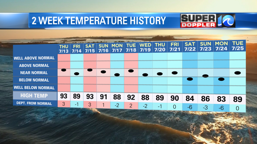
I think part of the reason is that we’ve had so many clouds and so much rain. Remember, we picked up about 6 inches of rain in Norfolk over the last 11 days. Then we had about another three-tenths of an inch last night. This wasn’t from a front, but there was a small line of strong showers and storms.
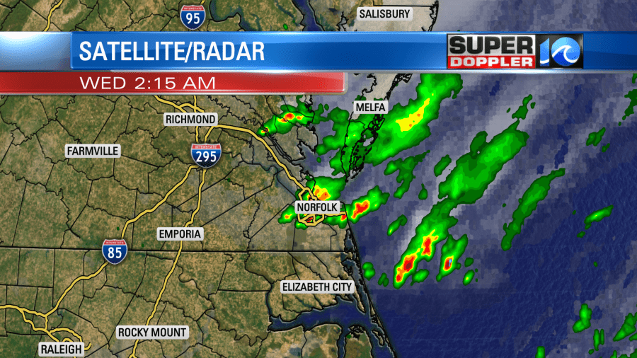
The only front that is nearby now is a stationary front that is falling apart.
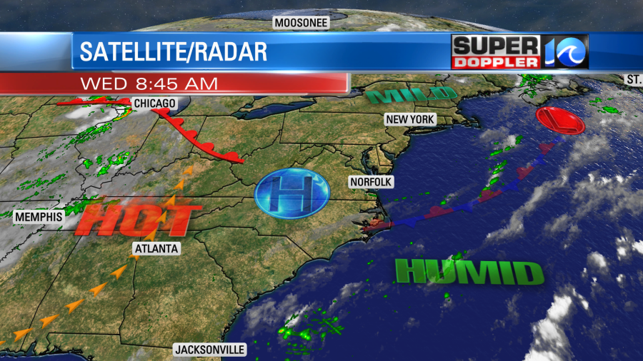
Otherwise high pressure is in the region. We’ll be partly cloudy today with some isolated PM showers or storms. Temps will start heating up. We’ll rise to the low-mid 90s in our area this afternoon.
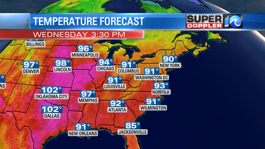
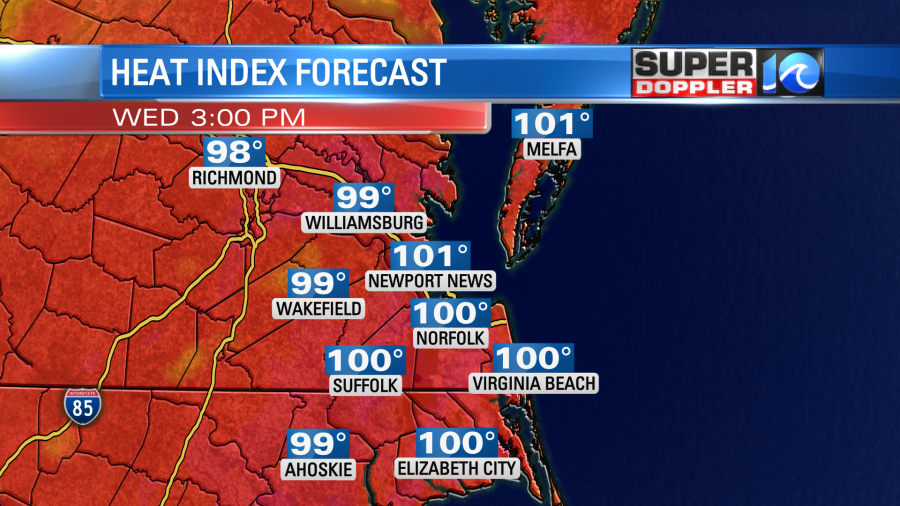
High temps will be in the 100s over a large part of the central U.S. Our local heat indices will be near 100 degrees.
So the below average weather pattern is coming to an end. Tomorrow the 100+ degree temps will spread north and east. Even Minneapolis may hit 100 on Thursday.
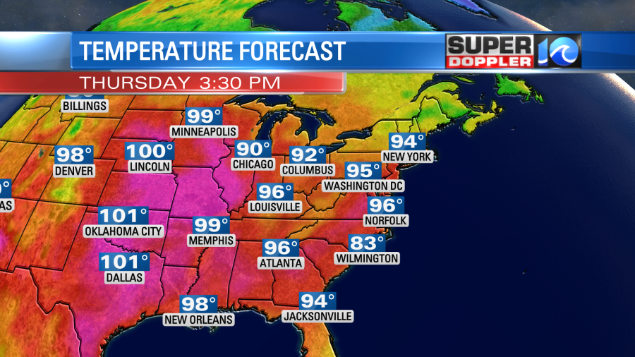
We will rise to the mid-upper 90s here. However, the heat index will be between 100 and 105 degrees. We’ll be partly cloudy with hardly any rain during the day. There may be a few showers or storms at night though. Temps will heat up even more on Friday and Saturday. The low temps may be near 80. The high temps will be in the upper 90s, and the heat index will be around 105 degree or higher.
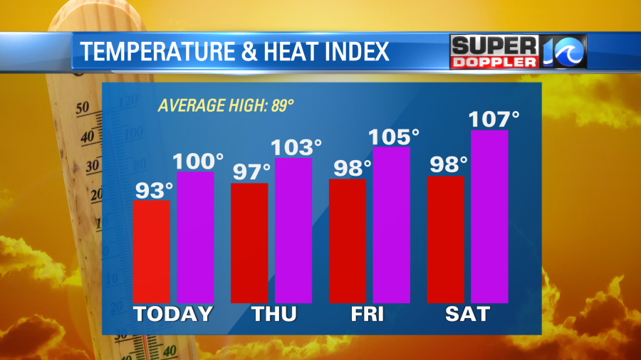
There will be some isolated showers and storms on Friday with some scattered PM storms on Saturday. There is an even higher chance for rain on Sunday as a cool front slides through the region. At least high temps will return to the upper 80s Sunday into early next week.
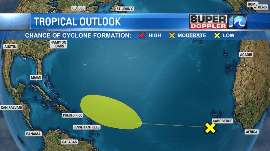
Things are pretty quiet in the tropics. There is now one small area of possible development, but it’s a low chance.
Meteorologist: Jeremy Wheeler

