As I read the blog title in my mind the song “Be prepared” with Scar from the Lion King popped into my head. Yes, it is time to prepare for some cold air. It’s going to be the coldest air of the season so far. One cold front came through yesterday and started the cold air intrusion. Today a second front is on the way that will reinforce that chill in the air.
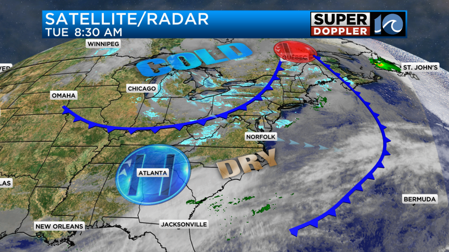
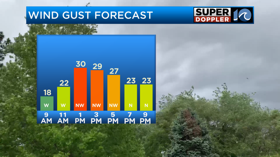
We’ll have a good amount of sunshine today with a few pockets of clouds around noon as the front arrives from the northwest. When the front swings through it will increase the winds. They will start gusting up to 30mph.
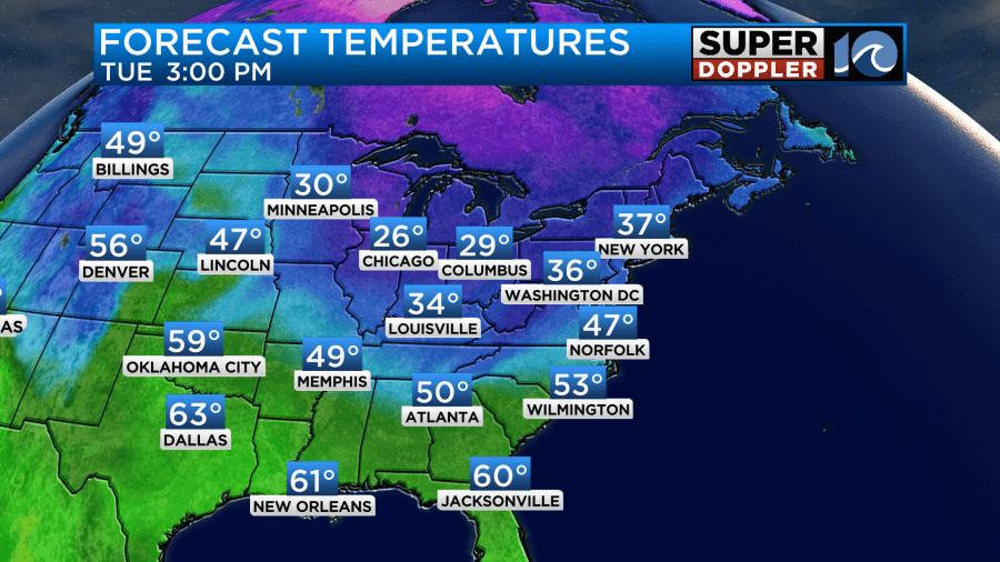
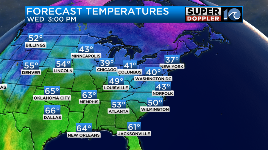
So even though we’ll have a good amount of sunshine today, high temps will only be in the mid-upper 40s.
The thing is… If you factor in the winds this afternoon, then the wind chills will be in the upper 30s later today.

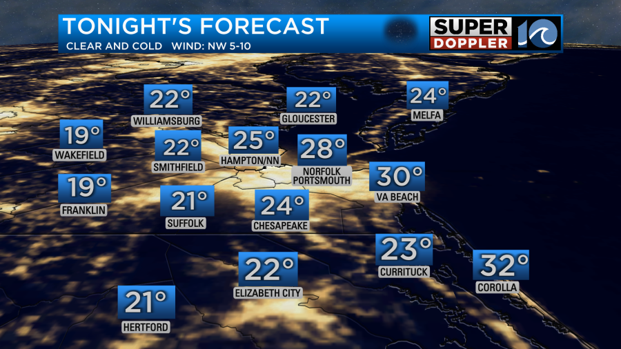
Make sure you’ve got some warm Winter gear when you head out. It might be time to pull out the scarf, gloves, and warm hat if you haven’t already. It will stay breezy through the evening. Then tonight the winds will gradually die down. With that, the clear skies, and light winds our overnight temperatures will drop down to the 20s area-wide. It’s even possible a couple of teens could happen far inland.
It’s definitely time to bring in the potted plants. Some of the far inland/rural folks may want to slow-drip the faucets. Luckily, we’ll be above freezing this afternoon and tomorrow afternoon. That does make a difference. Tomorrow we’ll have high pressure in the region. There will be lots of sun and less wind. However, we’ll only be able to warm up so much. This means that high temps will only be able to rise to the mid 40s.
We’ll warm up a little bit on Thursday. High temps will be in the 50s with lots of sunshine. Then we’ll have more warming Friday into the weekend. However, we’ll also increase the moisture. There will be more clouds on Friday. There will also be some scattered rain showers developing.
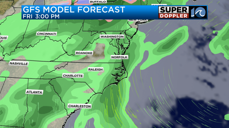
There will be a few rain showers between Saturday and Sunday, but the models keep shifting the timing. That is making a tricky precip forecast. So we’ll have more details on that in tomorrow’s weather blog. At least we’re pretty confident that high temps will be near 60 degrees, and no day will be a washout.
In world news….The world’s largest iceberg is on the move. This Antarctic mass of ice is 3 times the size of New York City. Here is the article with more information. World’s largest iceberg moving.
Meteorologist: Jeremy Wheeler


