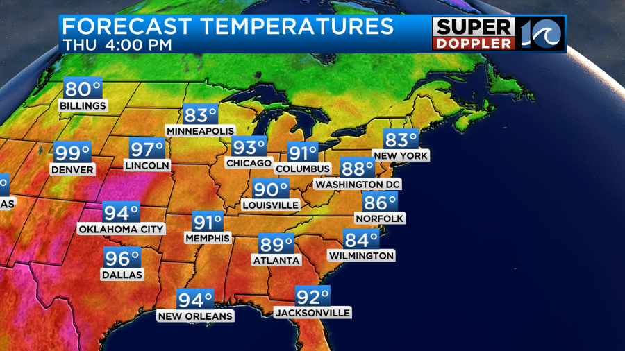
Today’s local weather should remain quiet. Over the next couple of days it will feel more Summery than the last couple of days. We’ve lost the northeast winds, and now today we’ll have a light southeast breeze. This will push our high temperatures up to the mid-upper 80s this afternoon.
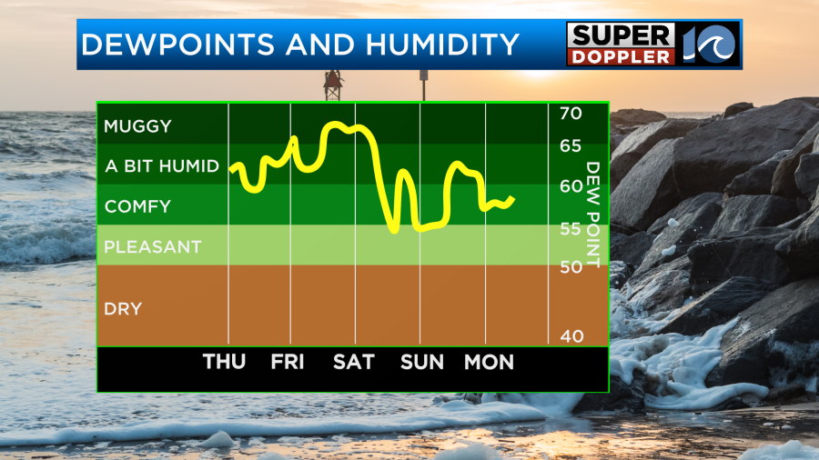
The humidity will increase a little bit too. Dew points are in the 60s.

We’ll have a mix of sun and clouds today with a big chunk of the day being partly cloudy. On occasion we’ll be mostly cloudy. I’m not expecting rain today other than a stray shower or two. High pressure is to our west. However, we are closely tracking that weak area of low pressure to our south.
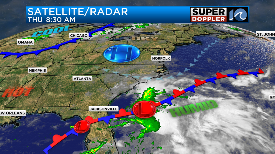
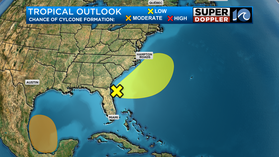
The severe flooding has gotten worse over Florida during the last 24 hours. The flooding is akin to a stalled out tropical storm or even a weak hurricane even though the low has been non-tropical. Some areas down there may get a little less than 20 inches before the rain wraps up. Luckily, we won’t see anything like that up here. Tomorrow the center of the low will be to our southeast and offshore. However, it will throw some scattered rain showers over the Outer Banks.

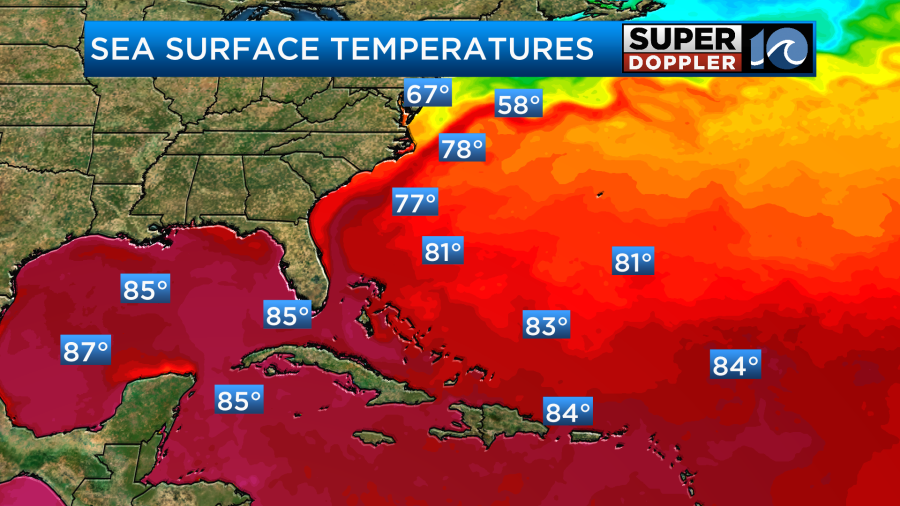
The water temps are cooler along the path, but it will encounter the Gulf Stream for a bit.
Also, the wind shear is fairly strong along the low’s path.
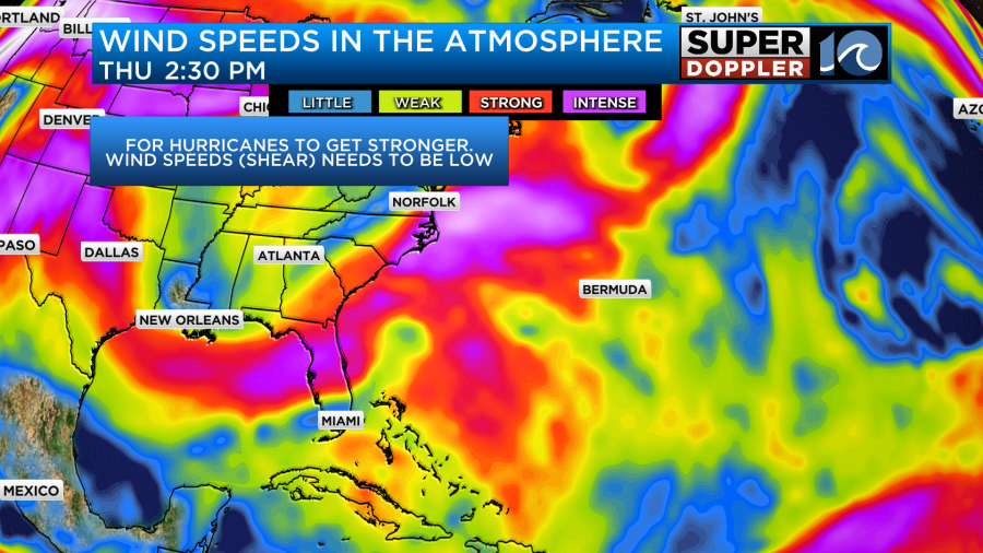
This should help to keep the system weak. It will also be moving along the stationary front (which may drift north a bit). So the impacts on our area should be minimal. We will probably have a moderate threat for rip currents between tomorrow and Saturday at our local beaches. There may be a few wind gusts to 20mph over the Outer Banks. That’s pretty much nothin. The models are in good agreement concerning the track.
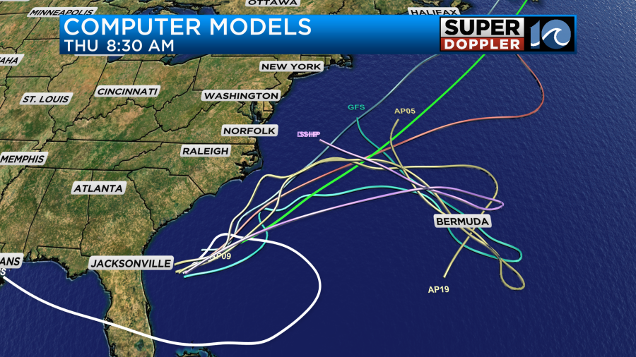
However, check back for updates in case the low gets a little more north or if the low strengthens a little more.
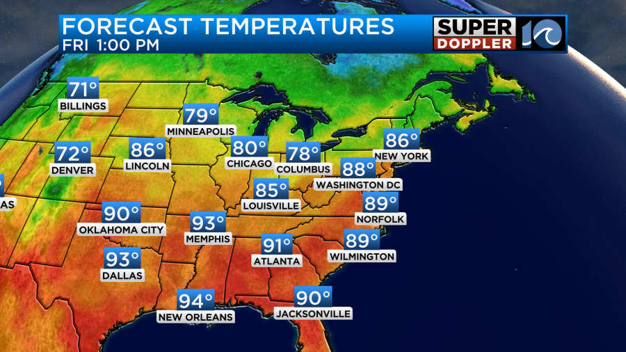
Other than that we will be partly cloudy tomorrow. High temps will rise to the upper 80s to near 90.

We’ll have an east/southeast breeze at 8-12mph.
A cold front is forecast to move over the area Friday night into early Saturday morning. This will produce some scattered rain showers and a few storms after midnight.

These will drop to the south along with the front by Saturday morning. There may be some spotty showers for a bit Saturday morning behind the front. After that we’ll have some clearing into the afternoon. Saturday should be pretty nice. High temps will drop to the low 80s. We’ll have a northerly breeze. The humidity will drop as well.
Then we’ll have great weather for Father’s Day. High temps will be in the low 80s with mostly sunny skies.
We’ll be mild and dry early next week. By the time we get to the middle of next week we’ll really need some rainfall. High temps will mainly be in the 80s, but we may get to the 90s later next week.
Last but not least…There is another feature in the southwest Gulf of Mexico that could form into another tropical system. It is currently just a broad low, but there is much less wind shear town there. So it has a moderate chance of formation over the next 2-5 days.
Meteorologist: Jeremy Wheeler