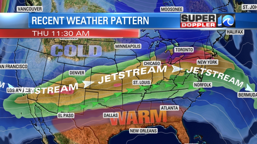
The forecast has been tricky lately to say-the-least. It is basically due to the pattern that we are in. The jetstream has been moving almost straight from west to east for a couple of days with small ripples from time-to-time. This setup typically allows systems to move quickly to the east.
The problem is that the models may not pick up on the speed on the systems very well. So rain may move in and move out faster than forecast. That was the case yesterday. We had a large swath of rain move in about 2-3 hours early. Plus, the size of the area of rain had changed dramatically on the models during the prior 12 hours. This earlier rain in-turn kept high temps in the 60s even though I called for 70. (it did make it to 70 in Elizabeth City). Either way it was warm and humid as expected.
Today we have a cool front dropping to our south.
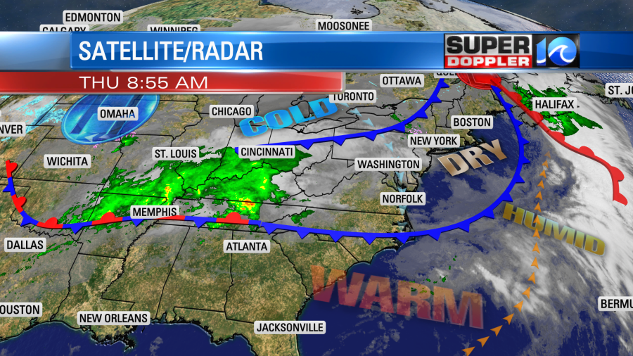
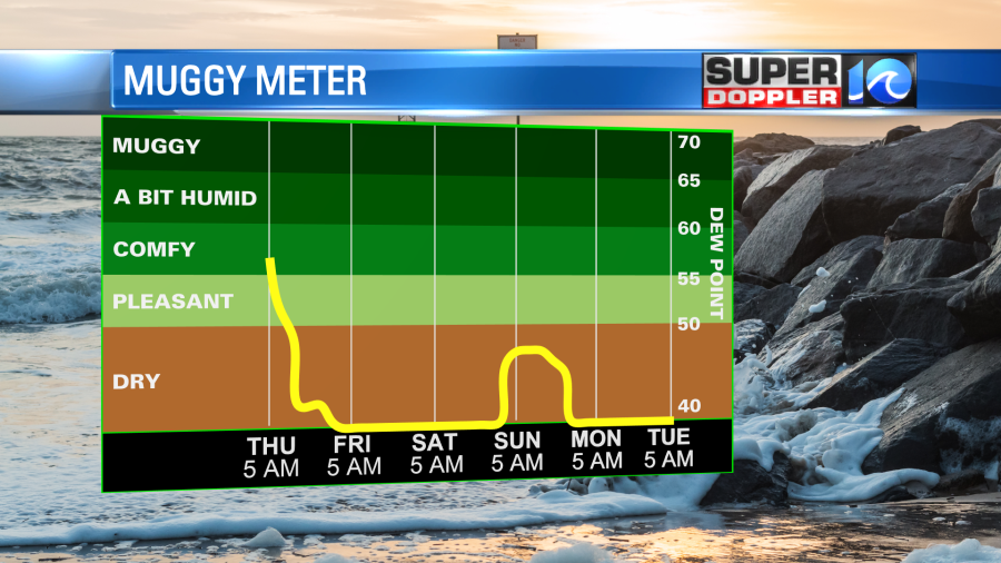
Cooler air has drifted into the region. Drier air is slowly filtering south. We’ll continue to dry out today. Dew points are dropping into the 50s, and they will be in the 40s by late today.
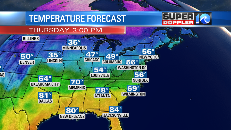
Winds will be out of the north at 10-15mph with a few gusts to 20mph. I’m hopeful that we’ll have a nice mix of sun and clouds from the late morning through the afternoon. Though some of our models do show the clouds increasing again by the late afternoon. Showers should stay to our west until the early evening. Then some isolated showers will be possible. High temps will be in the upper 50s today.
Tomorrow we’ll have a mix of sun and clouds again with some spotty showers in the morning. The front will stall to our south. So we’ll stay cool with high temps in the lower 50s. Temps will basically stay in the 50s for the next few days. It will be seasonable, but a little below average.
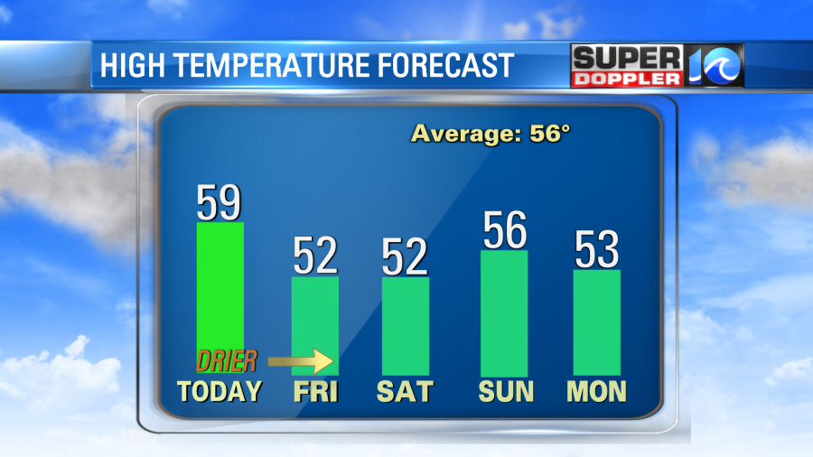
There won’t be any big rain showers, but some isolated showers will be possible between tomorrow and Sunday. Some of the latest models models are bringing a few more showers on Sunday, but we’ll see. Again, with the tricky forecast lately I’ve got a low confidence.
The tropical disturbance in the middle of the Atlantic is running out of time to develop. So now it has a very low chance for development.
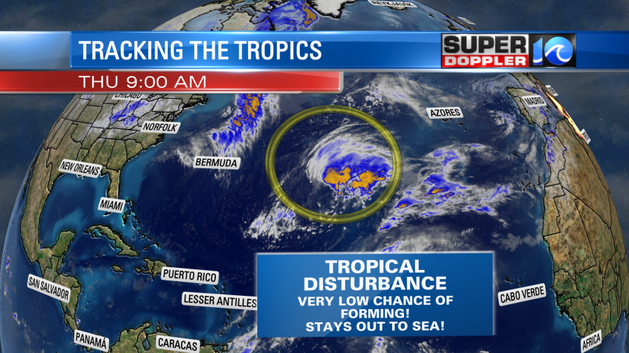
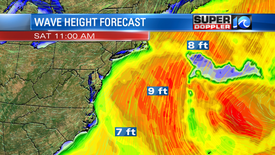
However, because it is still a sizable area of low pressure, it will still produce some ocean swells that will travel to the west. There could be some waves over 5 feet near the shore by the weekend.
Meteorologist: Jeremy Wheeler