Over the last 2 weeks we have had a lot of warm temperatures. While it wasn’t necessarily a heat wave (one could argue). We were well above average for many days. We even broke a record one day.
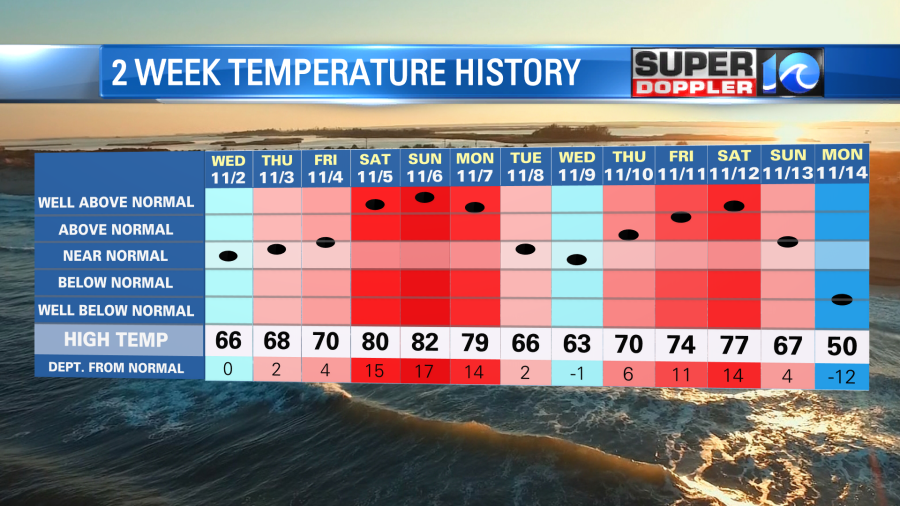
Then over the last 2 days we had some colder air move into the area. High temps were only near 50 yesterday. Going forward we will be in for a stretch of colder weather over the next few days.
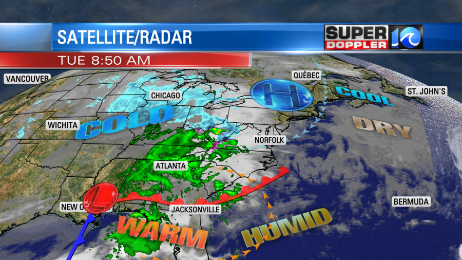
Today we started off with some cold temps. Lows were in the 30s and 40s with a few 20s inland. However, some warm air will try to push up into our region this afternoon. Currently the moisture is already increasing and clouds are gradually building from the west.
High pressure has moved away from the region. There is a warm front to our southeast. With low pressure to the southwest.
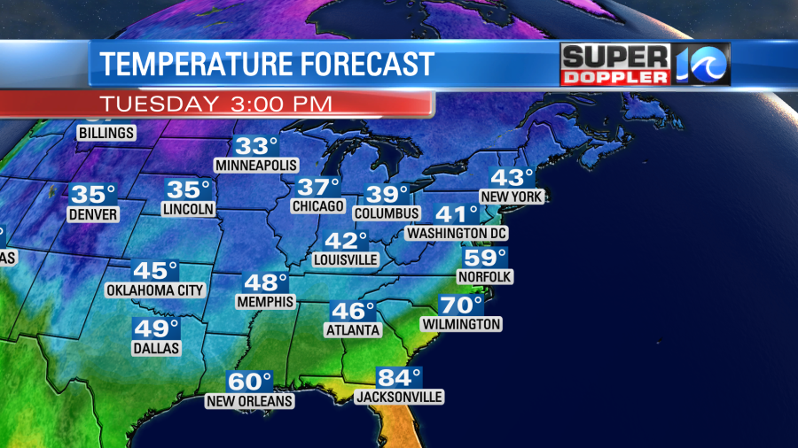
The warm front is expected to move up into our area this afternoon. It won’t clear the area. Rather it will move up to near the metro and then stall out. We’ll have high temps in the 60s to the south/southeast, but we’ll only be in the low-mid 50s north of the metro. Highs will be in the upper 50s to near 60 in Hampton Roads.
After the clouds thicken up there will be some isolated showers arriving by midday. Then showers will increase this afternoon into the evening.
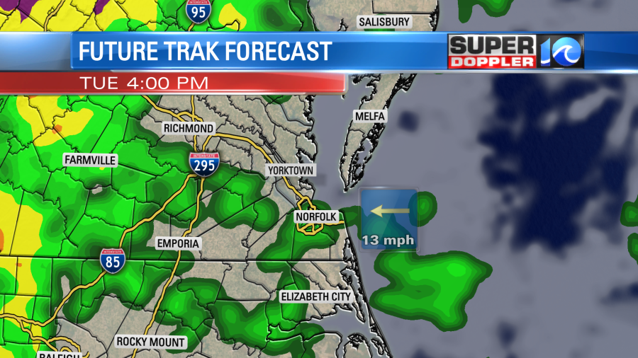
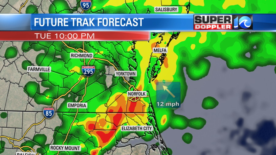
The showers will increase even more by the late afternoon into the evening. There could be some isolated heavy showers. Then between 6 and 11pm the rain will become more widespread. There could even be a few thunderstorms late as the low pressure system moves through.
Tomorrow morning a cold front will be moving offshore along with the low. We’ll have some isolated showers early in the morning, but then we’ll dry out for the rest of the day. We’ll gradually clear out too. High temps will be in the mid-upper 50s, but temps may fall late.
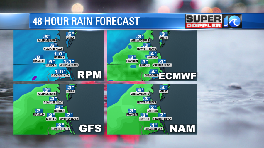
Before the rain ends we could end up with a quarter to three-quarters of an inch in the rain gauges. Some spots could see up to an inch.
After tomorrow we’ll have some colder and drier air over the region. High temps will only be in the upper 40s to low 50s Thursday through Saturday. Low temps will probably be in the 30s area wide. There will probable be a lot of frost and freeze conditions.
It is all quiet in the tropics.
Meteorologist: Jeremy Wheeler