The last 24 hours up to the writing of this blog have been very soggy and windy. An area of low pressure passed just to our south, and this created a lot of rain showers over the region. It was even heavy for a time last night.
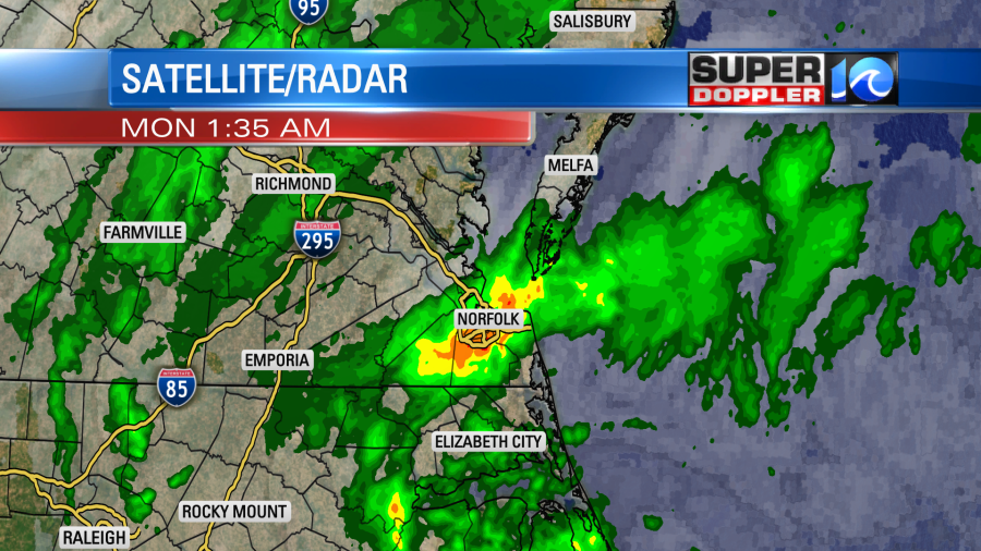
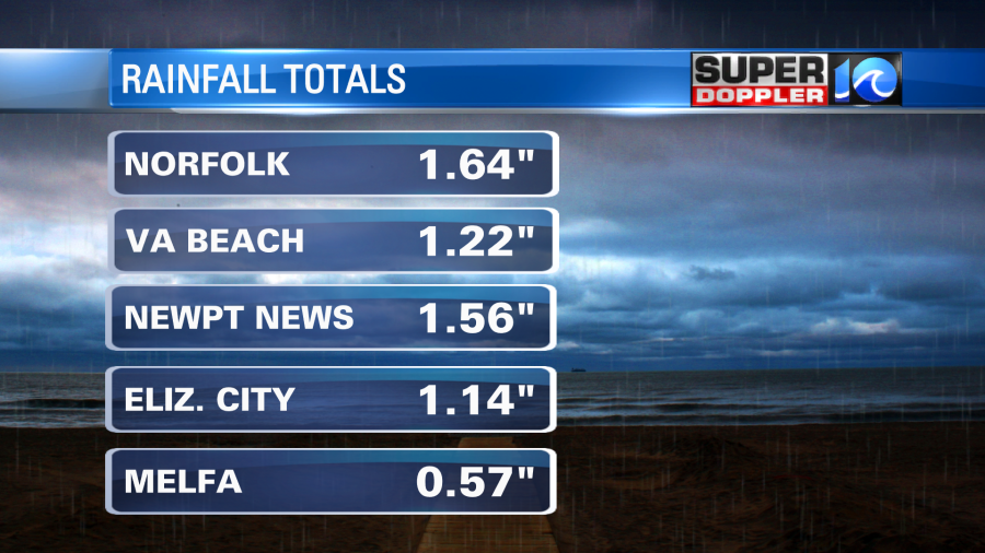
The rain wrapped up by about 8am. There was also some minor tidal flooding early this morning. That created poor drainage in some areas. Rain totals were about 1-2 inches.
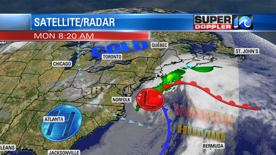
The area of low pressure will move out to sea today. High pressure will build in from the west.
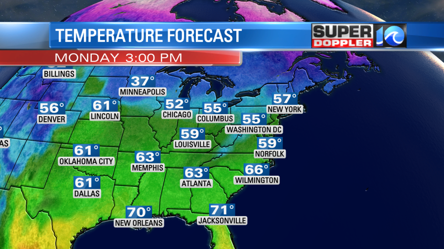
We’ll have strong northwest winds this morning with gusts to 25mph near the shore. However, winds will calm down by the afternoon. High temps will rise into the upper 50s with a few 60s inland/south.
Skies will clear through the day. It should be pretty nice out.
We’ll have nice weather on Valentine’s Day. Skies will be mostly sunny. High temps will be in the mid-upper 50s with fairly light winds.
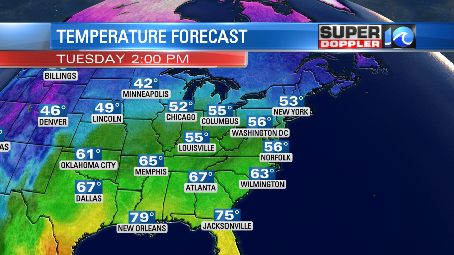
The temps across the eastern third of the country will be above average tomorrow, but they will be well above average on Wednesday and Thursday.
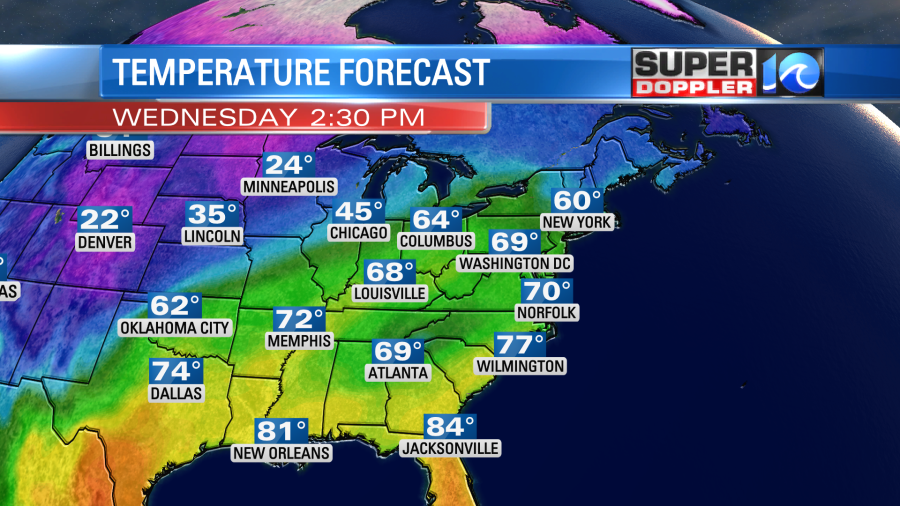

At the rate we are going with this warm air, some of us will be cutting the grass within the next 3 weeks. Even with a cold snap many plants and trees are in bloom or budding. Hopefully, we don’t get a long stretch of cold air, but the odds of that happening are slimming through time.
A cold front will bring some rain and cooler temps by Friday. I’ll talk more about next weekend in tomorrow’s weather blog.
Meteorologist: Jeremy Wheeler