We had rain and fog this morning, which really slowed things down during the a.m. commute. There was a lot of moisture pushing into the region and a warm front was lifting north through the area.
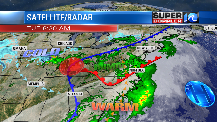
There is a cold front to our north and west, but we’ll stay in the warm zone today. High temps will rise to the mid-upper 60s despite lots of cloud cover. The widespread rain from this morning will be much more isolated this afternoon. The sun may even peek out a bit later today.
Tomorrow we’ll be in a smaller warm zone as the cold front steadily edges east (but hey it’s still the warm zone!). High temps will be in the low-mid 60s. We’ll be mostly cloudy through the day. There won’t be much rain until the late afternoon and early evening. Then we’ll develop some scattered showers. These will be ahead of the cold front. A couple of isolated thunderstorms may pop up as we get into the early evening.
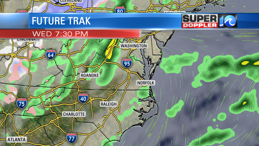
We’ll cool down and dry out behind the front on Wednesday. High temps will be in the low 50s with partly cloudy skies. We’ll be dry and cool on Friday with highs in the upper 40s.
We’ll definitely be cool over the weekend. High temps will be in the low-mid 40s.
The GFS model suggests that we’ll have an upper level disturbance swing through the region Friday night into Saturday morning, so it spits out some sprinkles and/or flurries in the region. The surface should be pretty dry. So we’ll see if that pans out.
The Euro model has this much earlier, so it has a couple of sprinkles late Friday instead of Friday night. We’ll see. Stay tuned.
Speaking of snow (or a lack of it). Some of the northeast states are going through a snow drought right now. I found this pretty cool article that focuses on New Jersey, but there are several states in the same boat. New Jersey missed the recent snow that we got here last week. Here is the article with more information: New Jersey Snow Drought.
Meteorologist: Jeremy Wheeler


