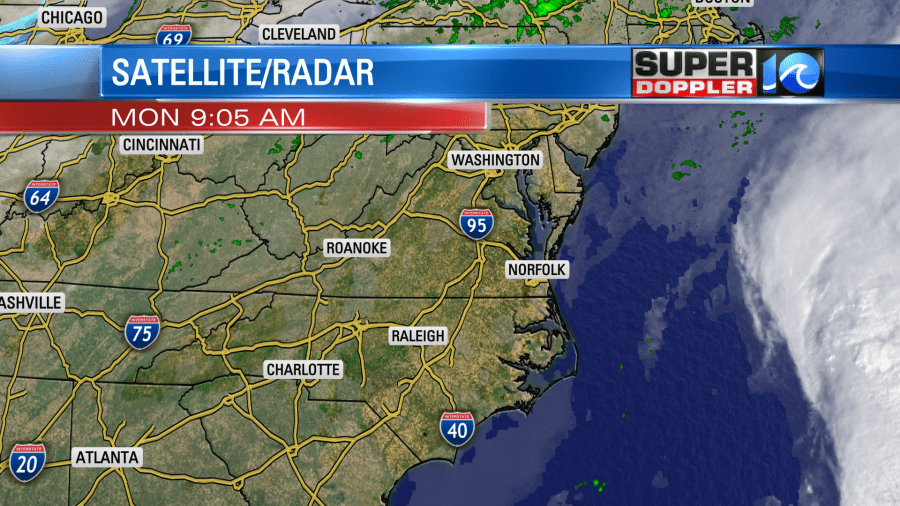
It was a dreary day on Sunday! We had on/ off rain, overcast skies and windy conditions. Good news is, that has mostly come to an end! Just a few light lingering showers this morning with some clouds clearing by the afternoon.
Zeta was a very slow moving system over the past 24 hours but as of the latest update it is now moving quicker off to the NW. It’s headed towards the Yucatan Peninsula. Unfortunately, moving towards the same area that was just hit by Delta a few weeks ago.
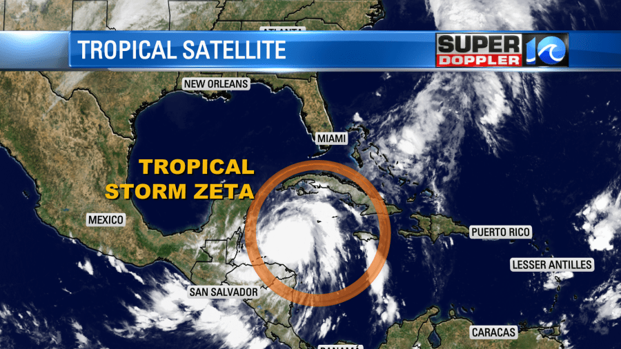
From there it will travel through the Gulf and then head towards the Louisiana coastline. The Gulf coast has taken the brunt of the storms this season! Right now the track has it close to the New Orleans area.

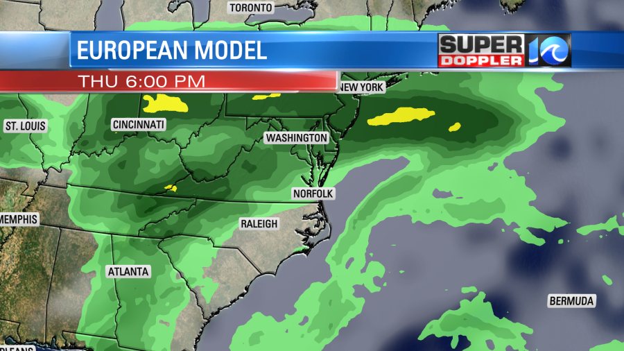
Eventually, we will see the remnants of Zeta into our area later this week. This will bring us widespread rain on Thursday and Friday. It doesn’t look like it will be a washout but something you will want to keep your eyes on!
The good news is, the Halloween forecast is looking dry! We’ll have some sunshine but it is going to be a lot cooler. Models are showing high temperatures on Saturday will be in the 50s. We’ll keep you updated as things changed!

Have a great Monday! -Meteorologist Casey Lehecka