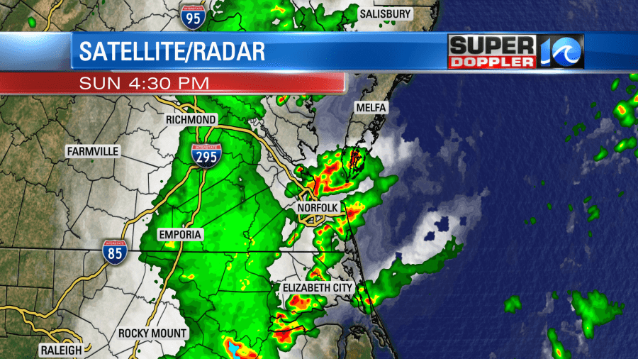
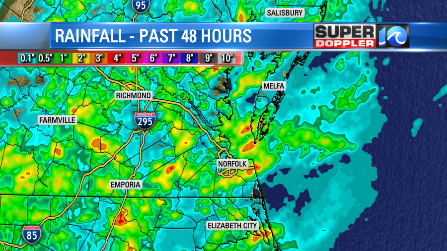
Yesterday there was a lot of heavy rain up-and-down the east cost. There was even some flooding in several locations. The biggest headlines came from New York where at least one death was reported. Many streams and rivers have swelled above their banks. We also had some clusters of heavy rain in our region yesterday.

The rain really added up for some. Some folks had 1-3″ of rainfall.

My weather watcher (Scott in Yorktown) had about 1.7inches. A viewer (Gerry in the Princess Anne part of Virginia Beach) had 2.5″ of rainfall. However, some viewers in Williamsburg missed the rain as well as in Bertie county, N.C.
Looking at the rainfall climate for Hampton Roads… We just finished a very wet June. We were about 2.67 inches above average. So far we have picked up 1.87 for the month of July. We’ll see what the rest of the month brings.

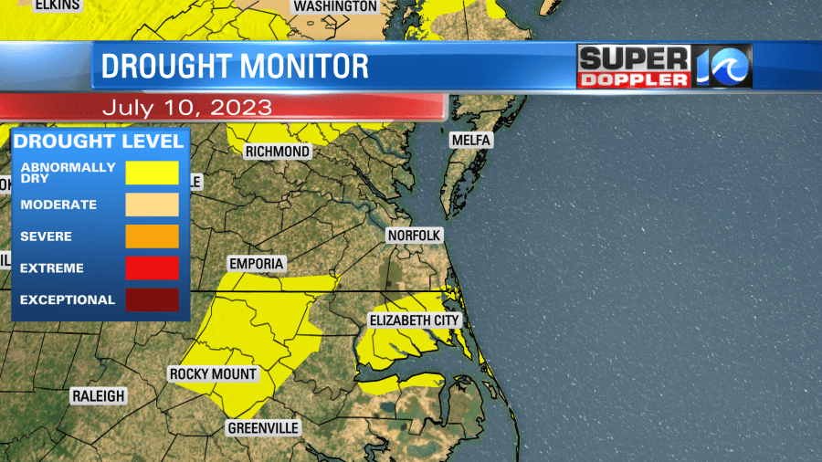
Surprisingly, there are still some areas that are abnormally dry according to the latest U.S. Drought monitor.

Those may disappear by the next update. We’ll see.
The rain from yesterday was focused ahead of a cold front. There was an area of low pressure to our north. Today both of those features have moved east.

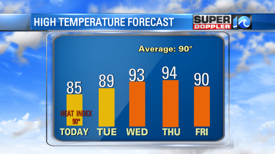
The front has drifted past Hampton Roads, but it is going to stall out today. We’ll be slightly cooler and only slightly drier today. High temps will be in the mid 80s with some upper 80s inland. We’ll have a few showers and storms popping up this afternoon, but the coverage will only be about 30%. That’s much less than yesterday. Still, there may be some isolated heavy rainers.
Tomorrow the front will sink a little more to the southeast. We’ll dry out a little more, but we’ll also have a lot of sunshine. So high temps will aim for the upper 80s to near 90 degrees.

We’ll be partly cloudy on Wednesday with highs in the 90s. Humidity will climb again. So the heat index will likely be over 100.


We’ll be hot and humid for the rest of the week. Highs will be in the 90s. The heat index will be over 100 for many. It’s getting to be that time of year!
Meteorologist: Jeremy Wheeler


