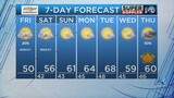
For the most part Ophelia is gone. It’s done. However, the remnants of Ophelia will be bringing us lots of clouds, some showers, and a cool breeze early this week. The remnants have basically become a weak area of low pressure, a big deck of clouds, and some scattered showers.
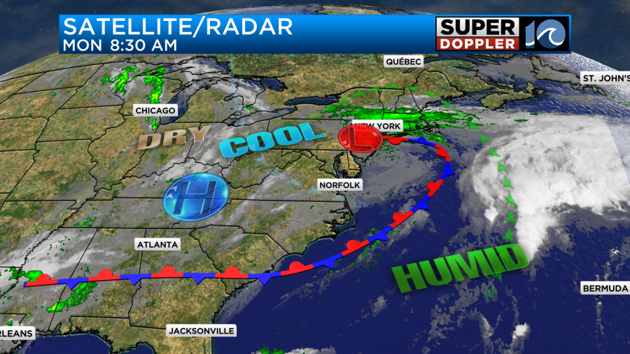
There is a stationary front attached to the low, and there is a weak area of high pressure to our west. The weather will definitely be calmer today. However, we are going to hang on to a lot of the clouds that we had over the weekend. The sun will pop out at times. So we’ll be partly to mostly cloudy through the day. More sun is expected to the south. There will be a light northwest breeze running at about 8-12mph. High temps will be in the mid-upper 70s.
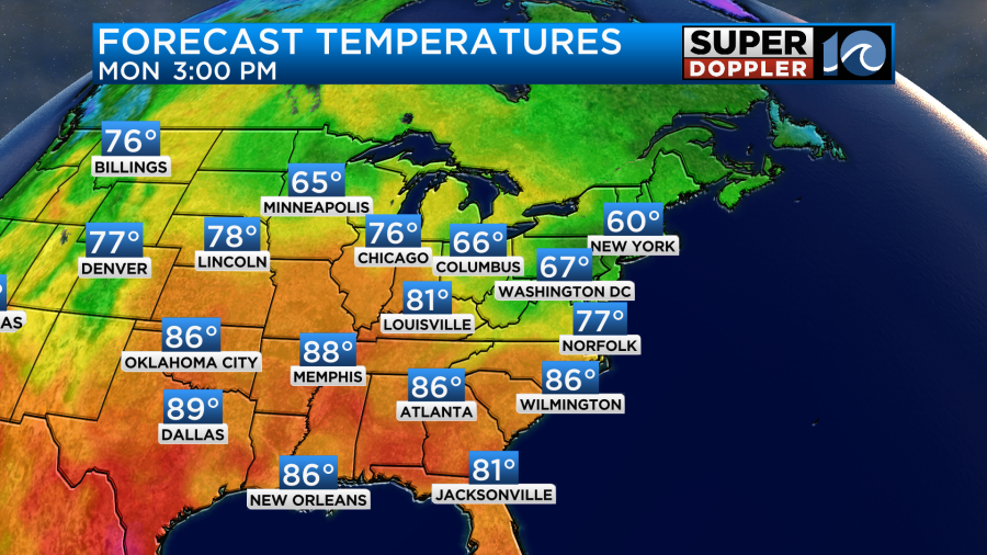
It may hit 80 in a few spots to the south/southwest. There will be some isolated showers or sprinkles in the region. Tomorrow the low and the front will both sink to the south. (The stationary front will become a cold front). We’ll be mostly cloudy with some scattered rain showers coming in from the northeast.
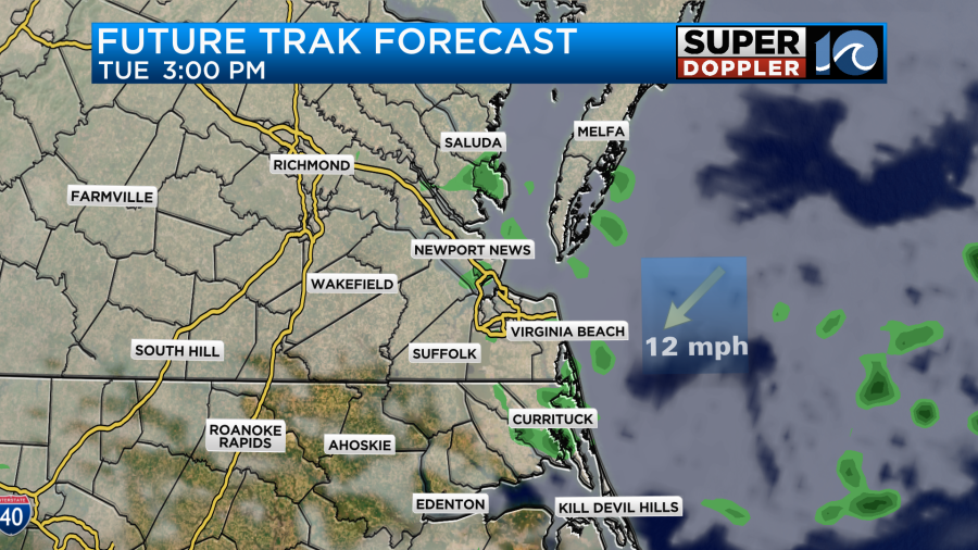
The wind will pick up out of the northeast. It will run at 10-15 mph with some gusts to 20 mph. The temps will cool some more. So highs will only be in the low 70s or even near 70.

Along with the scattered showers there will probably be a lot of drizzle. So I may increase the rain chance just for that reason. This type of weather will continue through Thursday. It will stay cool all week.

Truthfully, we often ask for high temps in the 70s, but I think it would be better if the sun was out some more during the next few days. The good news, of right now, the trend looks drier and a little warmer by next weekend.
The tropics are still busy. We lost Ophelia, but we gained Philippe.

Philippe is a tropical storm in the middle of the Atlantic. It will move to the west/northwest over the next few days, and it may turn a bit north by the weekend.
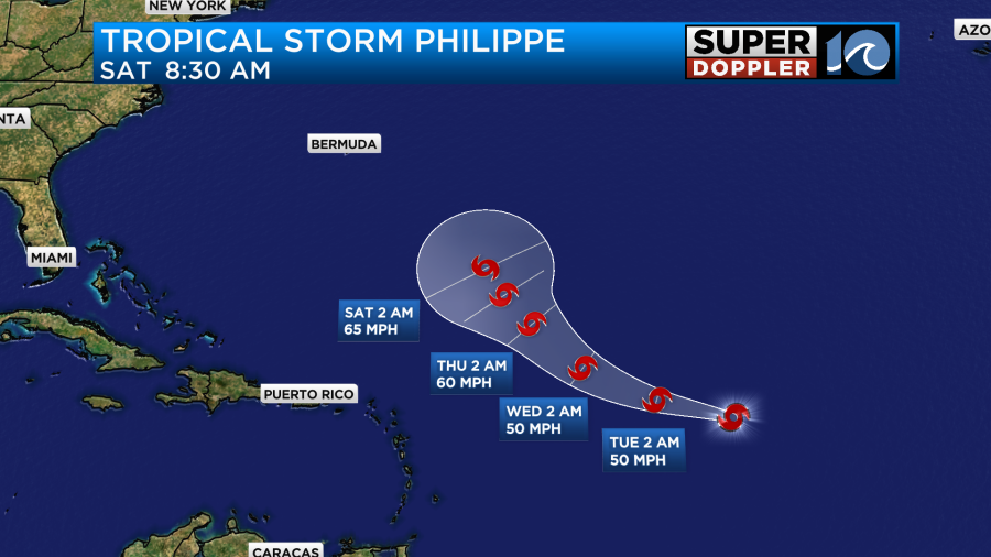
It doesn’t look to strengthen much. However, there is still a lot of uncertainty in the track. Take a look at some of the latest models:
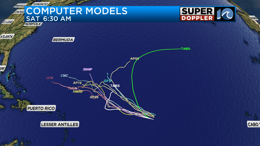
The Canadian model (CMC) isn’t favored, and that is one of the more western models. The GFS model has it turning to the northeast eventually. However, the consensus (TVCN) is more to the west. We’ll have a little more confidence in its track by tomorrow.
There is another tropical disturbance in the eastern Atlantic that has a high chance of formation over the next few days as it moves to the west/northwest.
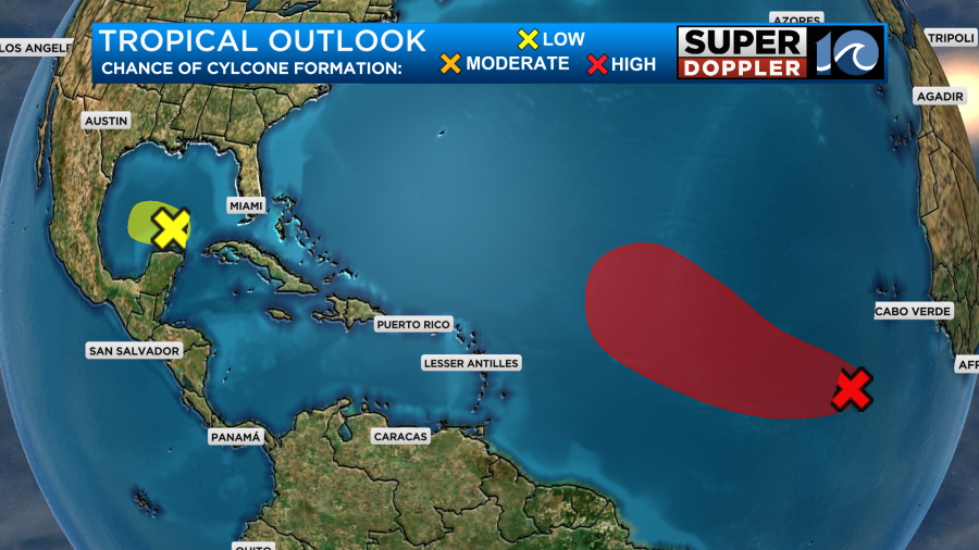
There is also a weak disturbance in the southern Gulf of Mexico that has a low chance of formation. We’ll keep an eye on each of these features and bring you updates this week.
Meteorologist: Jeremy Wheeler