
Last night there were multiple severe storms and tornadoes over the Tennessee River Valley. The severe weather has been off the rails for weeks, and now parts of Tennessee and Alabama have been hit hard.
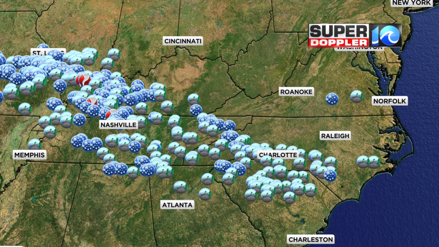
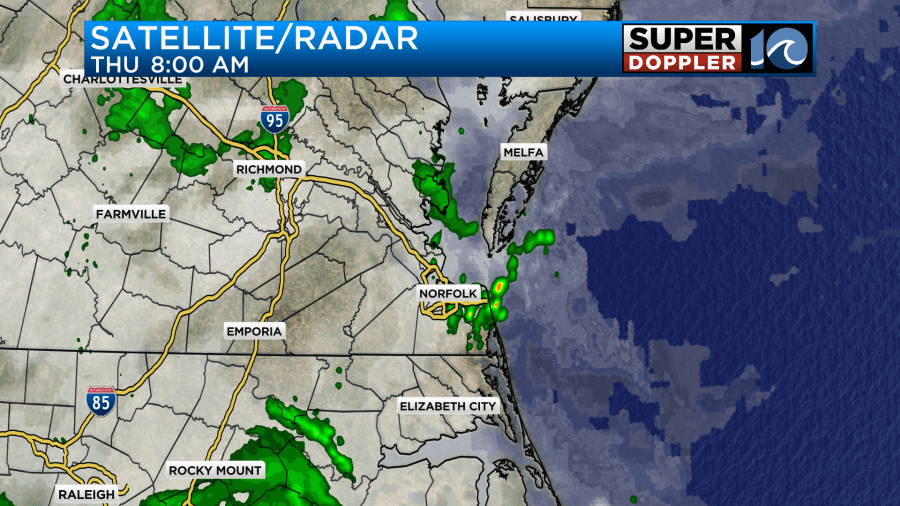
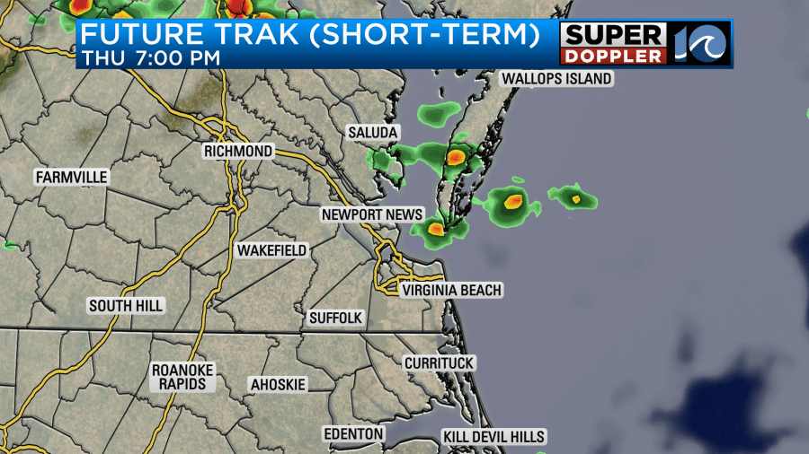
Luckily we have been spared from the bad weather. We did have a few showers and storms yesterday evening, but they only had a little heavy rain with an isolated strong storm or two. This morning there were a few scattered rain showers, but they were mostly light.
There aren’t any big weather features around at the surface. High pressure is to our southeast with a stationary front just to our north.
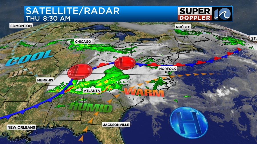
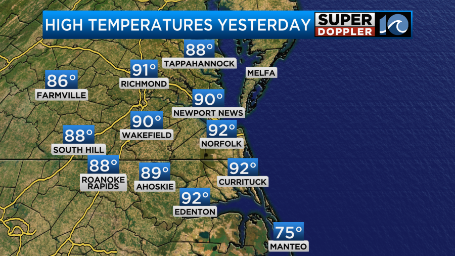
There is a big cold front to the west, and this is what will change up our weather (and temps) going into the weekend. Yesterday was hot! High temps were in the low 90s.
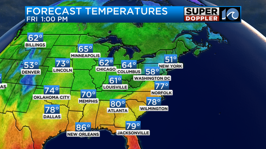
Today we will heat up to the mid 80s, and it will be humid again.
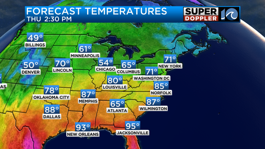
It will feel like 90 with the heat index. However, there will be a mix of sun and clouds today (partly to mostly cloudy). This will stop us from heating up to yesterday’s numbers. After the early showers this morning there will be a long break. Then we’ll have some scattered showers and storms forming later today.
With all of the heat and humidity there will be some fuel for a few strong to severe storms in the area. At one point we did have a slight risk for severe weather which is category 2 out of 5.
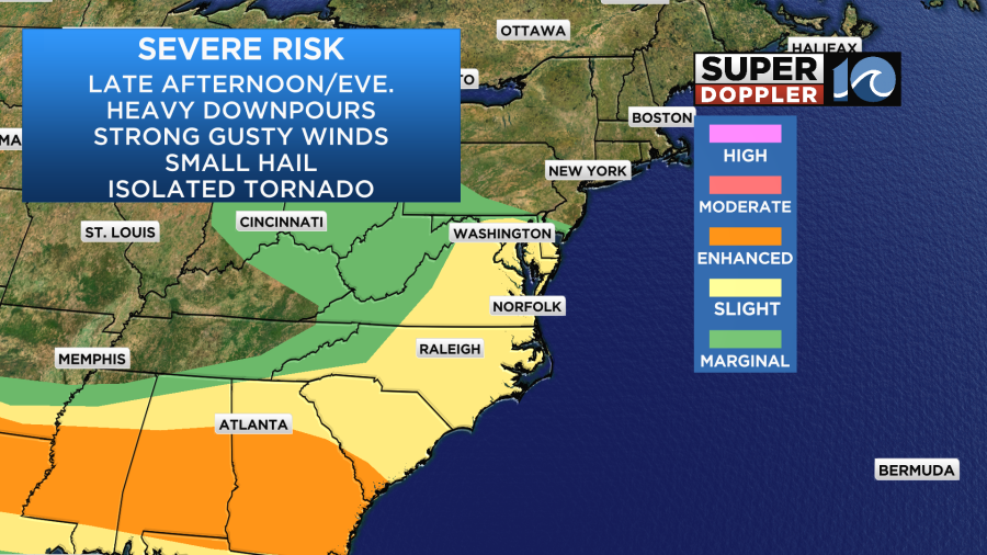
However, the 9:00am update came out and lowered our risk to marginal.
I agree with this due to the lack of big coverage later today. The rain and storms may pick up a little more by the evening, but we’ll see.
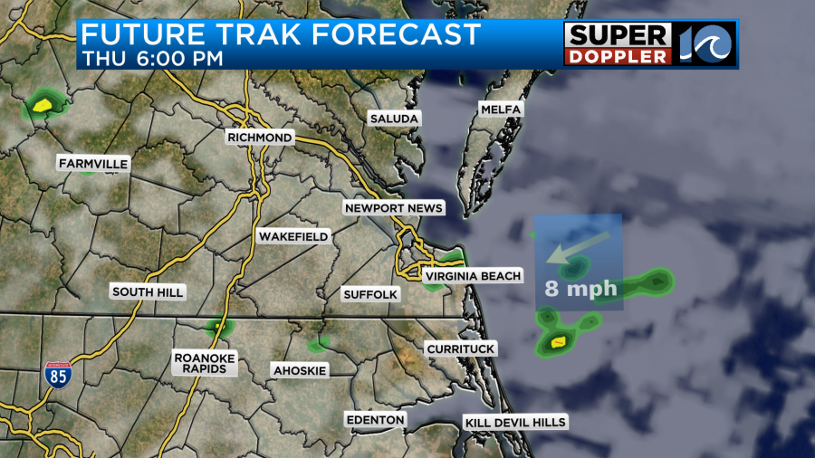
Tomorrow we’ll start off with quiet weather. However, clouds, rain, and storms will increase through the day. Temperatures will fall as a cold front swings through the region.
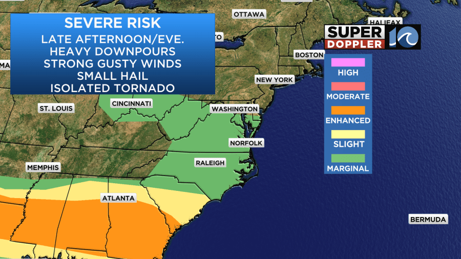
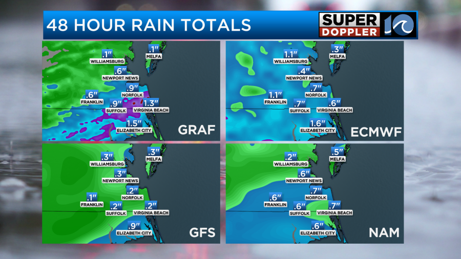
This should reduce our risk for severe weather. HOWEVER… the chance for rain and even heavy rain will probably increase. Our Future Trak model has some scattered showers by the mid afternoon. However, it has a flare up of showers and storms during the early evening.
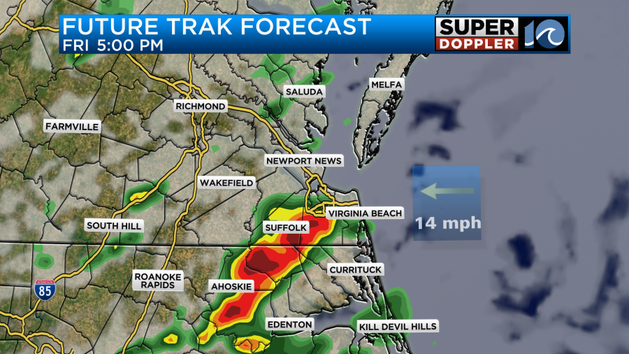
It seems like the front will briefly stall out with an area of low pressure moving along it. Then the front will make a stronger push to the south by the later evening. Much drier air will move into the region for the weekend.
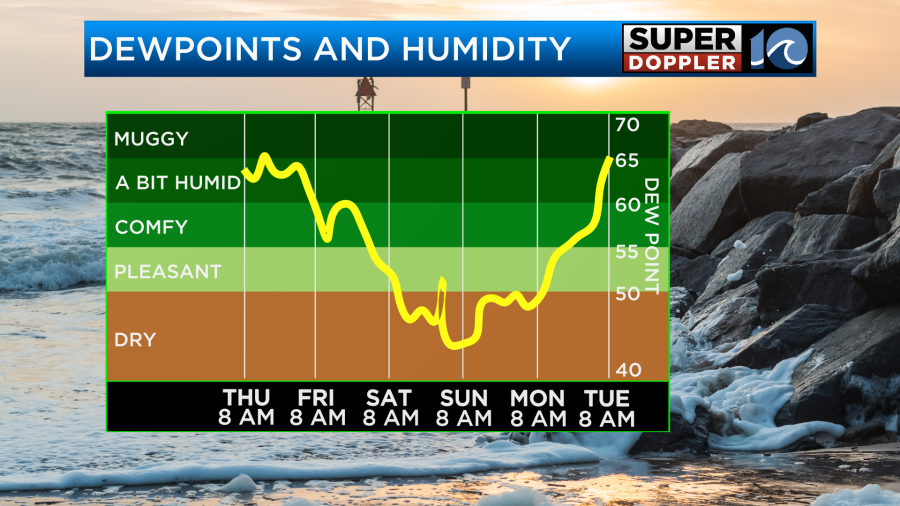
However, it won’t be dry enough to give us a lot of sunshine. The latest models now have some lingering/isolated showers on Saturday with a mix of sun and clouds. It also has high temperatures in the 60s Saturday.
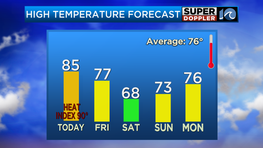
An upper level low may bring some spotty/isolated showers on Sunday. Otherwise, we’ll have a mix of sun and clouds with highs in the 70s.
We could pick up a couple tenths of an inch of rainfall today and this evening. However, tomorrow we may pick up a half inch to an inch and a half.
Meteorologist: Jeremy Wheeler


