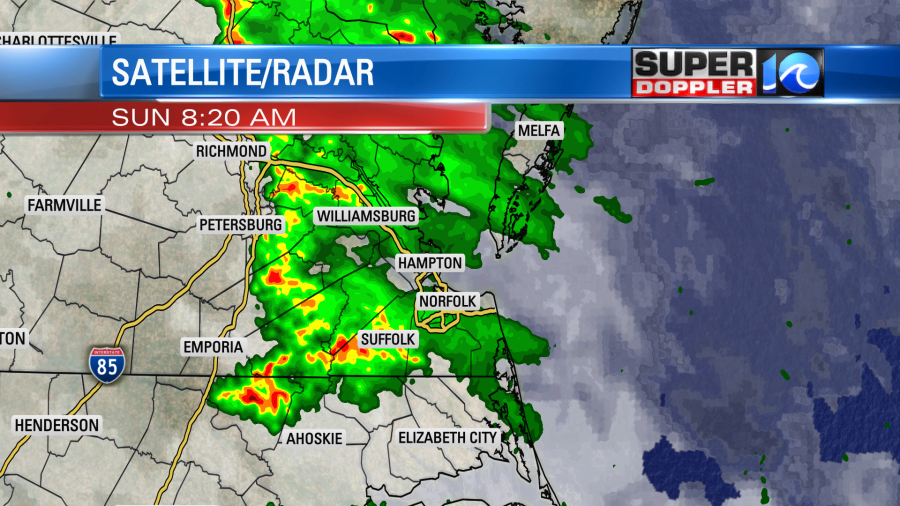
This morning there was a warm front lifting up from the south.
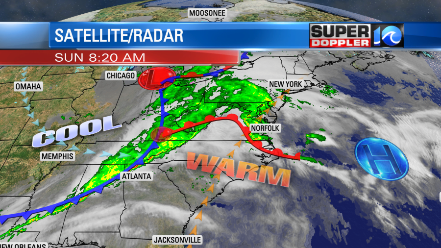
This created a few clusters of showers and storms early. Some of the rain was very heavy for a time.
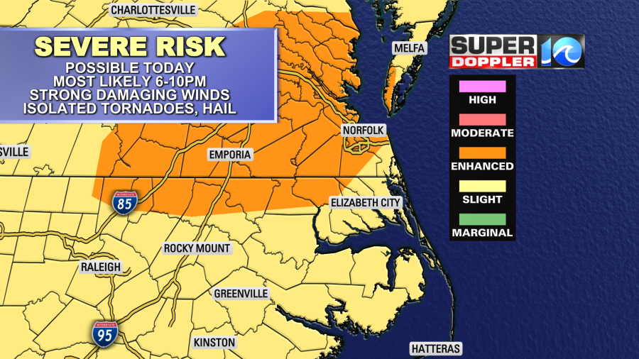
As we go through the day, the warm front will lift to our north, and that will put us in the warm zone. Winds will increase out of the southwest at 10-20mph with gusts up to 35mph. This will push the high temperatures up into the low-mid 80s. Humidity levels will rise as well. Dew points will be in the 60s. This will create increasing instability today. After the cluster of showers and storms this morning we’ll only have some isolated to scattered showers and storms between the late morning and mid afternoon. Even though the coverage won’t be high through that time, any storms that do form could pack a punch. The chance for rain starts increasing a bit during the late afternoon into the evening. However, the highest chance will be during the later evening as the cold front approaches from the west. A line of showers and storms will form ahead of that front.

Keep in mind that if the winds are a bit stronger (overall), then the line may come through a bit earlier than forecast. Either way this will give us our highest chance for storms and severe weather. Winds could gust up to 60mph in any of the storms. The showers and storms won’t last too long. Plus, they will be on the move. So I don’t expect any widespread flooding. However, large hail and isolated tornadoes will be possible.
We’ll clear out tonight with lows in the 40s. Then tomorrow will be much cooler and drier. High temps will be closer to 60 degrees. This is actually just below the average. We’ll have a lot of sunshine. It will be a nice day. Pollen levels will be moderate today and tomorrow. We’ll be nice again on Tuesday with highs in the mid 60s. Then we’ll warm up again on Wednesday into the 70s. We’ll have more scattered showers and storms forming later in the day. There is a huge cool down expected for the end of the week. High temps may only be in the upper 40s on Friday. Low temps will be in the low 30s for a bit. If it pans out, then we’ll have a frost in the region. I just planted some plants in the front yard. So I’ve got my fingers crossed that we’ll warm up a bit before we get to that day. Stay tuned for updates!
Meteorologist: Jeremy Wheeler


