Over the last 24 hours we had scattered rain showers with a few heavy downpours over the region.
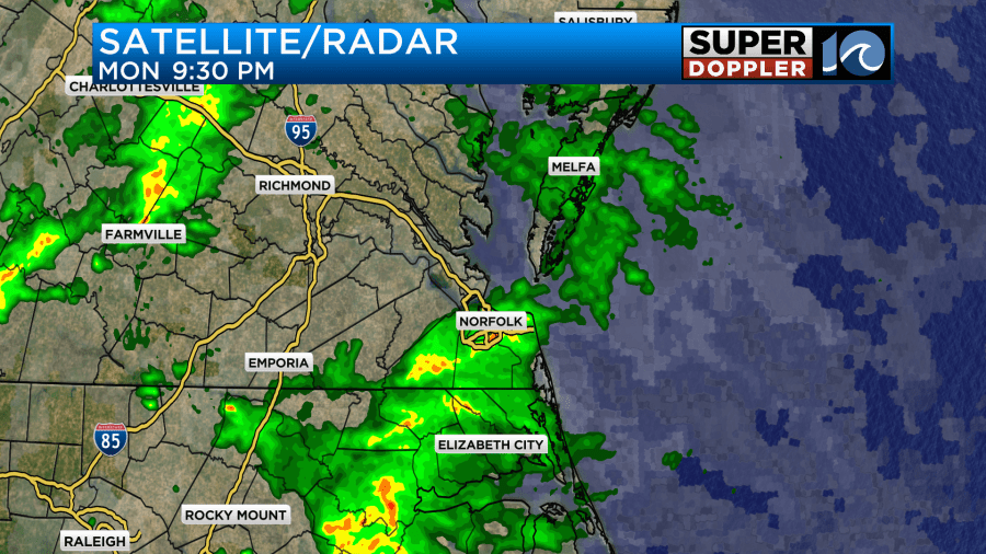
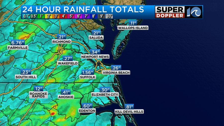
Overnight there were some heavy showers, but luckily they turned into scattered light showers during the morning commute. A few locations had about 1-2 inches of rainfall over the past 24 hours. However, most areas have had about a quarter to a half of an inch.
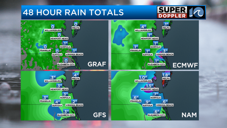
We’ll likely see another quarter to half inch over most of the region with some isolated locations getting an inch.
In the long term we are actually a bit dry. Overall, the last couple of months combined have been well below average.
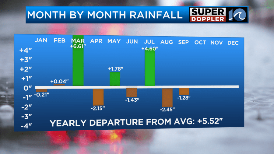
However, we are doing just fine (with a capital F) in the short term. In fact, some areas really won’t need rain for a while. On top of that there was some minor tidal flooding this morning, and that may have created poor drainage in some places.
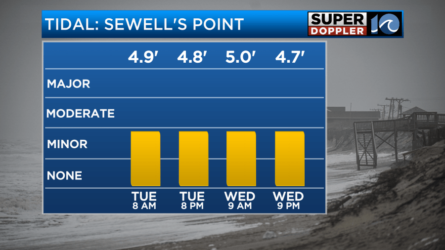
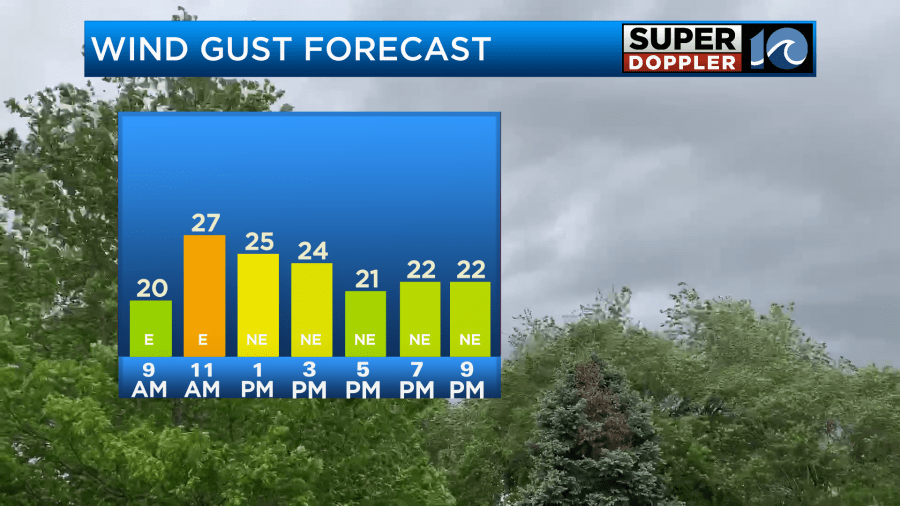
This minor tidal flooding is going to continue today into tomorrow. The main reason for this is that the northeast winds have increased. They will gust up to 25mph out of the east/northeast today.
This is due to a weak area of low pressure offshore with high pressure over the northeast.
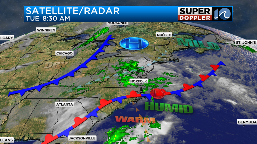
There is a stationary front just to the south. There is also an upper level low scooting east overhead. Plus, there is a lot of deep moisture over the whole area. This means that we’ll stay cloudy through most of the day. We’ll also have scattered showers continuing through the day. The showers may lighten up this afternoon, but pockets of drizzle will likely also mix in. This will continue into the early evening.
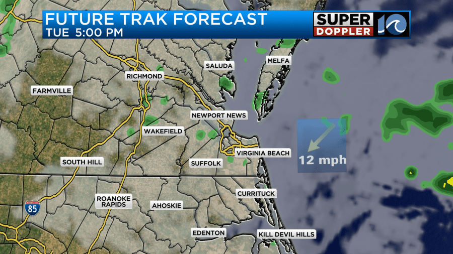
With all of these features combined, we’ll stay cooler today. High temps will be in the mid 70s.
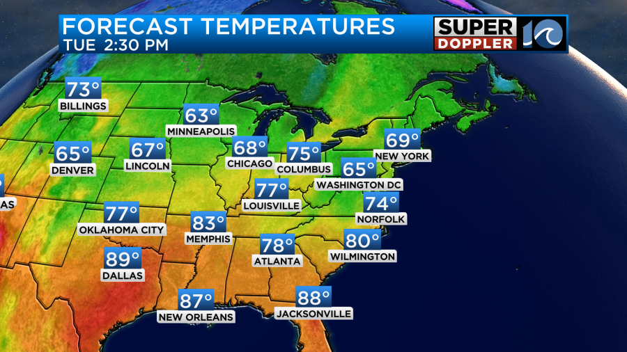
By tonight the showers should become very spotty along with a little drizzle. Then tomorrow we’ll finally filter in some drier air. A weak cool front will slide through the area through the day. This will create some isolated showers. High temps will be in the 70s, and we’ll continue with the northeast breeze. We’ll stay pretty humid through tomorrow afternoon. After the front slides to our south late Wednesday we’ll finally dry out to more comfortable levels.
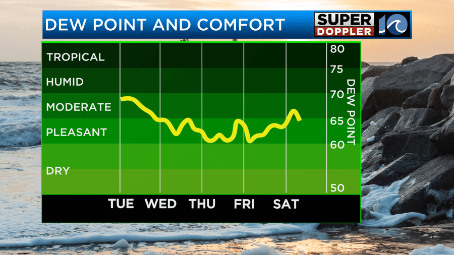
We’ll have some nice weather on Thursday. Skies will be partly cloudy. High temps will be in the upper 70s. The drier conditions are what will make it feel nice. It won’t be super dry, but it will be better. The nice conditions will continue through the weekend. Highs will be in the upper 70s to near 80. The long-range models are still showing some much cooler temps going into Tuesday and Wednesday of next week. It’s possible we’ll have our first day this season with highs in the 60s. We’ll see.
In the tropics… There is only one named storm in the Atlantic basin as of this writing. Tropical storm Kirk is gaining strength over the central Atlantic. It is forecast to move northwest and then north. It is also expected to become a major hurricane within the next few days.
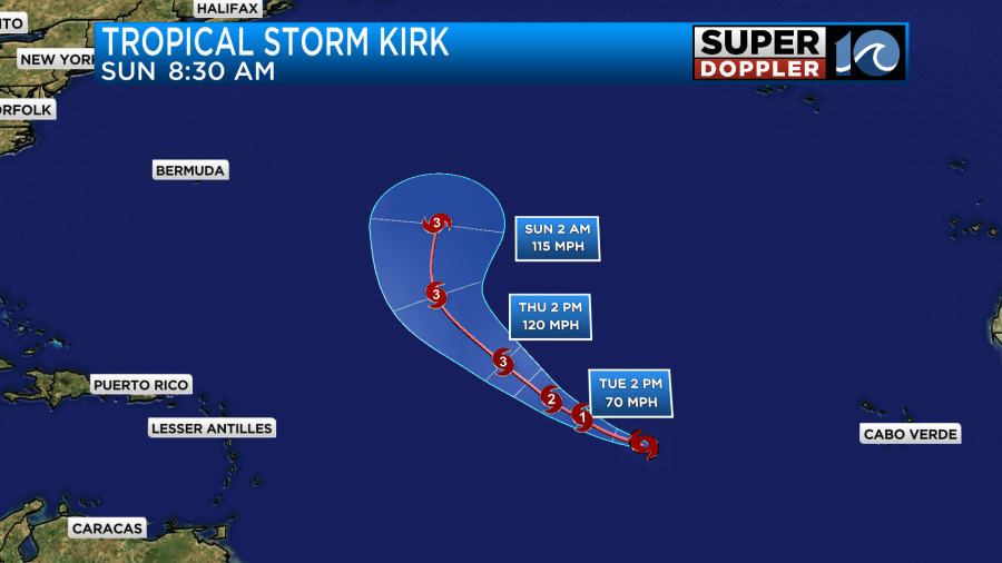
It will likely stay out to sea, but it will probably send some sizable waves towards the east coast. We have already had a lot of rough surf and beach erosion over the past month. So this will increase again as we head later into the week and weekend.
Aside from Kirk there are two other potential areas of formation.
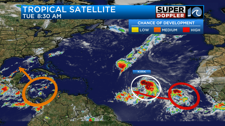
The area of interest in the eastern Atlantic has a high chance of formation. It will (probably) stay out to sea, but that is definitely not a guarantee. The feature in the Caribbean has a medium chance of formation, but it is the most concerning. It is forecast to get into the Gulf of Mexico in a few days. The long range models have it more as a rainmaker than a windmaker. However, there is still a lot of warm water over the Gulf. So I don’t have any confidence in any forecast that far out. Even heavy rain could be a big problem for the Gulf Coast. I’ll have more on it in tomorrow’s weather blog.
Meteorologist: Jeremy Wheeler


