This morning I was tracking widespread rain moving in from the west.
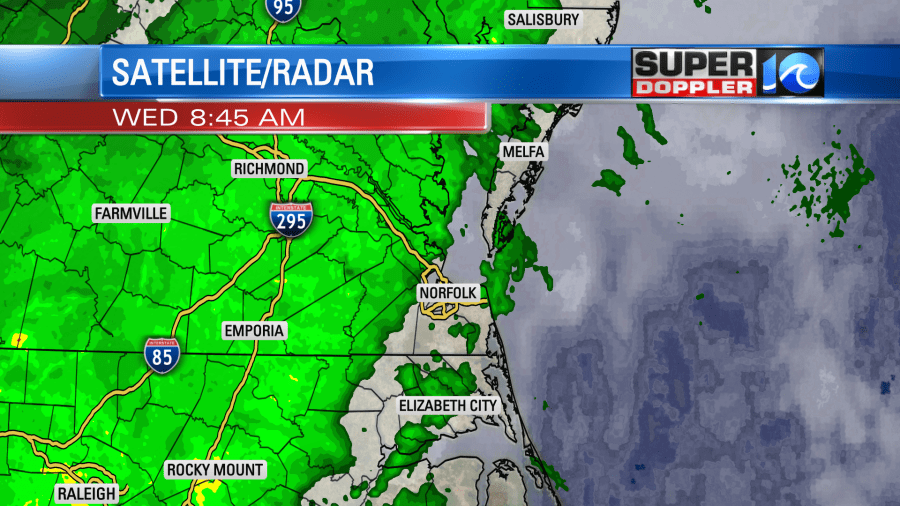
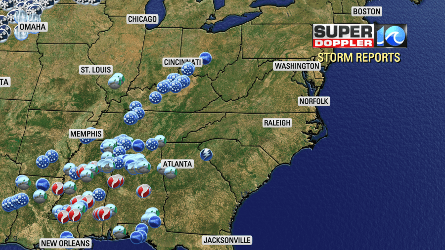
Between 5 and 8am there were some scattered rain showers affecting the morning commute. However, we were lucky that the rain shield had stayed to the west up to that point. As we go through the morning the steady rain will slide through the region. This is from a process called overunning. That is when warmer/more humid air pushes up over a cooler air mass. This in turn wrings out the moisture and causes rain to fall. So this is indirectly tied to the storms that happened to our west over the last 24 hours. It was pretty rough out there. They had over a dozen tornadoes across the Deep South along with numerous severe wind and hail reports.
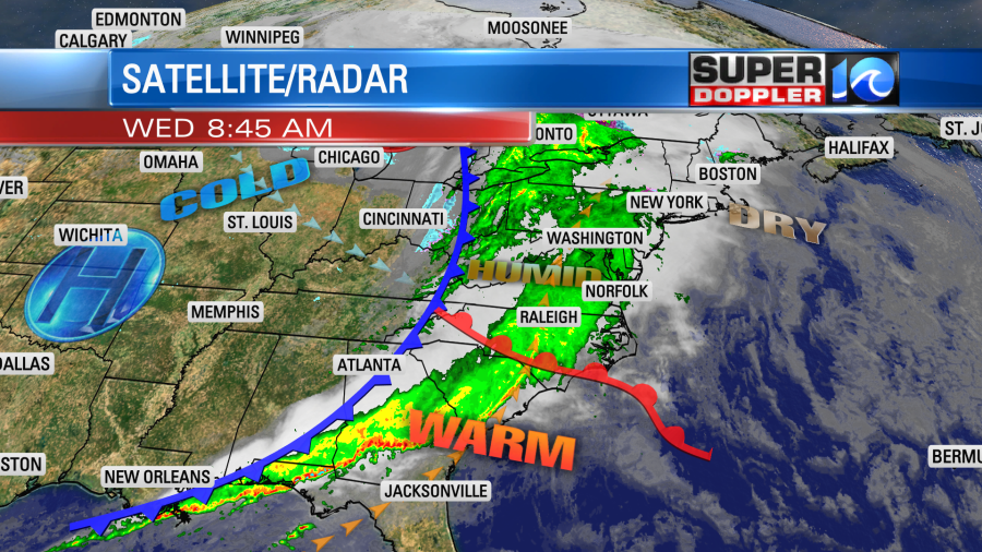
As the storm system moved east it lost a lot of its energy. So our region will only experience light rain with a few heavier showers. There is a warm front to our south. That will move in around midday (thus shutting down the overrunning). There is a strong cold front to our west.
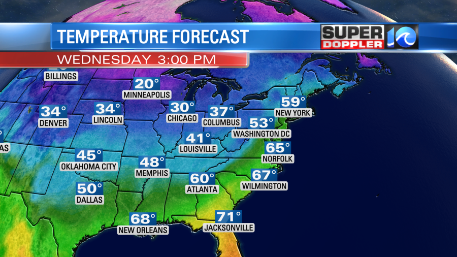
We’ll be warm, humid, and breezy today as the winds pick up out of the south. They will run at 10-20mph with gusts up to 30mph. This will push the high temps up in the upper 60s with a few 70s south.
Rain will be pretty widespread from the mid-morning until about Noon-1pm.
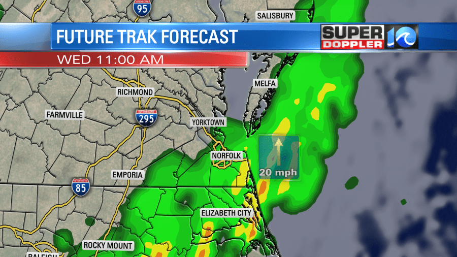
Then after the warm air moves moves in at the surface the showers will become more isolated/spotty. So we’ll still have a lot of clouds this afternoon, but the rain showers will only be isolated into the evening. The cold front will move through during the early evening. That will prompt the last of the rain. Then we’ll dry out and clear out tonight. Low temps will drop to the 30s and 40s. Rain totals will be around a quarter of an inch or so.
Tomorrow we’ll have lots of sun with a few clouds. However, the colder air will pour into the area. So high temps will only be in the upper 40s to low 50s. We’ll be cool and dry on Friday with highs in the 50s. Then we’ll warm to the 60s again on Saturday. We’ll have increasing clouds. There will be some isolated showers late in the day with a little more by the evening. This will be ahead of the next cold front that will cool us down on Sunday.
Today is the last official day of hurricane season. We had 14 named storms with 8 of those becoming hurricanes.
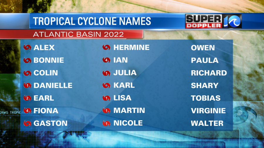
There were many storms that stayed offshore. However, many of the ones that affected land did a lot of damage. Ian and Nicole were notable for Florida and the Southeast. However, the parts of the Caribbean and Central America also had some flooding and damage from several other storms.
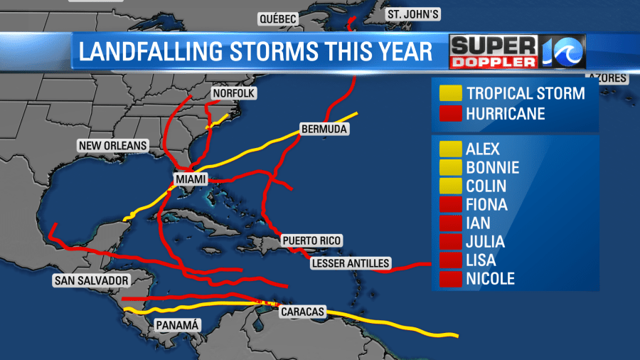
There are no tropical systems expected for the next few days in the tropics. Even though the season has ended, you can still have a storm form until the end of the year… Technically. But that is very rare.
Meteorologist: Jeremy Wheeler


