The smoke was very thick Wednesday at times. We ended up with a code red alert for the region which means that the air was unhealthy for everybody. Last night we had an area of showers and storms that washed out some of the smoke and haze.
The air felt a little fresher this morning, but I did have some people report the smell of smoke where they were. The light amount of smoke in the air combined with the high moisture, so there was some pretty thick fog in the region as folks headed to work.
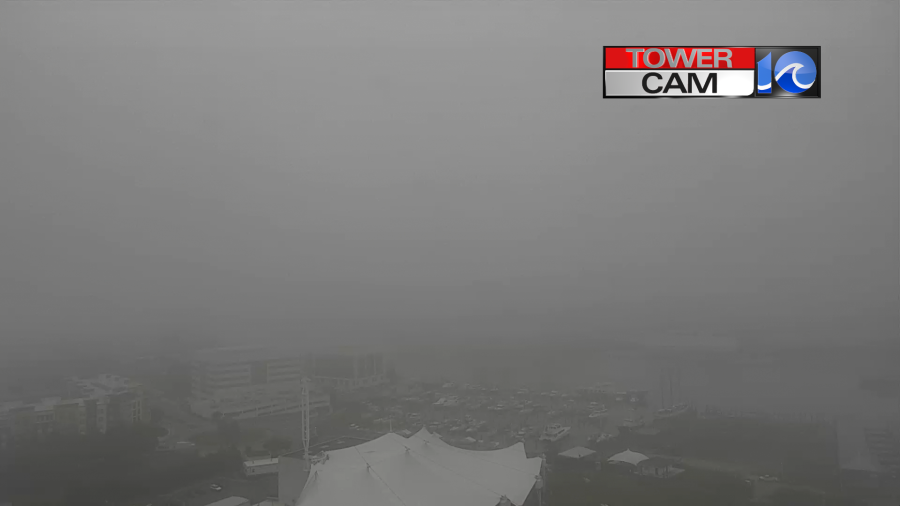
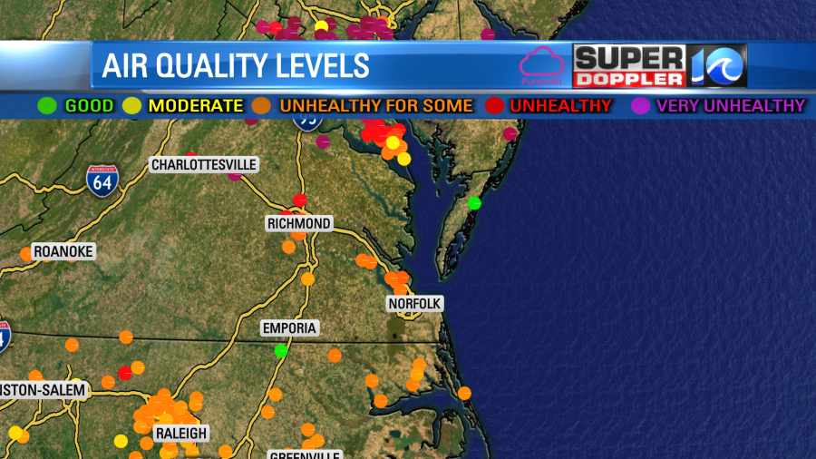
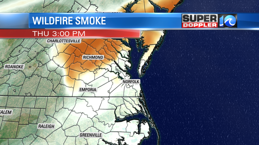
The fog should eventually lift today, but it may take some time. As mentioned, there will still be some smoke in the region. Though I think it will be better than yesterday. Most sensors were showing orange levels with red levels to our north.
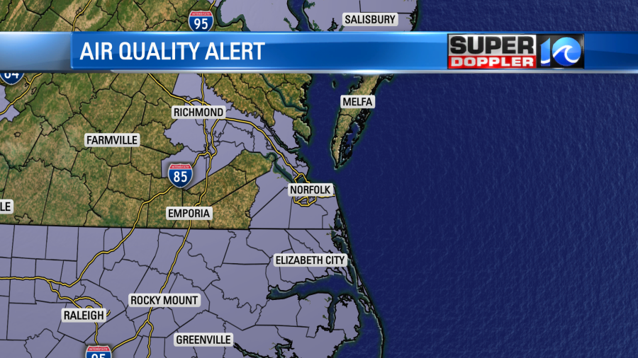
The Virginia Beach Department of Health issued a message to residents Thursday saying they should limit or avoid outdoor activities because of the smoke from Canada impacting air quality. Poor air quality can aggravate health problems, such as asthma, heart disease and lung problems.
We do have more Air Quality Alerts for the region.
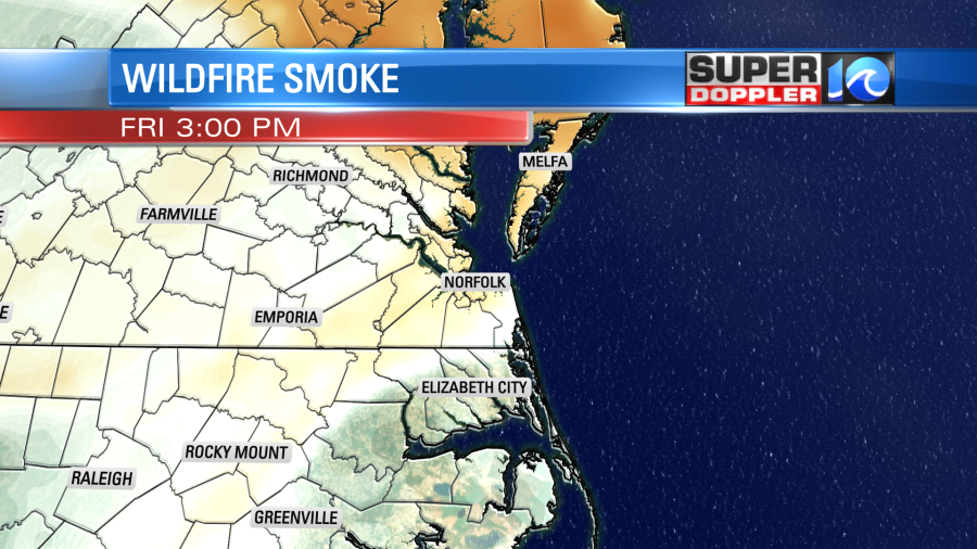
Our Future Trak model is also optimistic about less smoke today and tomorrow.
Though it does have it picking up a bit more tomorrow before thinning out again.
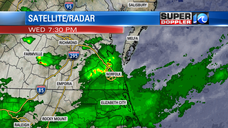
Aside from the smoke and haze in the region we will have a few more showers and storms today. There is a cool front to our south, and it is briefly stalling out.

There is also a weak area of low pressure stalling along the front, but it is offshore and to our southeast. What you can’t see is that there is also an upper level low overhead.

This means that we will have a few showers and storms popping up between about 11 a.m. and 5p.m.
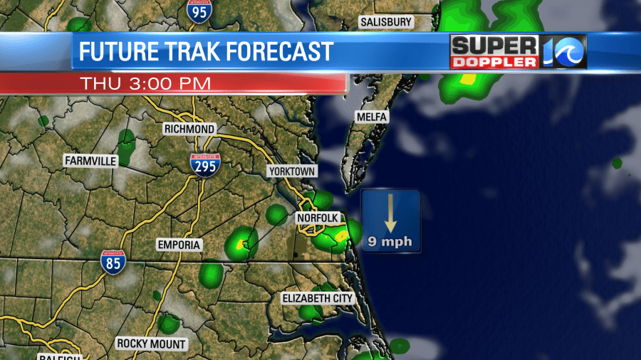
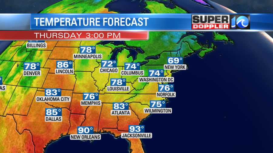
The haze and some clouds will keep temps from climbing too much. We’ll also have a light north wind. So high temps will aim for the mid 70s later today.
Any rain that forms will dissipate by the mid-late evening. So we’ll have partly cloudy skies overnight. There will likely be some more fog forming.
Tomorrow the front will sink a bit more to the south. Outside of the smoke/haze we’ll have partly cloudy skies. There will be some isolated showers and/or storms in the afternoon and early evening, but it is a pretty low chance. I think it will be a pretty nice day overall. High temps will probably run a bit higher as more sun is expected. They will aim for the mid-upper 70s.

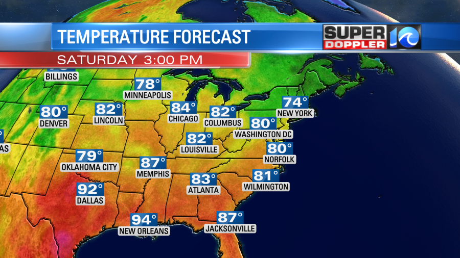
Luckily the weather looks to improve even more as we head into the weekend. High pressure will build in closer to the area. We’ll have partly cloudy skies on Saturday with high temps in the low 80s. Yes!!!
I don’t see any rain in the forecast for Saturday. However, it is tough to say whether-or-not the smoke will return.
Sunday looks awesome too. For now it looks mostly sunny with highs in the mid-upper 80s. I am a little concerned already about Monday. It looks like a pretty stormy setup with a warm front entering from the south. Then a cold front in the evening. We’ll definitely be warmer than we have been, and there will be some high humidity. We have plenty of time to keep an eye on it. Plus, the details may change.
I know we have had a lot of cool temps over the last 2 months. It does seem like our weather pattern is finally changing to a warmer one. There has been record heat in other parts of the country. I found an article this morning about some extreme heat lately in Puerto Rico. Apparently, they just had a heat index that was higher than parts of the Middle East. It hit 125 degrees. That is the feels like temperature a.k.a the heat index. That is a very high number. The highest that I’ve seen here has been about 115. Maybe up to 118, and those were during a couple of very hot Summers. Here is the article with more information: Puerto Rico record heat.
One big concern about this… Sure the land is heating up, but that that means that the water temps will also be heating up big-time. Despite a possible El NIno weather pattern, could this mean that there will be a high amount of tropical activity in that part of the Atlantic? We’ll see.
Meteorologist: Jeremy Wheeler