We have another warm Summer-like day before cooler/wetter weather arrives this weekend.
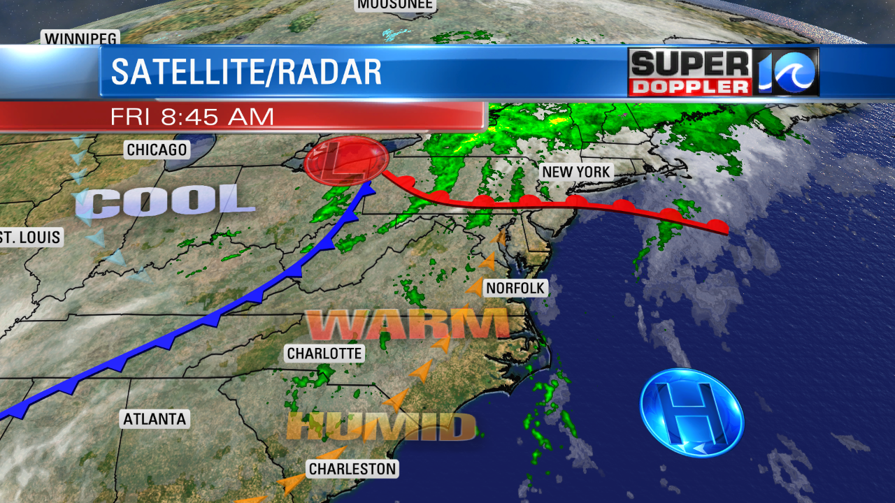
Today we are still in the warm zone with a warm front to our north and a cold front to the west. High pressure is sitting to our southeast.

We have a lot of humidity coming up from the south along with the warm temperatures. So we did already have a few isolated showers along the coast this morning. We may see a couple more isolated showers pop up this afternoon, but they should be limited.
We’ll have the breeze out of the southwest today at 5-15mph. This should stop the sea breeze from forming and cooling things down in the metro. So high temps will rise to the mid 80s with cooler temps near the shore and on the Eastern Shore.
By tomorrow morning the cold front will move into the region. There will be a few scattered showers during the morning. The chance for rain is about 30% to 40% between 8 a.m. and noon. The front will then stall out somewhere near the state line by midday. Scattered showers will form north of the front as it will probably nudge northward a bit. There could be a few thunderstorms during the afternon as well.

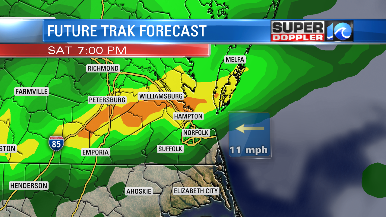
High temps will be in the low 70s. Future Trak shows a pocket of heavier showers Saturday evening as an area of low pressure moves along the front.

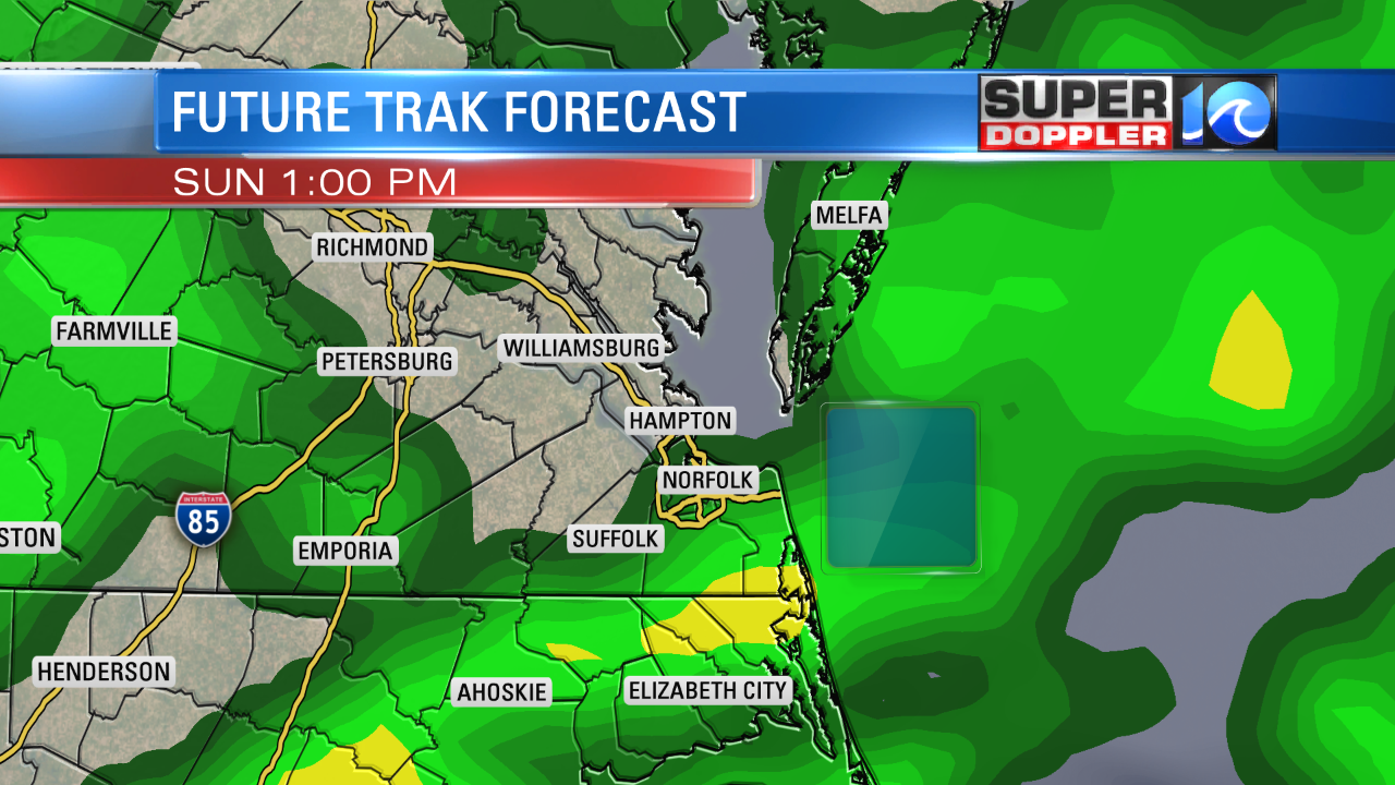
The low will move offshore Sunday, but the front will linger over the area. So there will be on-and-off showers through the day.

Hopefully, there will be some breaks in-between. Another low will move along the front Sunday night into Monday. So even more rain will fall. This should wrap up by Monday evening.
The timing of the weekend rain showers could easily change, but those are the latest trends in the models that I see. The rain will add up in the rain guages. We’ll see about 1-2″ solid, and some locations could see more than 2″. There could be some localized flooding, but I’m hoping the rain will be spread out enough that it won’t be widespread. We’ll be cooler and dry for most of next week after Monday. Highs will be in the 70s.
Some of that cooler air headed our way comes from a recent chill in the Midwest. In fact there was some record snow over parts of Minnesota which impacted some graduations and games there.
Meteorologist: Jeremy Wheeler


