If I shake my head at this recent forecast any more, then I am going to get a mild concussion. Of course this is the weekend with one of the trickiest (& wettest) forecasts that we’ve had a long time. Actually, the trickiness has already started. For instance…This morning many folks over North Carolina and near the state line woke up to rain showers.
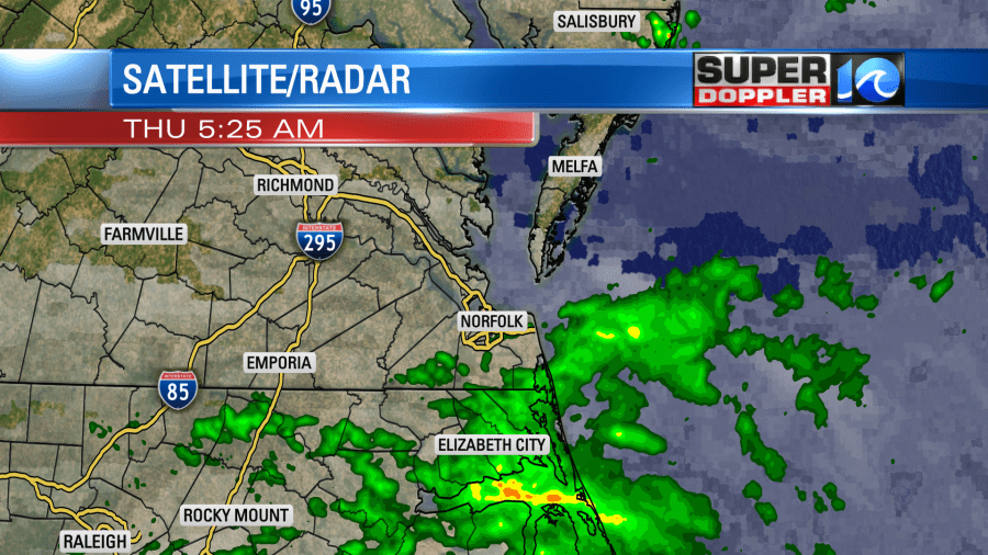
I’ll admit this was a bit of a surprise. Basically there is a very weak and small area of low pressure that formed along a stationary front to our south.
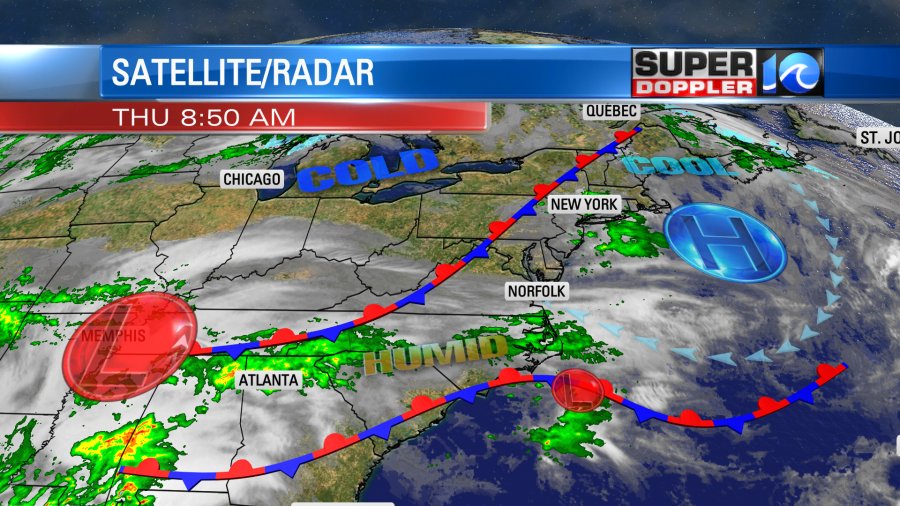
Most of the models did not pick up on this feature. There is also a stationary front to our northwest. High pressure is offshore. There is a much larger area of low pressure forming over by Memphis. That will impact us tomorrow.
So, meanwhile, we started off today with clouds and some scattered showers. As we go through the day the showers will decrease.
Showers will linger longer over northeast North Carolina. It will be pretty decent out this afternoon with a mix of sun and clouds and high temps in the upper 60s.
As we go through tonight the rain will move in from the southwest. I think most of the rain tonight will be from overunning. However, a warm front will lift up into the area by tomorrow morning. This will increase the rainfall during the morning commute.
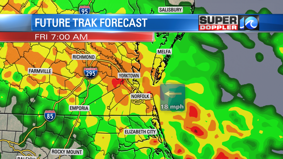
The moisture will quickly increase at the same time. So there may be some heavy downpours during rush hour.
The warm front should lift north through the day. This will, hopefully, decrease the rain showers during the afternoon. Our model is showing this scenario.
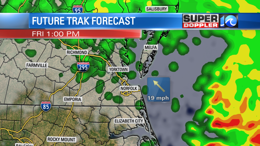
However, some other models keep the rain going for a while.
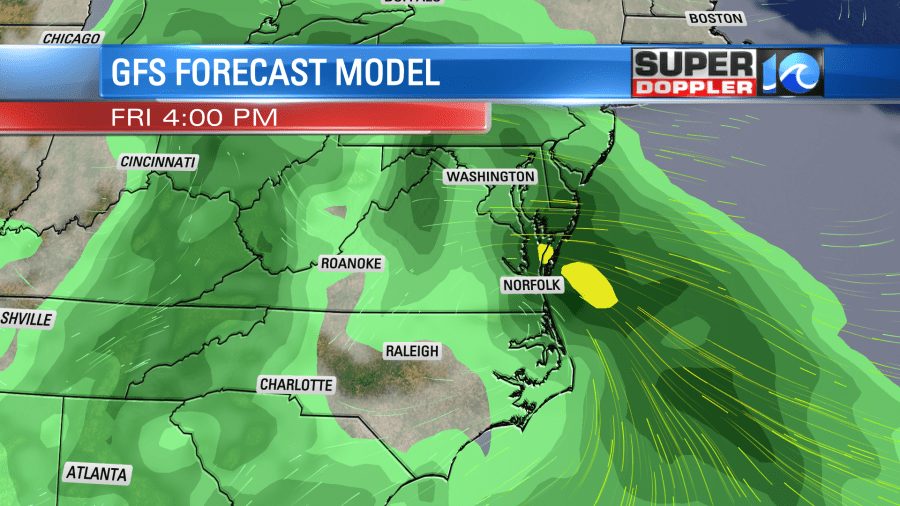
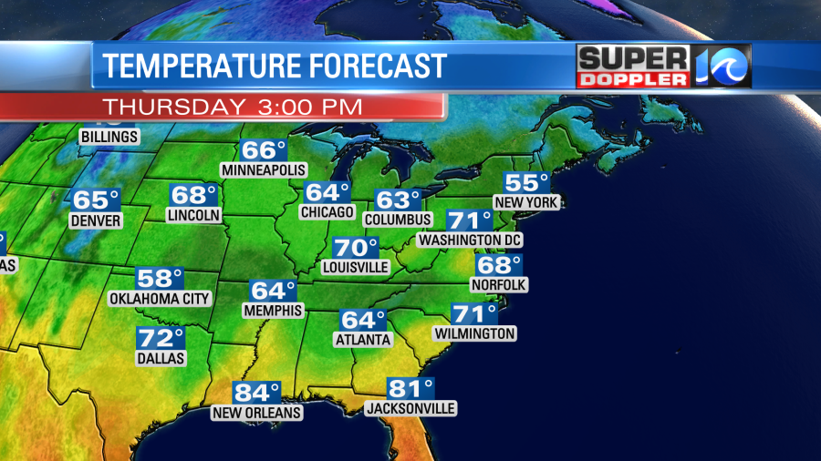
Keep in mind that the GFS is a little blocky at that point. Either way there could be a few thunderstorms as we go from the late afternoon into the evening. High temps will be near 70 degrees. Winds will be picking up out of the southeast. They will run at 10-15mph with a few gusts to 25mph.
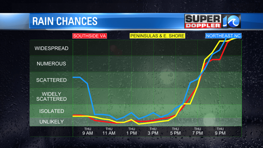
The good news is that all of the models are showing a drier Saturday. they have a mix of sun and clouds with only some isolated showers possible.
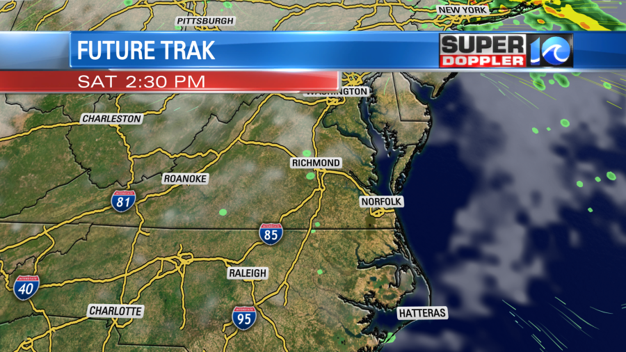
High temps will be able to push up to the mid 70s.
We could see an inch to an inch and a half of rainfall through early Saturday.
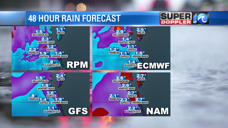
It is great that we are getting this rain in the long run, but the timing STINKS!!! Unfortunately, The models are now trending wetter on Sunday. They now have rain in the morning and in the afternoon.
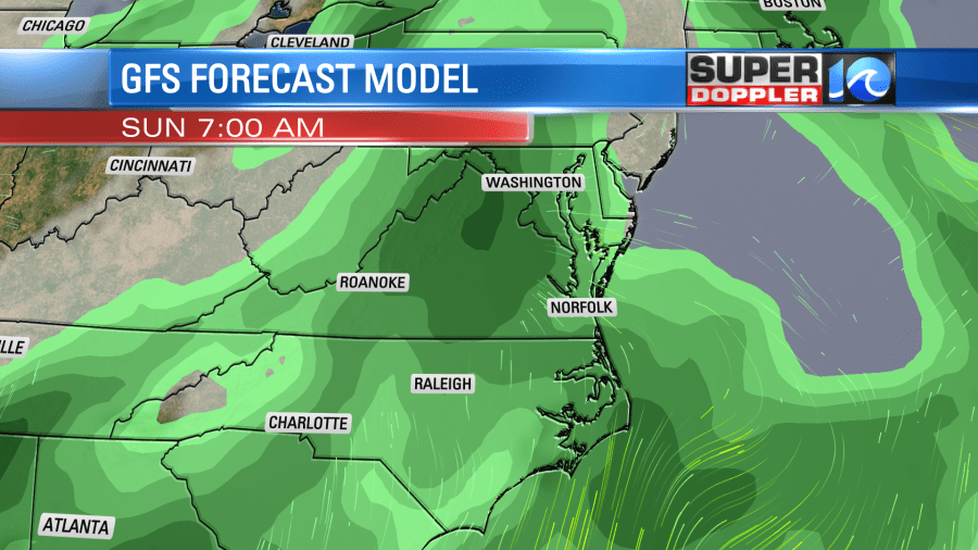
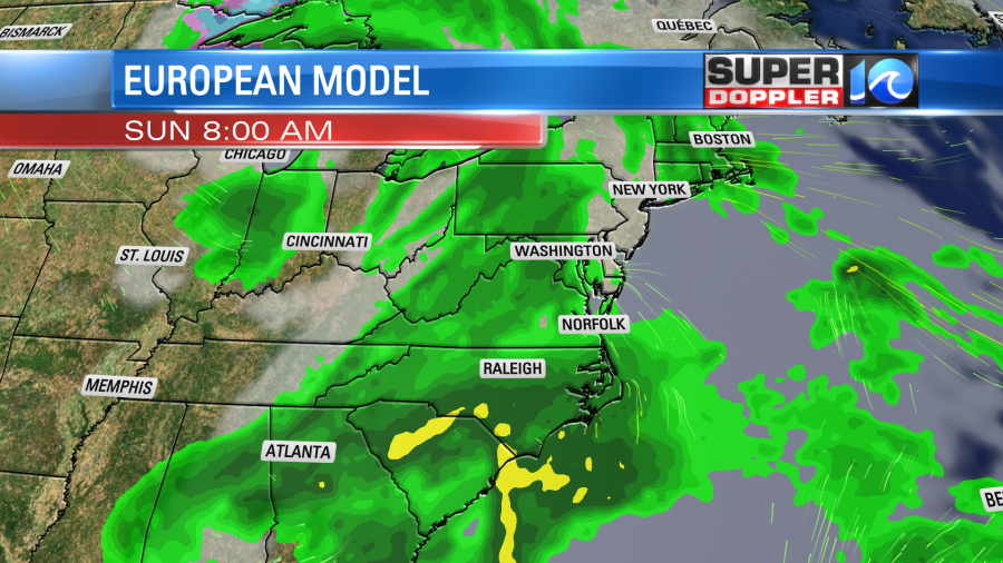
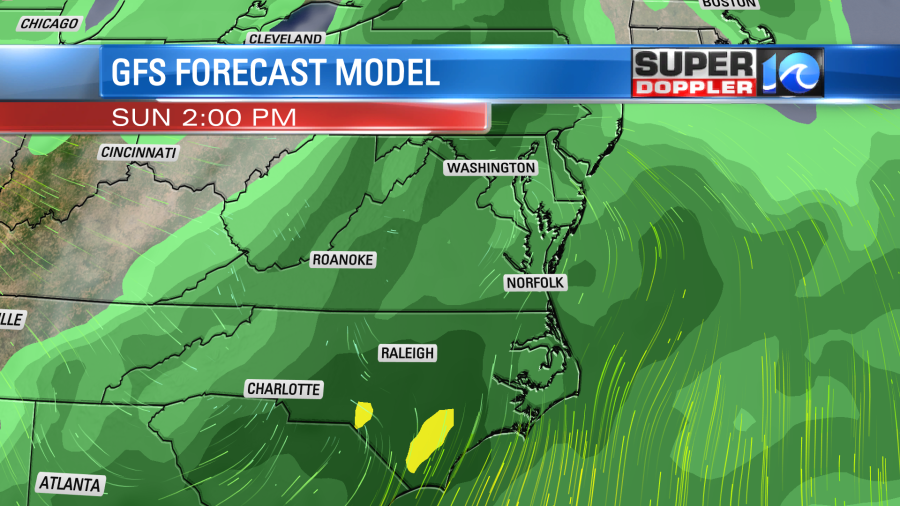
I don’t think it will be a complete washout. For now I’m thinking there will be scattered rain showers on and off through the day. But it is not good news for the Something In The Water festival.
At least high temps will still be in the 70s.
This second wave of rain will be from a strong area of low pressure forming to our north with a cool front traveling into the region. We’ll likely dry out on Monday behind the front, but temps won’t drop much as we will have increasing sunshine. There is still time for the forecast to change.
I know this is a frustrating forecast. The best advice I can give is to keep checking back for updates. The weekend will be all within the higher resolution models tomorrow. So we’ll hopefully be able to really time out the rain effectively tomorrow for the whole weekend.
Meteorologist: Jeremy Wheeler