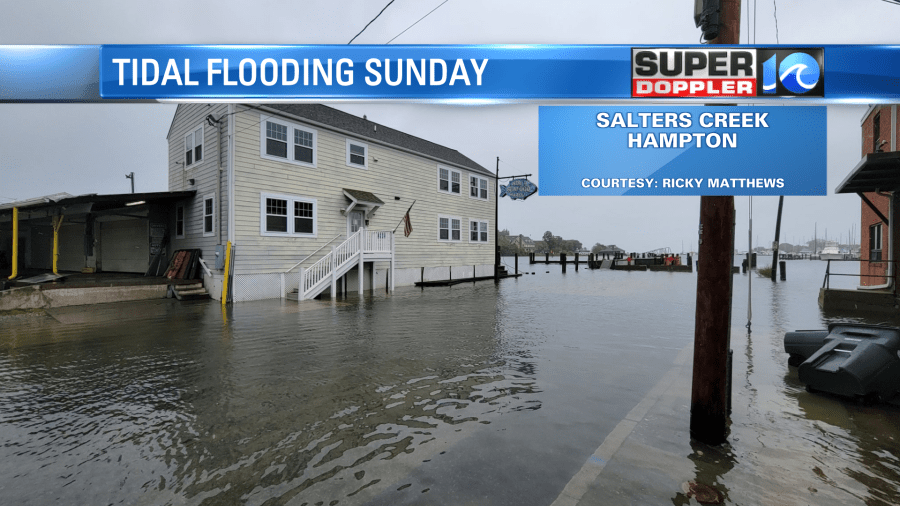
The coastal low will continue to churn offshore for the next several days – giving Hampton Roads some dreary, damp and windy weather through at least Monday & Tuesday. Tidal flooding will also be an issue (as it was in a few spots today), as elevated tides will take us through Tuesday.

The areas of light rain, mist and drizzle slowly fade through the night as the wind continues to crank out of the northeast. Winds will gust to 30+mph along the waters through the night with temperatures holding near 50°.
Tidal flooding will be an issue for the next several high tide cycles due to the persistent, cumulative effect of the northeast wind.
Today, both the morning and high tide cycles came in around 5ft – which led to nuisance & minor flooding in the typical low lying, flood prone spots. The issue may come with the high tide cycles on Monday & Tuesday, as the cumulative effect of the northeast wind will pile on the water. Several high tides could reach 6ft, which puts us in the moderate flood stage. Another thing to note, the low tide cycles in between will also remain elevated, meaning there won’t be much relief in between cycles.

Expect high levels on the lower side of the Chesapeake Bay, including the James & York Rivers. Same for the Elizabeth River and northern parts of Norfolk/Virginia Beach. Into North Carolina, areas towards Duck are expected to experience tidal flooding as well. You can view your local tide gauge here. Some over wash of NC 12 may occur in a few spots along with beach erosion as well.
The low will slowly pull away from our region Monday and Tuesday, so only expect a few showers or areas of drizzle along the coastline. However, tides will continue to stay elevated even into Tuesday, we may finally get some more sun by Wednesday.

Meteorologist Steve Fundaro & Ricky Matthews


