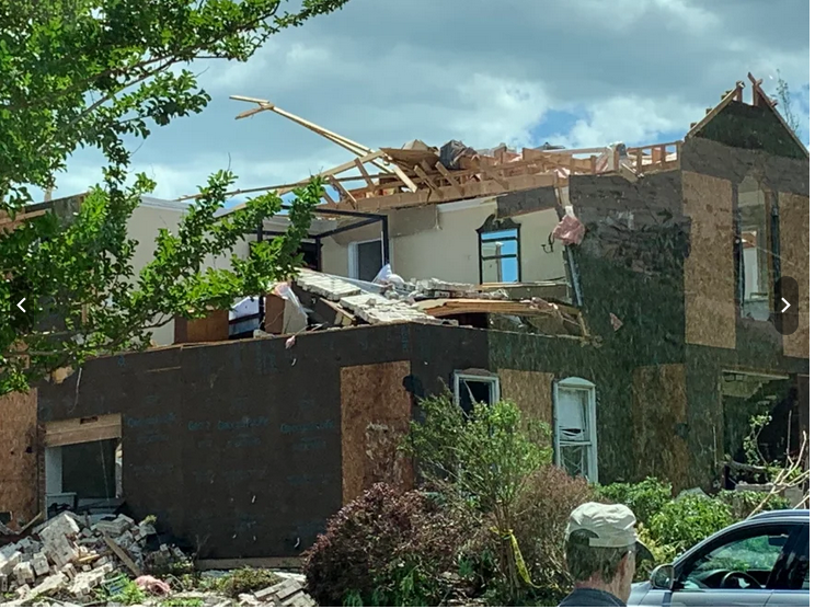
Before I get into the forecast for the next few days I do want to revisit the Virginia Beach tornado for a moment. The official designation came out for the storm from the National Weather Service (Wakefield office) yesterday. After they did their survey they concluded that the tornado was rated an EF-3 at its maximum strength. This means that it was a 3 on the Enhanced Fujita Scale.
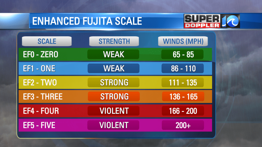
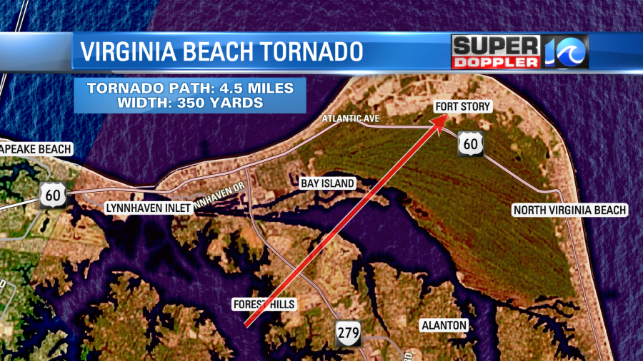
The range on that category is 136-165mph. The tornado’s winds were estimated at 145mph. The path was about 350 yards at its widest. The length of the path was about 4.5 miles.
This makes it comparable in strength to the Suffolk tornado of 2008 as well as the Gloucester and Bertie county tornadoes of 2011.
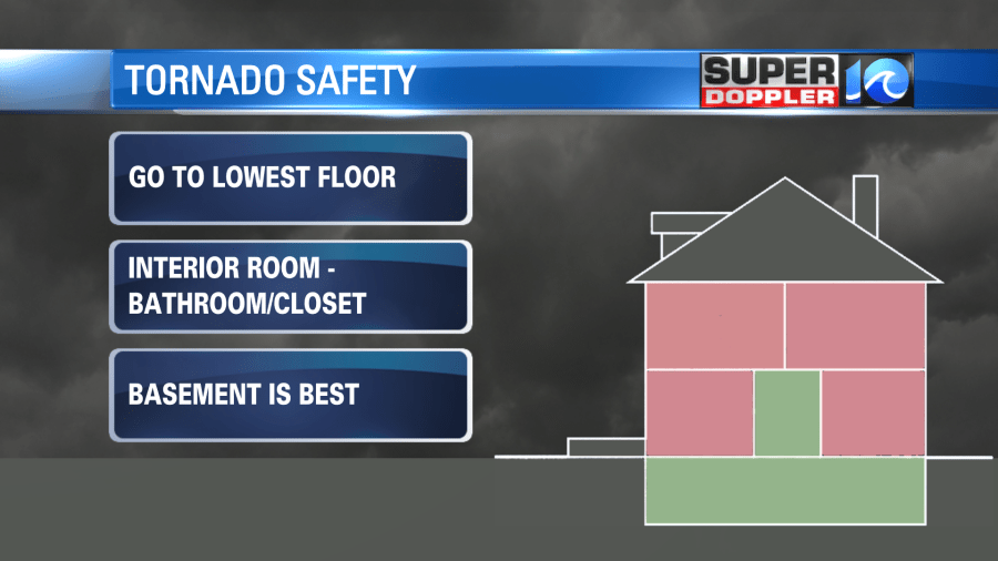
Despite the hundreds of homes that were damaged on Sunday, there were luckily no injuries nor any deaths. When a tornado warning is issued for an area we always tell people to get to the lowest floor of your home.
The damage from a tornado tends to happen on the roof and upper floors first. This isn’t always the case, but it is definitely true for weaker tornadoes. We can see a lot of that type of damage in this case. Remember, the tornado peaked at an EF-3, but was weaker for most of its lifetime.
Anyway, as far as the horizontal layout, it’s best to get into an interior room like a closet or bathroom.

Luckily there are no tornadoes nor any thunderstorms expected over the next several days. The system that caused the tornado is long-gone. However, another big area of low pressure has formed over the Great Lakes. It is loosely tied to our last weekend’s weather.
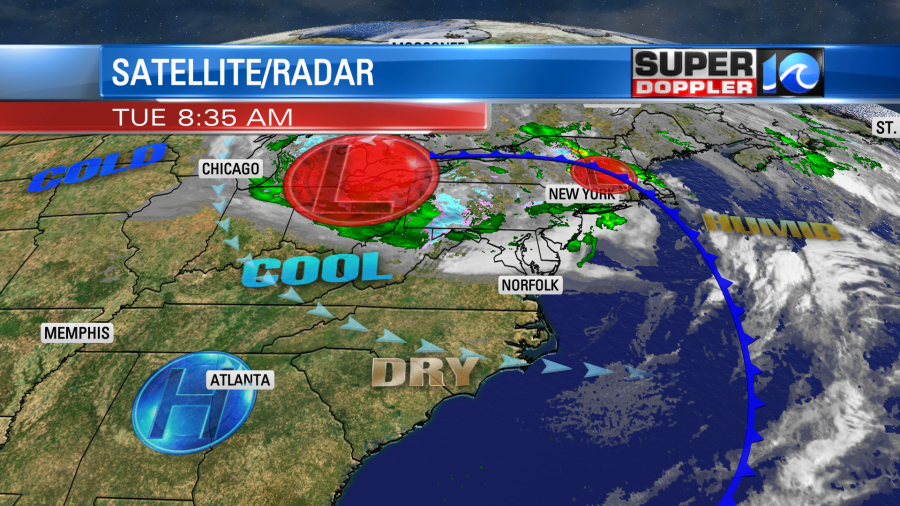
The low has become a fairly large and strong system. There is also an area of high pressure to our southwest. This is going to be a stuck pattern for a couple of days. We’ll have the winds out of the west again. They won’t be as strong as yesterday, but they will gust up to about 30mph. A few gusts to 35mph will be possible. We started with plenty of sunshine, but some cumulus clouds will build in during the afternoon. There may also be a few spotty rain showers forming. High temps will only be in the upper 60s.
While that surface low is churning over the Great Lakes there is also an upper level low spinning overhead. That feature is actually much larger. You can see it on the water vapor product.

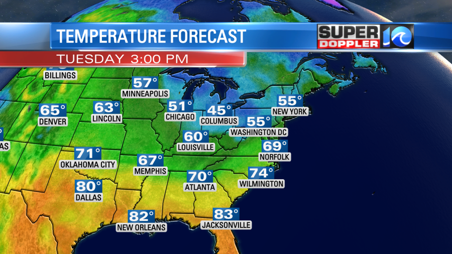
It is having some influence on our weather. It is basically a colder pool of spinning air in the upper levels that makes things a bit unstable. So today that will create the chance for some spotty showers. However, tomorrow it will be a bit closer to our area. So we’ll have more clouds, and there will be a higher chance for some scattered rain showers.
High temps will only be in the mid 60s. This is about 10 degrees below average. We’ll hold on to a west/northwest breeze.
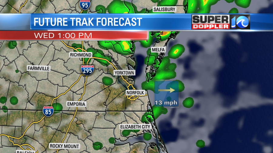
We’ll be dry but still cool Thursday into Friday. High temps will be in the 60s. We should at least have less wind. There may be some isolated showers on Saturday. Highs will be in the upper 60s to near 70.
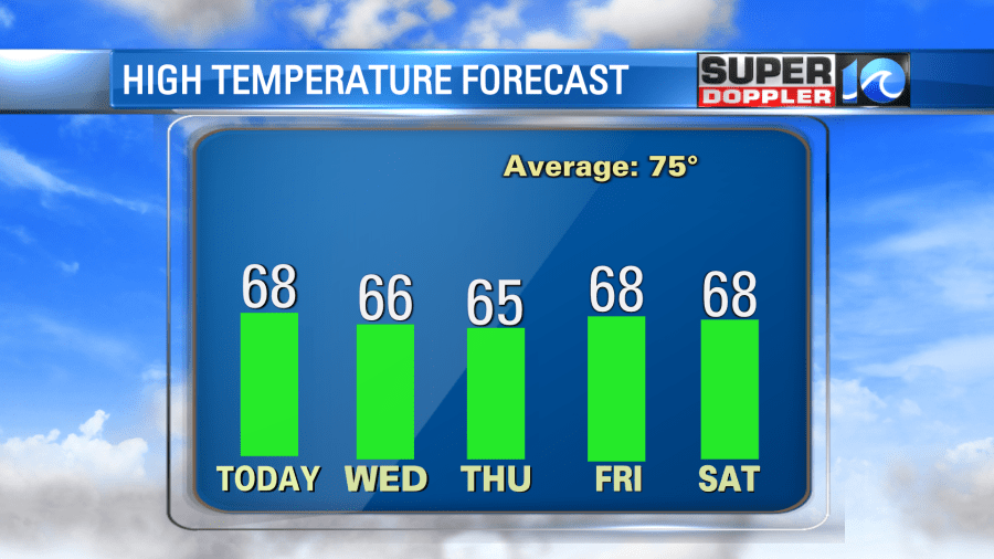
Then we’ll warm up Sunday into next week into some solid 70s. The pattern looks to finally change during that time. Things should get back to a more normal pattern.
Meteorologist: Jeremy Wheeler