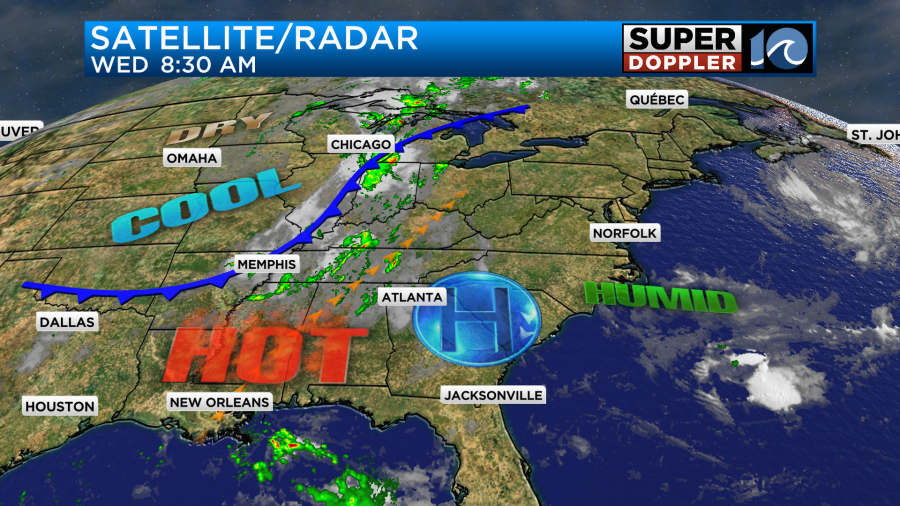
We are in the middle of a mini-heat wave. Yesterday it was in the upper 80s in Norfolk due to a light north breeze off of the water, but most of the temps were in the low 90s. The heat indices were in the upper 90s. We had a lot of sunshine through the day, and that will continue into today. High pressure is just off to our southwest. There is a cold front slowly rolling across the Midwest.
Again, we’ll have lot of filtered sunshine today with light and variable winds. High temperatures will aim for the low-mid 90s.
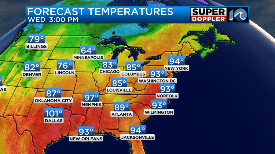
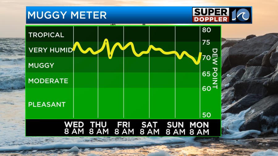
It is very muggy outside. Dew points are in the mid 70s. So the heat index will rise to near 100 this afternoon.
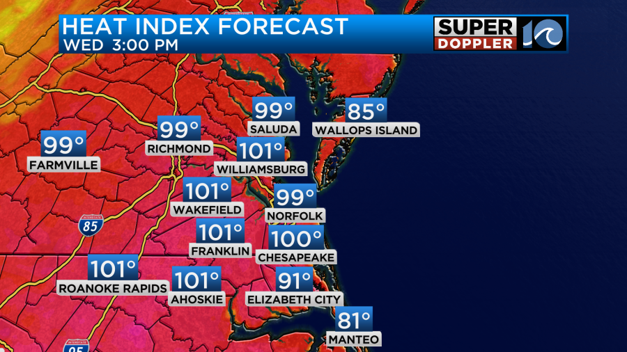
Tomorrow the cool front will edge a little closer to the area, but it will still be to our west. The local effect will be to drop the pressure slightly. That will allow the heat and humidity to pop up some isolated showers and storms in the afternoon. They may mostly be to our west, but there could be a couple in our area.
High temps will run up into the low-mid 90s.
The heat index will be near or just over 100 degrees. Notice the cool down across the Midwest and in the Ohio River Valley.
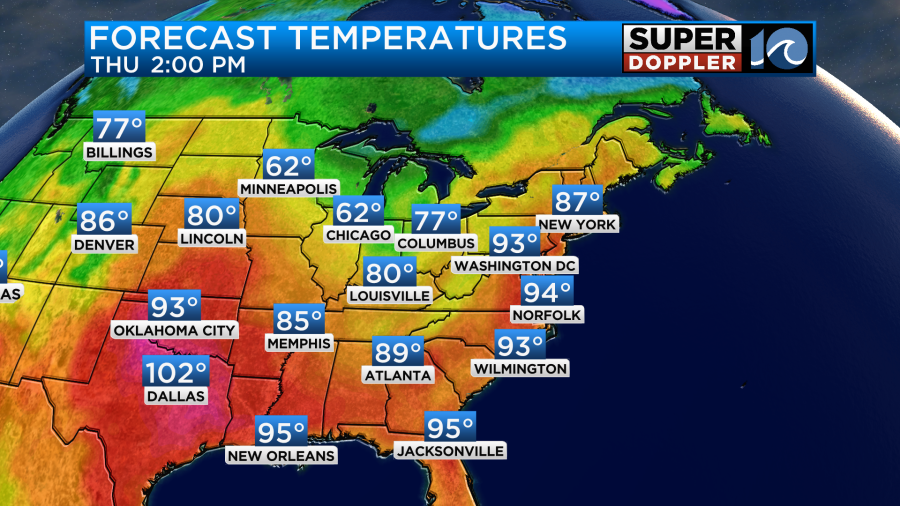
The cold front will move very slowly in our direction. So it will be nearby on Friday, but not close enough to really cool us down. High temps will still be near 90 degrees. The heat index will be in the mid-upper 90s. We’ll be partly cloudy with a few PM showers and storms. The front will be in the region over the weekend, but it will pretty much stall out. So we’ll cool to the mid-upper 80s at least, but the humidity will stay up through that time.
We will have some scattered showers and storms, but it will not be a washout.
In the meantime we are tracking Lee in the tropics. As of this writing it was a tropical storm, but it was gaining strength fast.
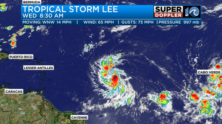
It is over very warm water. There is not much wind shear in it’s path (so much for El Nino). Also, Lee has a pretty healthy outflow at the top. So it basically has an open lane to grow and strengthen.
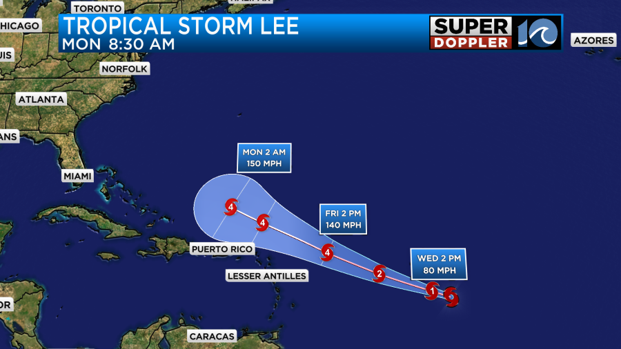
The track is fairly scary as it is pretty much just a line to the west/northwest. However, the long-range models look a bit less scary as they eventually turn Lee to the north.

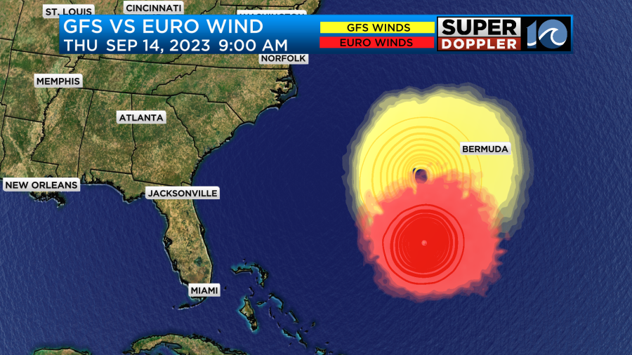
The GFS and Euro models also track Lee to the north in the 7-9 day range.
However, it is still early in the game. There easily could be some changes in the track before we get to even day 5, let alone day 7 or 8. It is possible that it could become a category 5 storm during that time. So be sure to check back for updates on the track of Lee.
There is another disturbance in the eastern Atlantic that has a medium chance of formation, but it will likely stay out to sea anyway.
Meteorologist: Jeremy Wheeler