
The weather (mainly the temperatures) have been trending in the wrong direction lately. We are in the middle of a colder stretch after some decent warmth recently.
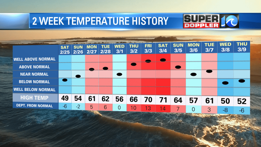
Yesterday wasn’t bad. We had fair skies with highs in the low 50s. However, it was a little cool at times. It was definitely below average. The average high is in the upper 50s for this time of year.
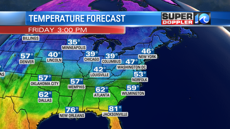
We will continue with below average temperatures for a while. Today, despite lots of clouds and some rain, we’ll aim for the low 50s this afternoon.
There is a warm front moving up from the south. However, the warm air will get pinched off from the cold front sliding in from the west.

There is also a weak area of low pressure moving east.
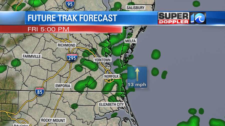
We’ll be cloudy all day as the moisture has increased since yesterday. We’ll have a light southeast wind through the day, and that will up the moisture even more. This setup will allow scattered rain showers to fall on and off through the day. It looks like we’ll have 2 rounds of higher coverage. There will be one in the mid-late morning and another one during the mid-late afternoon.
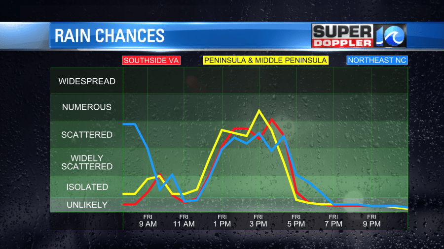
The evening commute could be pretty wet.
Any rain that falls should be light, and no thunderstorms are expected. We’ll have a few more scattered showers in the later evening, but rain will end before midnight.
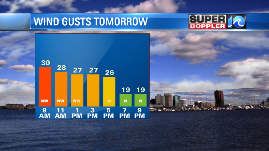
Tomorrow we’ll dry out as the low moves out to sea, and high pressure sits to our west. However, wind will be strong out the northwest. The gusts could be up to 30mph for a time.
High pressure will edge in a bit from the west, but it won’t build in fully. The low may actually throw some moisture and clouds back behind it. So we’ll probably have some building clouds tomorrow with some isolated showers near the shore. High temps will only be in the upper 40s to low 50s.
We’ll start off Sunday dry with a little brief clearing. Then we’ll have increasing clouds during the day with some scattered rain showers later in the afternoon/evening.
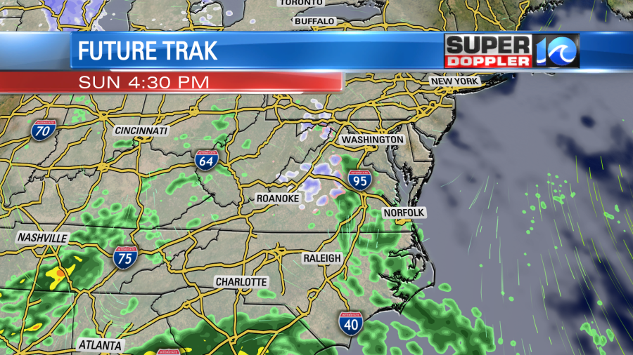
This as another area of low pressure swings into the region. High temps will be held down in the upper 40s. We’ll have a lot of rain Sunday night into Monday morning.
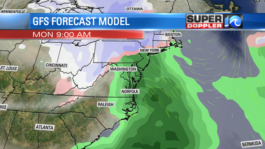
The rain showers could last for the first half of Monday, and it could also be heavy for a while. High temps will be in the 50s. We’ll be chilly and dry into the middle of next week. High temps will only be in the upper 40s to near 50. Low temps may drop to the low 30s on one of the days. We have a decent shot at a frost on Sunday morning, Tuesday morning, and especially Wednesday morning next week. Stay tuned for updates on that.
There is a lot of rain moving onto the west coast from the Pacific. This may seem like a good thing as it would melt a lot of the snow. However, it will be too much-too soon. So unfortunately, it will likely create a lot of flash flooding and mudslides. Whatever snow doesn’t melt will likely turn into a crusty later of ice. It could be a HUGE mess. Here is an article with more information: California rain and flooding.
Meteorologist: Jeremy Wheeler


