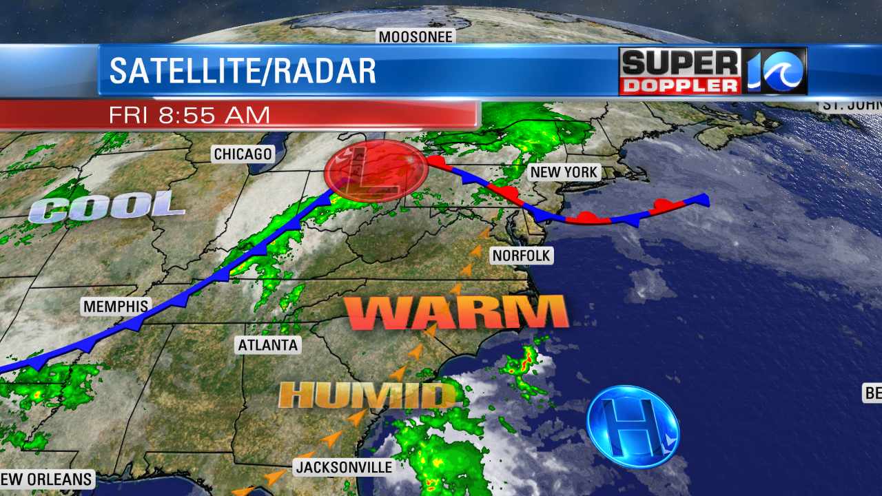
Yesterday we topped off in the upper 80s to low 90s in the region with some cooler temps near the shore. Today, we will have some similar temperatures, but I think we’ll have a few more clouds.
So we’ll probably be a degree or two shy of yesterday’s high temps. (Mainly upper 80s with a couple of 90s inland.). There is a stationary front to the north of Hampton Roads. There is a cool front way off to the west. We won’t have any rain or storms from those features.

However, there will be a lot of heat and humidity in the region. So we may have some isolated showers or thunderstorms popping up over North Carolina this afternoon. A couple of those could cross north over the Virginia state line between the late afternoon into the early evening. Winds will be out of the southwest at 5-15mph.
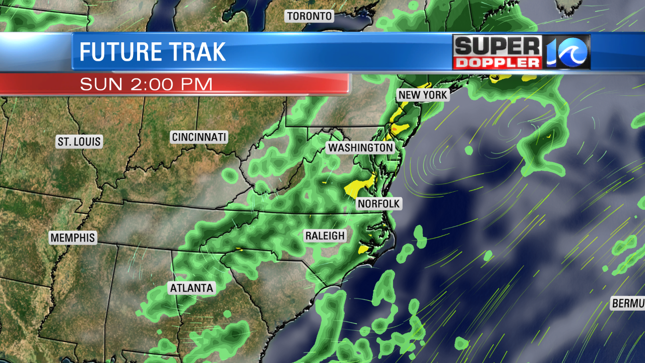
Tomorrow, the cool front will move into the region during the afternoon. We’ll have some scattered showers and storms develop over the area, but they won’t be too numerous. The chance for rain will be between 30% to 40%. Temps will be more into the lower 80s.
We’ll have partly to mostly cloudy skies. The front will stall out for a time on Sunday before it drops a little more south. This will deliver some cooler temps with highs in the upper 70s. We’ll have some scattered showers on and off thorugh the entire day, but it doesn’t look like a total washout.

There should be plenty of breaks in-between the showers. The truth is…we could use some rain. With the warmer temperatures this last week, the ground has started to dry out quickly. We finished April with a little over 3″ of rain. While this was only slightly below average, we only had 3/10ths of an inch for the last 10 days of the month. Now wer’re into May. So I will welcome some rain.
We will be dry and cooler to start next week. Highs will be in the low 70s on Monday with partly cloudy skies. We’ll warm up to the low 80s by Wednesday.
There is still a weak tropical disturbance which is now east of Florida.

It is tracking to the east/northeast. It still only has a low chance of any formation. Hopefully, it will stay well to our southeast. We’ll monitor it going into the weekend.
Before I go…I found an interesting article about how hurricane Harvey strengthened before landfall over Texas back in 2017. Normally, hurricanes churn up the cooler water from below as they move. This is called upwelling. However, it seems that there was no cooler water under hurricane Harvey. Could this be a foreshadowing of future cyclones? Here is the article with more information: Hurricane Harvey strengthened before landfall.
Meteorologist: Jeremy Wheeler


