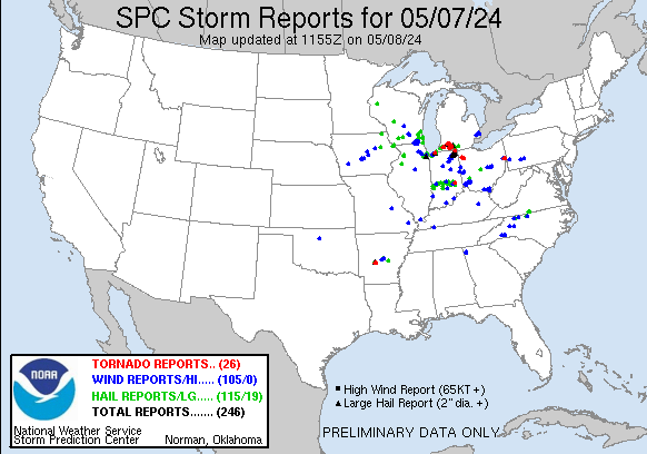
There was another round of tornadoes and severe weather over the central U.S. yesterday. This time is was focused more to the north.
Our focus won’t be storms today. Some isolated pop-up storms may form this afternoon, and there may be a few more in the evening. However, our focus will be more on the unseasonable heat today. High temperatures are going to aim for the low 90s this afternoon.
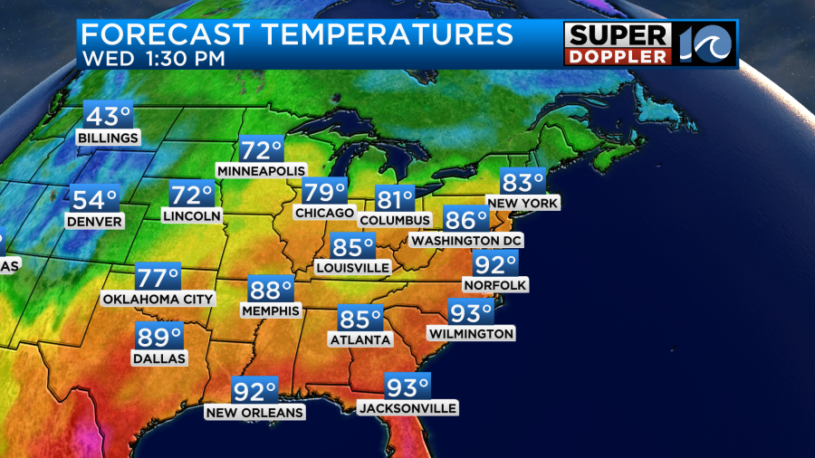
When you factor in the humidity, then that heat index is going to be running in the mid 90s during the afternoon and early evening.
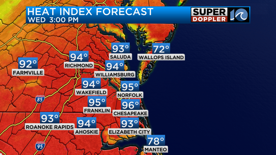
This is well above average. The average high this time of year is in the mid 70s. The record high for today is 95 degrees set back in 1880. Dew points are in the mid 60s, and they will rise to the upper 60s this afternoon. Luckily there will be a decent breeze out of the west with the wind running at 10-15mph. I mentioned that there will be a low chance for an isolated shower or storm in the afternoon. There will probably be a little more by the evening hours.
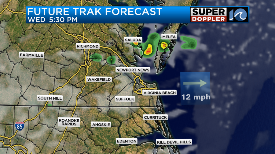
Some of these storms could be on the strong side. If they aren’t then another cluster of showers and storms are forecast by the later evening. Those could potentially be strong to severe.
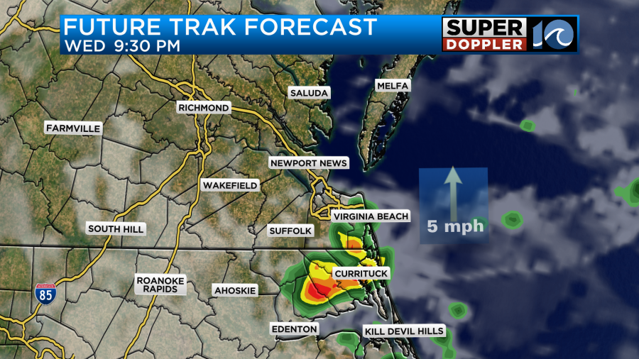
We do have a marginal risk for severe weather. I think it’s mainly for the evening.
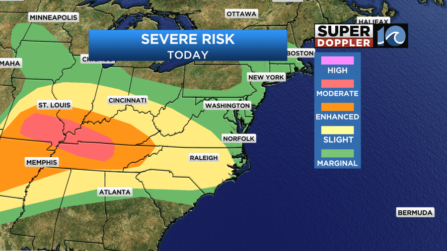
Strong gusty winds and heavy rain will be the main threats. Meanwhile, there is another moderate risk over the Midwest today.
Early tomorrow morning there may be a cluster of showers and storms moving through the region during the AM commute.
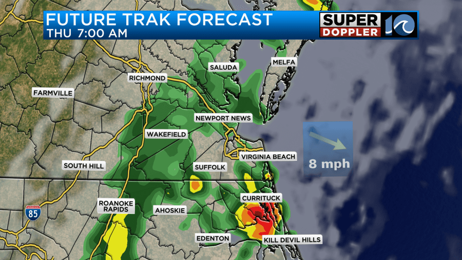
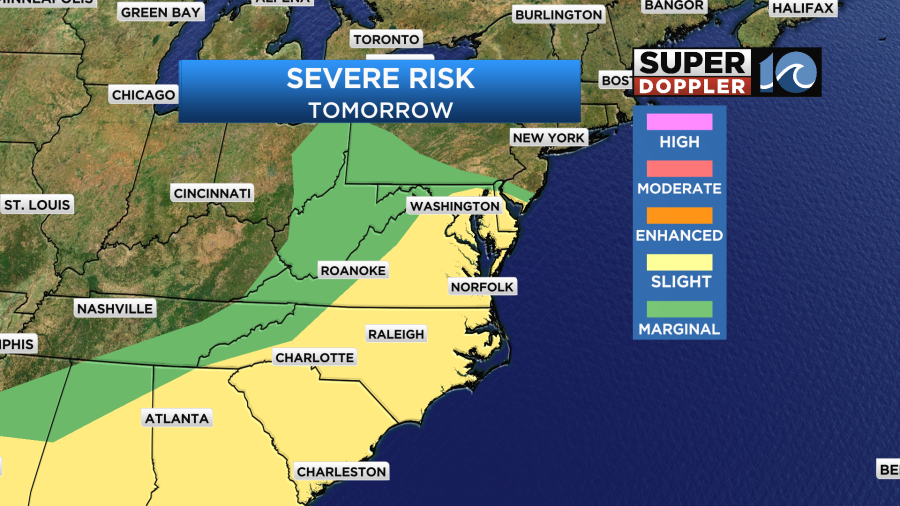
Our Future Trak model is very bullish on this feature, but the Hi-res NAM model has started to back off a bit. Either way we should have a long stretch of quiet weather Thursday. Then more scattered storms are expected later in the day. The morning cluster may contain some strong damaging winds for a time if it does hold together. If that round is weaker than expected, then I imagine the afternoon storms will be bigger and stronger. We do have a Slight Risk for severe weather tomorrow.
We will heat up tomorrow into the upper 80s, but it will feel like the low 90s with the heat index. A cold front will finally enter the region on Friday. This is going to increase the clouds, and it will also create a bigger area of scattered showers and storms.
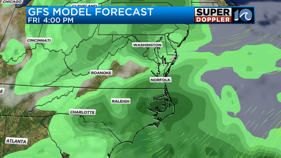
Heavy rain and a few strong storms will be possible. At least it will be cooler. High temps will be in the upper 70s.

We are still looking to dry out nicely this weekend. Dew points will drop like a brick on Friday.

With high temps in the low-mid 70s it should feel great both Saturday and Sunday. Keep in mind that an upper level low may create a couple of isolated showers on Mother’s Day, but it’s a low chance. We’ll continue to have highs in the 70s early next week.
In National News… I read an interesting article this morning about how some researchers at Florida Atlantic University have developed a novel technique to look at post-hurricane storm damage in a faster way. This rapid/high resolution assessment uses aerial imagery data and LiDAR. This was used after hurricane Ian’s damage in 2022. This new technique could replace the current method which is costly and labor intensive. Here is the article with more information: Possible new method for hurricane damage assessment.
Meteorologist: Jeremy Wheeler

