
Locally, we’ll have some great weather today. A cool front has settled to our south, and high pressure has built into the area.
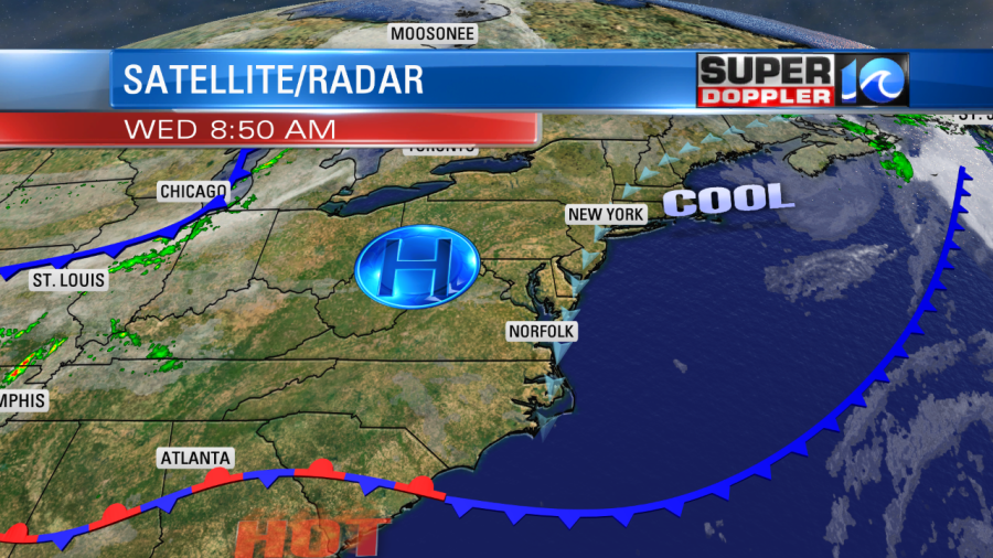
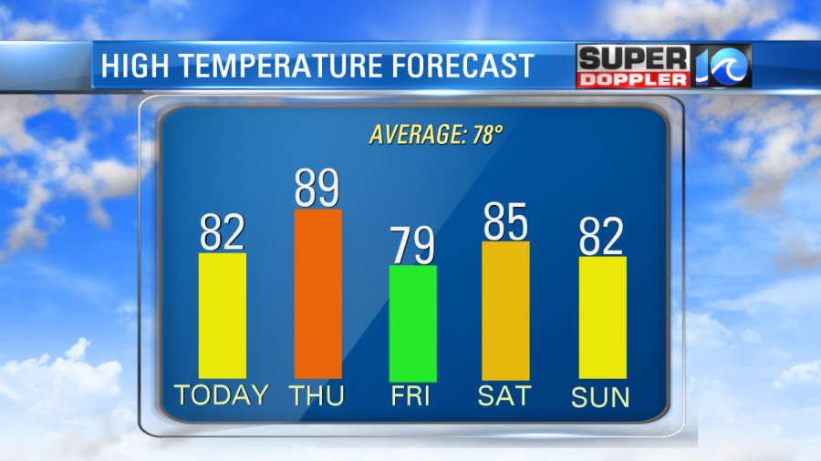
So we’ll have lots of sunshine with highs in the low 80s. It will be dry, and there will be light breeze out of the north. This will make it a pretty comfortable day.
We are going to heat up tomorrow as the light winds turn to out of the southwest. We’ll be partly cloudy. High temps will rise to the upper 80s to near 90. Plus, it will be pretty humid as dew points rise to the mid-upper 60s.
There may be an isolated shower or storm late in the day, but I think it will literally be 1 or 2 in the region. However, by tomorrow evening a cold front will move into the region. It may cause a few scattered showers and storms. Don’t get your hopes up too high though.
I only have the chance for rain at 30% at this time. Either way, we will cool down behind it on Friday. High temps will drop to the upper 70s. We’ll have a mix of sun and clouds. There may be a lingering shower in the morning, but it’s a low chance. We’ll heat up again on Saturday to the mid 80s. Then we’ll drop to the low 80s on Sunday.
We may see some isolated showers on Saturday, and then there is a little higher chance for showers on Sunday. (30%). However, there are still no big areas of rain headed our way. While Norfolk is only down about 0.3″ below the average rainfall for the month. All of that rain we had was at the beginning of the month. We have hardly had any rain in the last 2 weeks. Wallops Island is down 1.26″ below the monthly average.
Meanwhile, things are a little quirky in the tropics. Jerry has become post-tropical and basically all of the convection (thunderstorms) have moved well northeast of the storm.

However, the circulating winds are still going to impact Bermuda as the center will move just north of the island tonight. Impacts should be minimal. Rain won’t be a problem, that’s for sure. Then it will move east/northeast over the central Atlantic before falling apart.
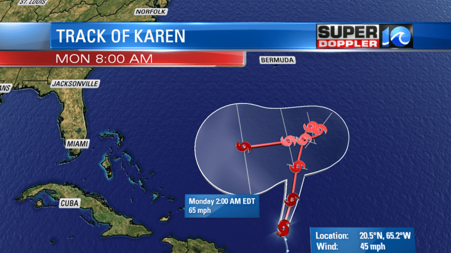
Tropical Storm Karen did move over Puerto Rico. It brought some gusty winds and heavy rain to the region. Some rain lingered into this morning even though the system was moving away from the island. Mudslides may be a problem today.
Karen will move north for a couple of days before a blocking high will build to the north of the storm. This will put the brakes on the system for a bit. The forecast then calls for it to meander east, and then button-hook around to the west through day five.
The models are in pretty good agreement about this.
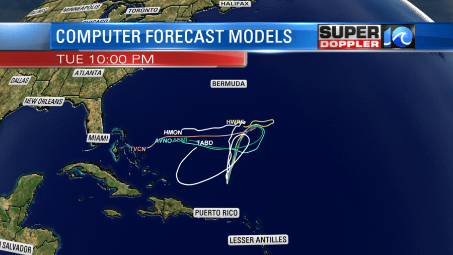
Some of the models have dry air building in from the north, and they have that weaken Karen. Some other models suggest that Karen will be strong enough to not let the dry air affect the center of the storm. So they strengthen it. This is pretty far out in time. We’ll see how it fares.
In the eastern Atlantic, Lorenzo has strengthened into a hurricane and is moving steadily to the west. It is forecast to become a major hurricane, but it is likely going to stay out to sea.

All of this is bringing some more waves to the east coast. That will basically continue into next week. There is a moderate threat for rip currents today.
Meteorologist: Jeremy Wheeler


