The National Weather Service has confirmed an EF-3 tornado struck parts of the north end of Virginia Beach Sunday evening. From 5:48 to 5:53pm Sunday, the tornado spun up on the Eastern Branch of the Lynnhaven River, crossed Great Neck Road, severely damaging homes on Haversham Close, then crossed the Broad Bay into First Landing State Park. Eventually exiting the region through Fort Story. Peak wind gusts were 145mph, with the entire path stretching 4.5 miles long, and about 350 to 400 yards wide.
______________________________________________________________________________________________________
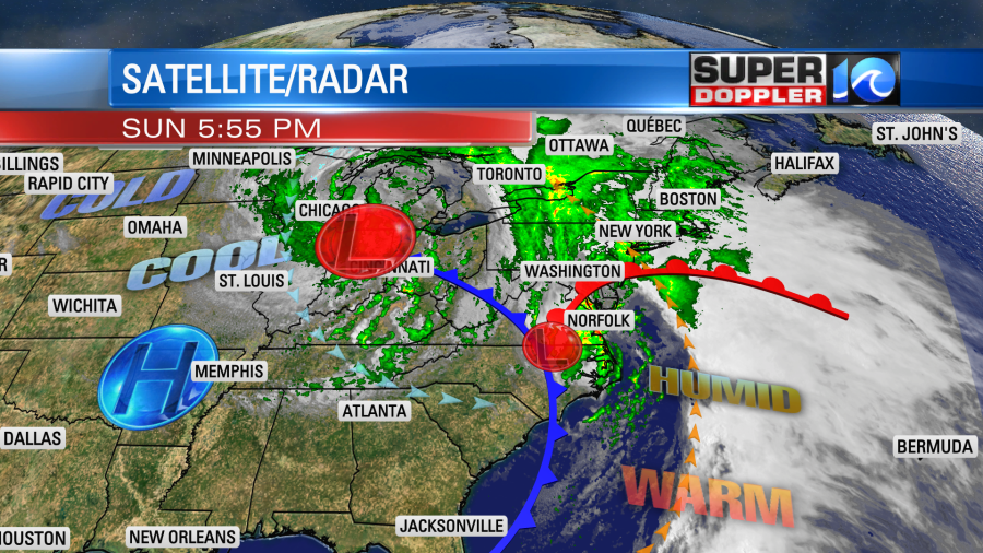
We had some storms this last weekend that produced severe weather. There was even a reported tornado in Virginia Beach. The storms happened as a small but potent area of low pressure swung through the region.
The tornado affected northern Virginia Beach around the Great Neck area. This was in the early evening. Heavy rain was on the radar at that time. There wasn’t a classic hook, but there was some notching.

There was a strong indication of rotation at the time as well. We can see this when we look at the velocity (horizontal wind speed).
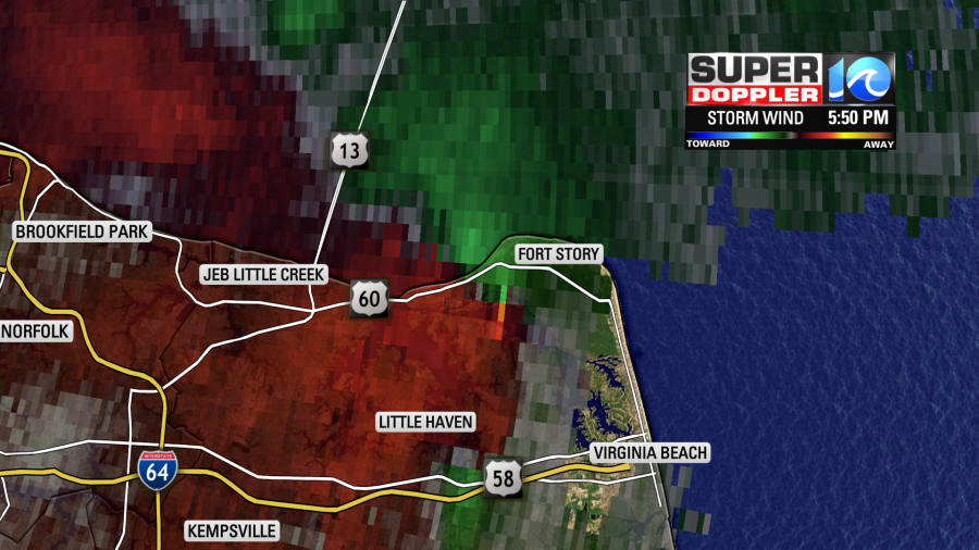
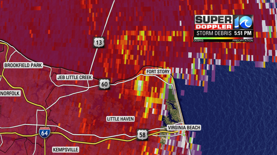
Chief meteorologist Jeff Edmondson even showed the product that detects storm debris during his live coverage.
The low that moved through was along where a warm front meets a large cold front. That is called the triple point. Virginia Beach was in the warm sector at the time. Temps had made it into the 70s with dew points in the mid-upper 60s before the rain. I looked back at some of the severe parameters. It looks like (According to the Storm Prediction Center archived loops) that the CAPE (amount of potential energy/instability) was around 1000-1,500 J/KgK at the time. Wind shear (the increase in wind speed with height) was around 60 knots, and low level shear was about 30 knots. Their conditional probability of a significant tornado had popped to 50. The cloud decks were pretty low too. You may not know what most of these mean, but basically these are all decent ingredients for tornado formation.
There were numerous homes damaged, but miraculously there were no injuries and no deaths.
Here is the estimated track:
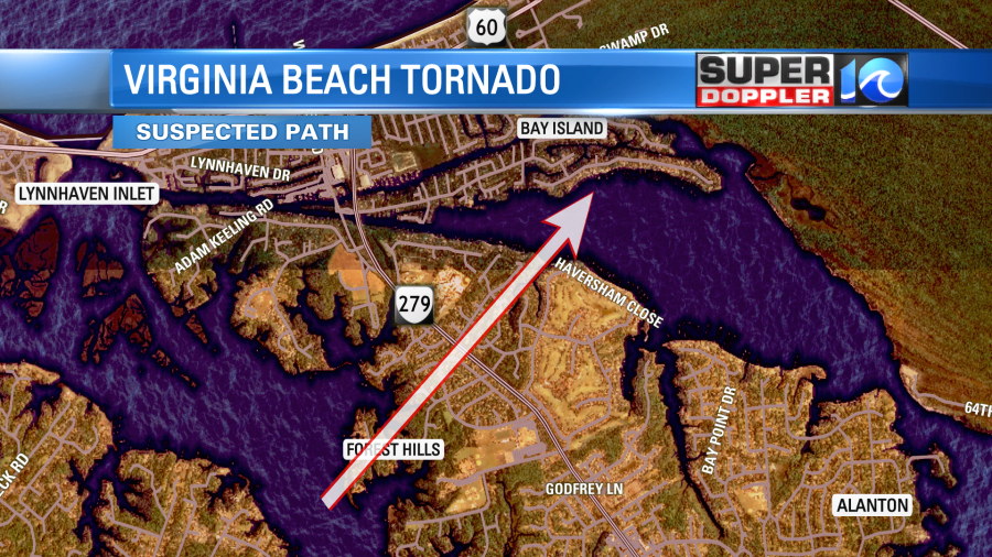
The National Weather Service will do a survey today, and we’ll likely get the exact track later today.
There were several other reports of storm damage too. There was some damage to an apartment complex in northern Norfolk around Oceanview. Plus, we had some damage to trees around Murphreesboro, NC.

The low that helped to create the severe weather is now up in the northeast states. It is much weaker now. At the same time a much stronger area of low pressure has formed over the Great Lakes. High pressure is to our southwest.
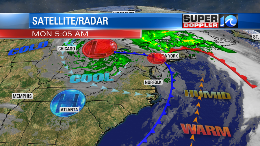
There is also an upper level low over the Great Lakes.
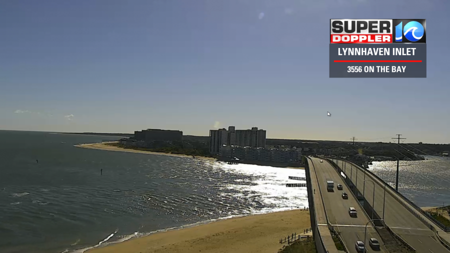
We started off with lots of sunshine this morning.
As we go through the day we’ll develop partly cloudy skies. We’ll be on the edge of the upper level low. So there may be a stray shower or sprinkle during the afternoon. The wind will be strong out of the west through the day. Gusts will be up to 25 to 30mph. This will dry us out with dew points falling to the 30s. However, it will also hamper cleanup efforts. Temperatures will climb to near 70 later today.
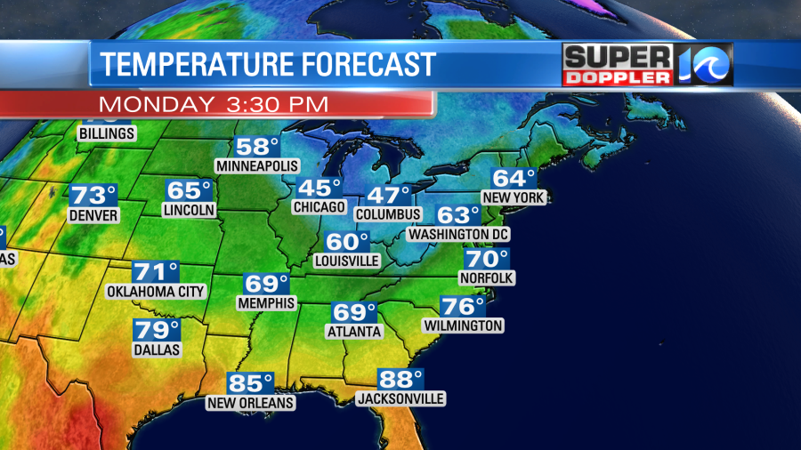
This pattern will be stuck in place for a few days. So our high temps are going to stay in the 60s most of the week.
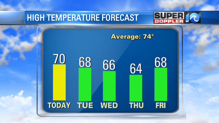
We’ll have cool/sunny mornings with partly cloudy afternoons. Some isolated showers will be possible through Wednesday. We’ll stay cool on Thursday and Friday, but we should be totally dry by then. High temps will still be in the 60s. Maybe we’ll warm up a bit by next weekend.
One good thing that happened recently is that we got some much-needed rainfall over the whole region. We had about an inch to an inch-and-a-half last Friday. Then we got about another inch to an inch-and-a-half yesterday.
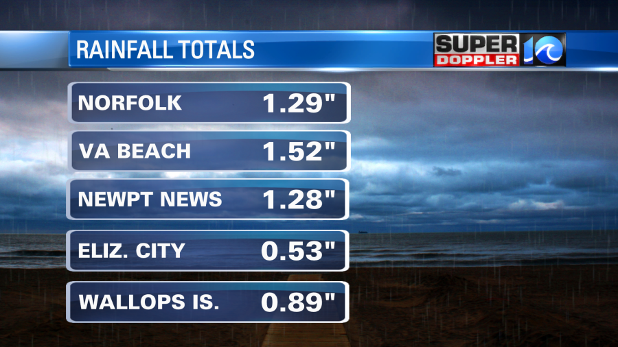
Some areas had a little more. Some a little less. If you remember we were in a moderate drought going into this weekend. I think this recent rain will help.
Stay tuned for updates
Meteorologist: Jeremy Wheeler