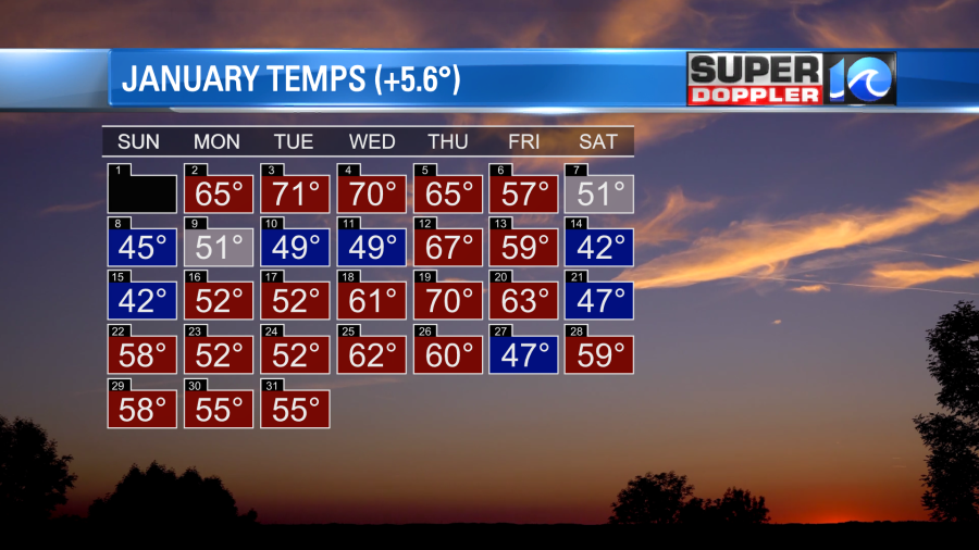
According to NOAA (National Oceanic and Atmospheric Administration) Earth just had its 7th warmest January on record. Meanwhile, the United States had its 6th warmest on record. January’s global sea ice was the lowest on record. It’s hard to believe that we weren’t ranked higher, but there was some pretty cold air in the northern states for a time. Locally, we just finished a very warm January which was a few degrees above average.
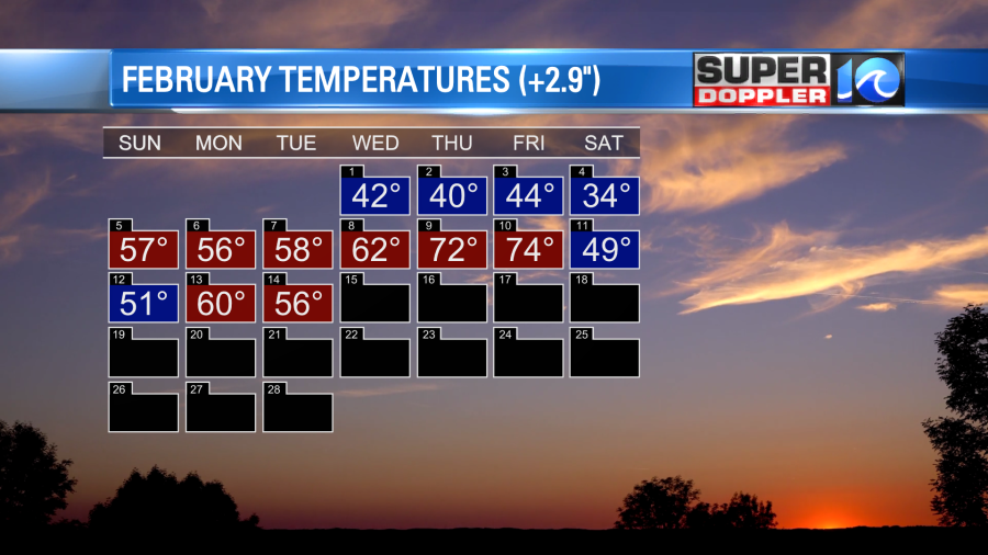
We are still going with a warm February.
Last week we had a stretch of mild temperatures with a quick cold snap. We will continue this pattern this week. In order to get a long stretch of cold air you need to have a snow pack to (basically) store that cold. It does literally store some of the cold, but it also allows for much colder overnight air temperatures. Unfortunately, for snow lovers, there is hardly any snow in the eastern third of the country right now.
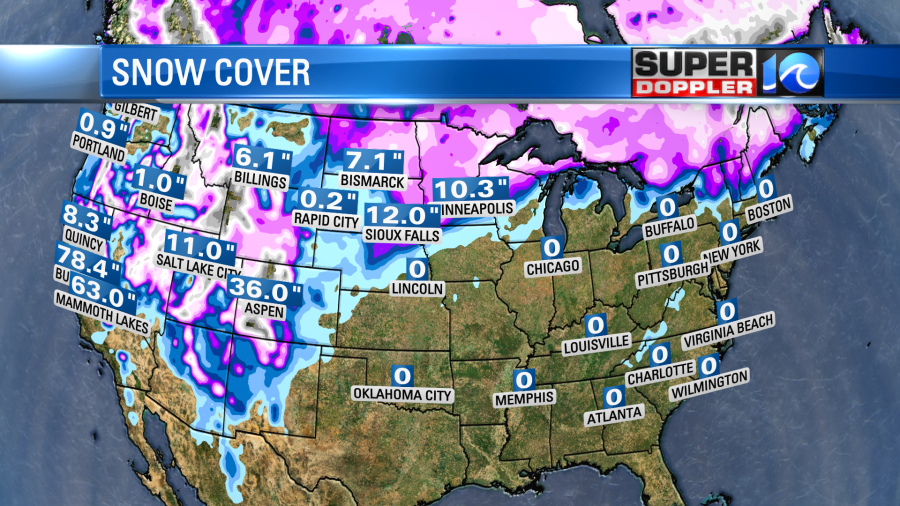
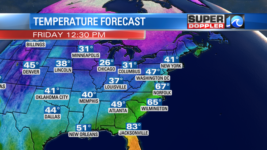
All of the snow is in the north/central U.S. and the west. There was some snow over parts of the Midwest and Northeast recently. However, mild temps lately have melted a lot of the snow. In fact, temps will near-record in many locations today.
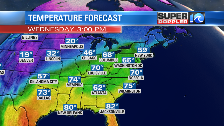
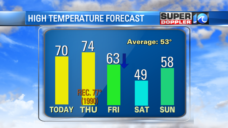
We will be pushing 70 degrees here this afternoon after starting near 50 this morning. High pressure is edging offshore with a warm front lifting to the north.
We’ll have a mix of sun and clouds today. The wind will be out of the southwest at 10-15mph with a few gusts to 20mph.
Tomorrow we’ll start off in the mid-upper 50s, and we will end in the mid 70s.
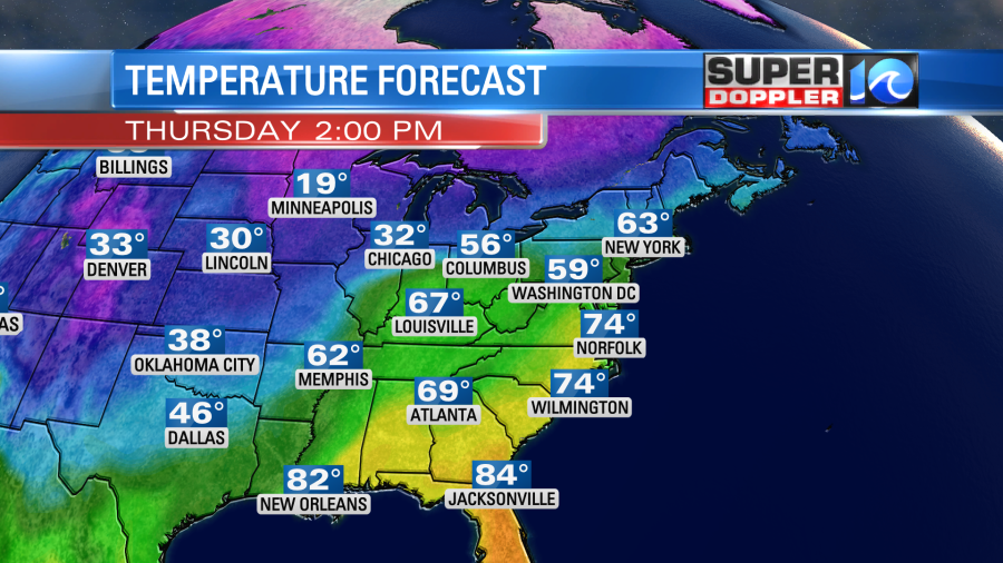
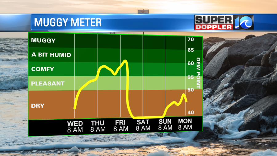
The average high for this time of year is in the low 50s. We’ll be well above average, but we’ll probably be shy of the record (77 degrees in 1990). Tomorrow the wind will pick up even more. It will gust up to 25-30mph. We’ll be partly cloudy for a long stretch. However, the moisture will also be increasing. Dew points will rise into the 50s and possibly even into the 60s for some.
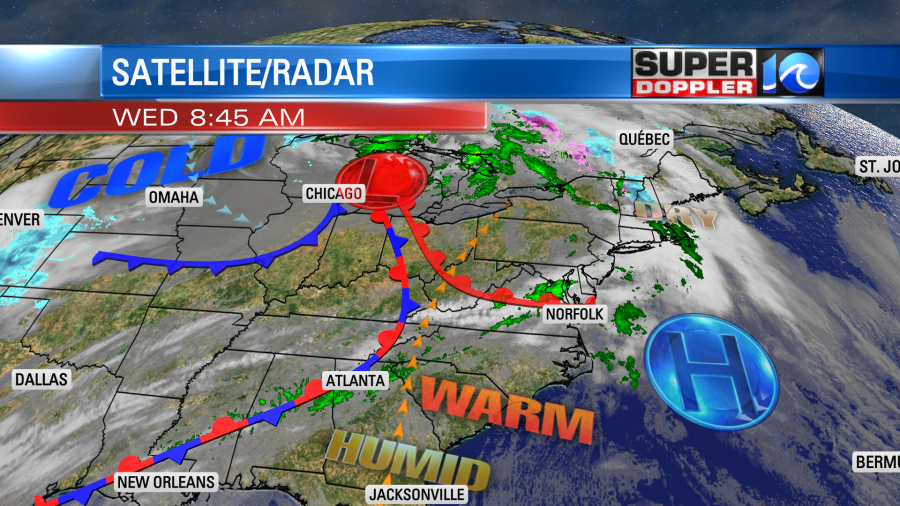
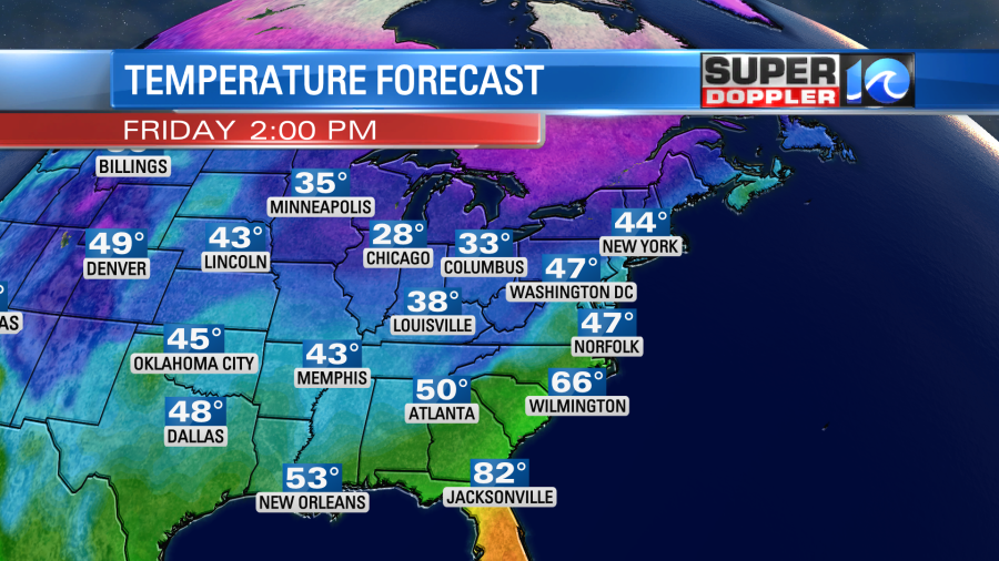
We won’t have much rain, but we will have enough moisture for some isolated showers in the area. Meanwhile a strong cold front will be moving in from the west. That front won’t arrive here until around midday tomorrow. This means that we’ll have temperatures rising into the 60s during the morning and midday. Then temps will crash to the upper 40s to low 50s during the afternoon.
The front will slowly move through the area. It will march through a region of high humidity. This will create a lot of rain. It will start off in the morning during the AM commute. It will continue until at least the mid afternoon.
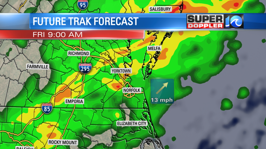
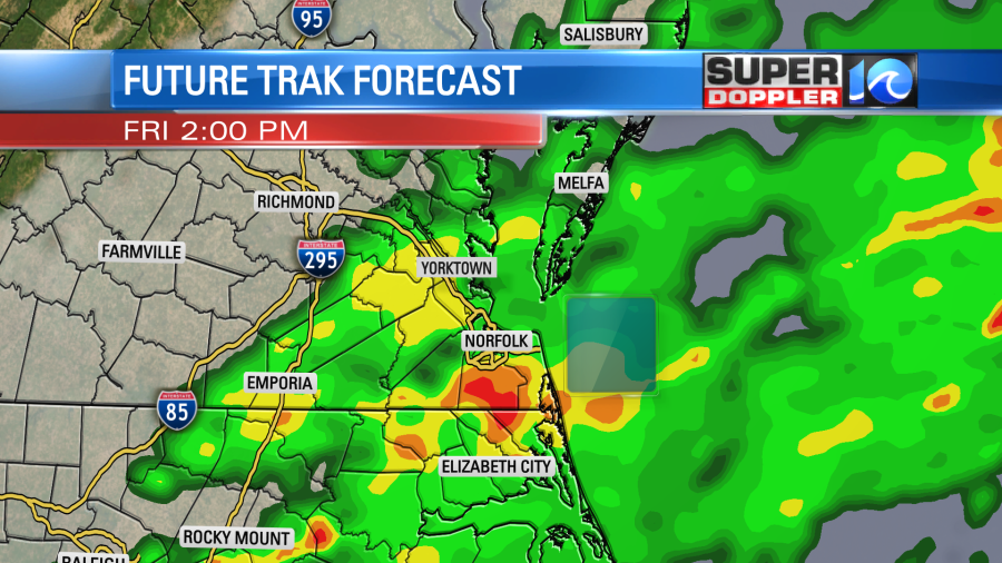
There may even be a few thunderstorms in the region. For now it looks like the rain will end by the evening, but check back for updates on that.
Colder/drier air will drop into the region Friday night into Saturday. We’ll have clearing skies with temps falling to the 30s Saturday morning. High temps will only be in the upper 40s during the afternoon. Luckily the models are warming us up to the upper 50s on Sunday. We’ll be partly cloudy with only some isolated showers in the area.
Meteorologist: Jeremy Wheeler