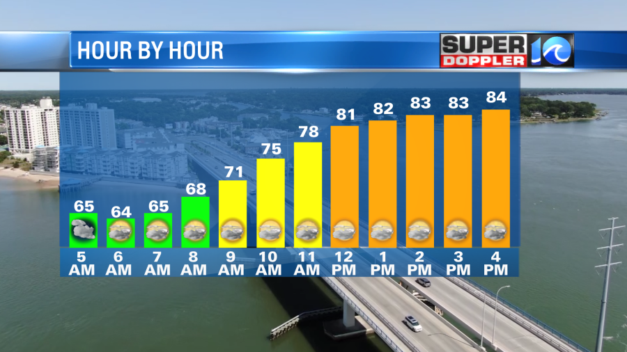
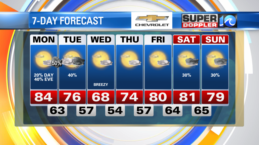
A nice day Monday for our region with highs primarily in the 80s. We’ll see a few clouds today, mainly high level clouds through the morning hours and a few areas of clouds this afternoon too. Overall, a nice day – with rain chances low through much of the daylight hours for our area.
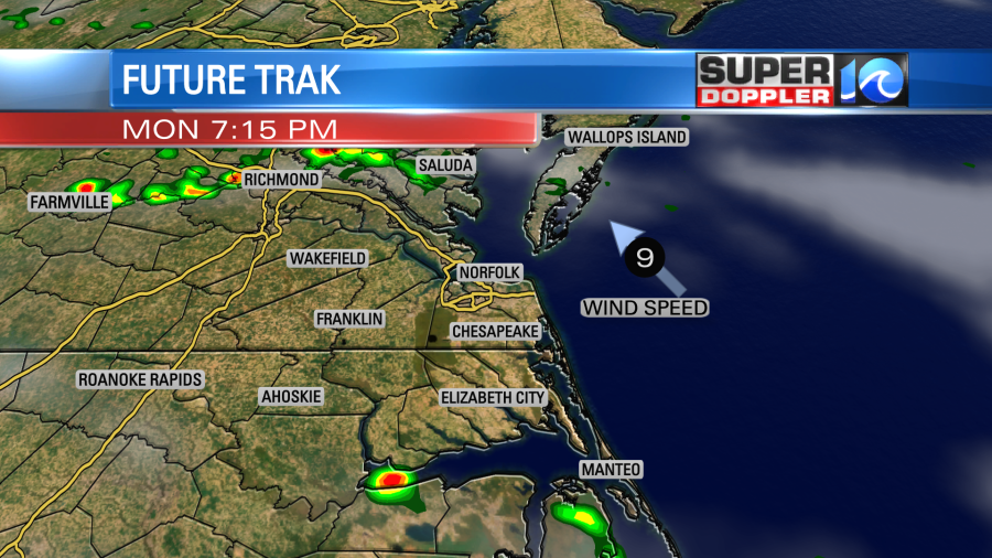
This evening and into tonight, rain chances increase a bit. They also remain elevated Tuesday.
I would not be surprised to see a shower or storm develop later this evening in central VA and move into parts of our region. I’ve seen this setup before – where a shower or storm pops up near Charlottesville and moves down the I-64 cooridor. Sometimes these can hold together and move into areas near Williamsburg, Surry, or Gloucester. So keep an eye on the radar later today if you live in these areas. We’ll have to see if we do get the storm to develop or not.
Overnight, a few more showers could move into the area as well and linger into early Tuesday before we see a break in the rain.

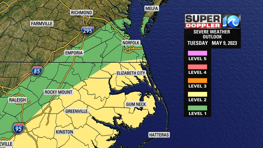
Tuesday afternoon, we’ll see a little higher chance for showers and storms. A few could even be strong to severe with the main concern being gusty winds. Parts of our area are in a level 1 severe weather risk, while most of NE NC is in a level 2 severe weather risk. /
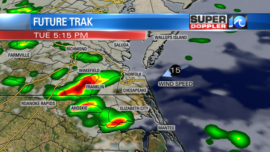
Once the showers and storms fade Tuesday night/Wednesday morning we’ll see a cooler day Wednesday as our wind blows more out of the northeast. At times, some gusts to 20 could occur. Highs will be in the upper 60s near the coast and low 70s inland.
Dry and calm weather takes us through the remainder of the week with our next rain chance arriving by the weekend.
Hope you have a great week!
Meteorologist Ricky Matthews
Follow Ricky on Facebook and Twitter