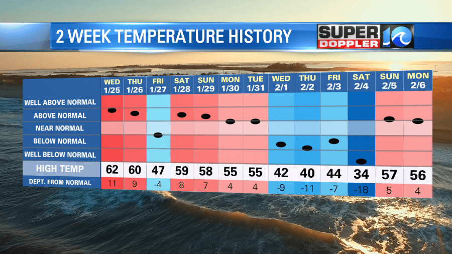
Lately we have had some warm temps. Over the last 2 weeks there were many days above average with a brief shot of Arctic Air late last week into last weekend.
Today we started off with clear skies, cold temps, and frost. Low temps bottomed out in the upper 20s to low 30s. However, we are going to warm up fast today. We’ll have a good amount of sunshine with a light south wind developing. Plus, the air is pretty dry. So temps will rise to the mid-upper 50s this afternoon.
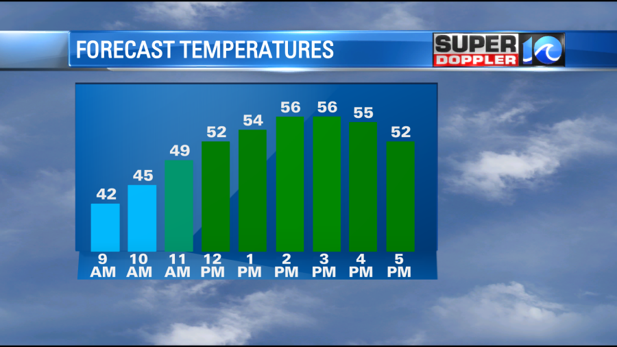
So dress in layers as you head out. It should be pretty nice out this afternoon. However, temps will warm even more over the next few days. High pressure is overhead today. The center of it will edge offshore this afternoon, but it will move more offshore by tomorrow.
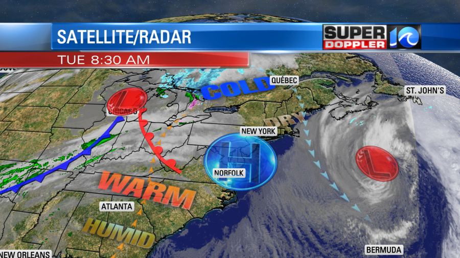
This will allow winds to be more out of the south. At least for a little while. We’ll start off milder Wednesday in the 40s, but we’ll climb to the 60s in the afternoon.
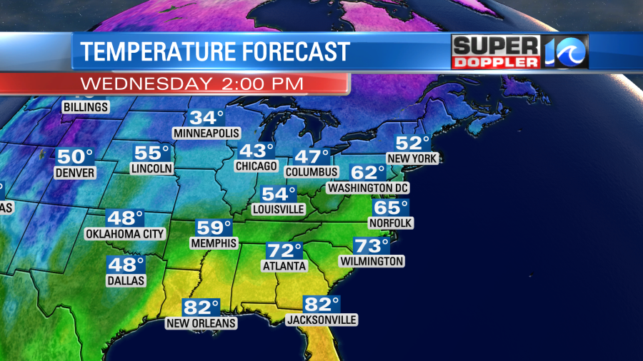
We’ll be partly cloudy with a light south wind through midday. Winds may turn out of the northeast for a bit in the afternoon. This will be from a weak cool front that will move in and stall out over the area. With water temps in the 40s it would likely cool down some locations closer to the water. However, it should stay mild all day inland/south. It should be a pretty nice day.
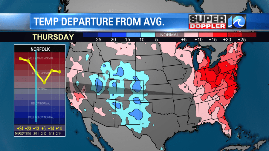
On Thursday the front will stream north as a warm front. This will let the south winds pick up. We’ll have increasing clouds with only some isolated showers in the afternoon. High temps are forecast to spike around 70 degrees.

This will be about 20 degrees above average, but it should be shy of the record high of 75.
A cold front will slowly move through the region on Friday. Rain will increase along the front, and it could become widespread later in the day. There might even be a couple of thunderstorms in the afternoon.
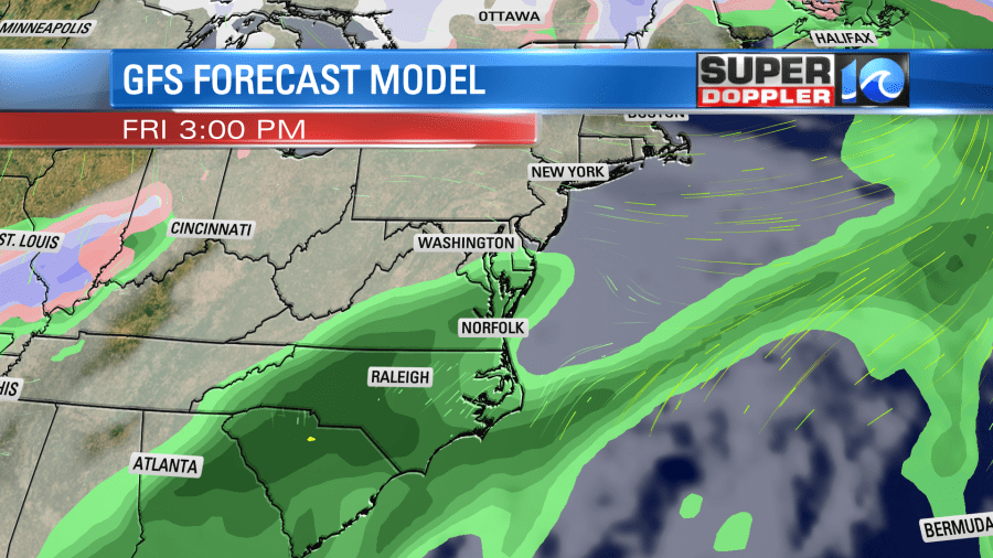
Temps should still be mild as the front will be slow. Highs will be in the 60s. We’ll cool down on Saturday. High temps will fall to the 50s. A second front and an area of low pressure will keep the rain going. That’s a new update that the models are now forecasting.
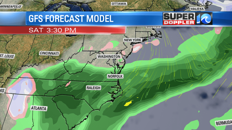
A strong upper level low will also move in from the west on Saturday. High temps will fall to the 50s. The models are now also extending precip into Sunday as an area of low pressure forms just offshore, and the upper level low swings offshore. They even hint at a brief wintry mix. This is HUGE change from yesterday, and it seems a bit too drastic. So I’ll talk more about it tomorrow after a couple of model updates come through.
Meteorologist: Jeremy Wheeler


