Yesterday the drizzle dropped south into our area, and scattered showers arrived shortly behind it for many. It was definitely a cool and cloudy day, but it didn’t feel too cool. Highs were in the 70s, but the wind was a bit less than expected, and the humidity was high.
This pattern is going to continue for at least a couple more days, but the breeze should pick up today. Low pressure is offshore, and it is attached to a stationary front. High pressure is to the west.
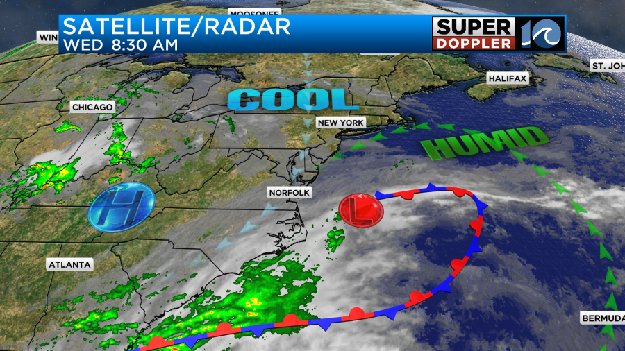
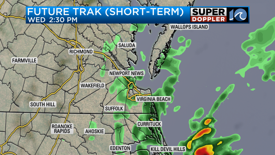
Deep moisture is wrapping around the low from the ocean, and it is pouring into our region with the northeast wind. The breeze will run out of the northeast today at 10-15 mph with gusts to 20 mph. There will be occasional drizzle (like yesterday), and there will be some scattered rain showers mixing in once in a while as well.
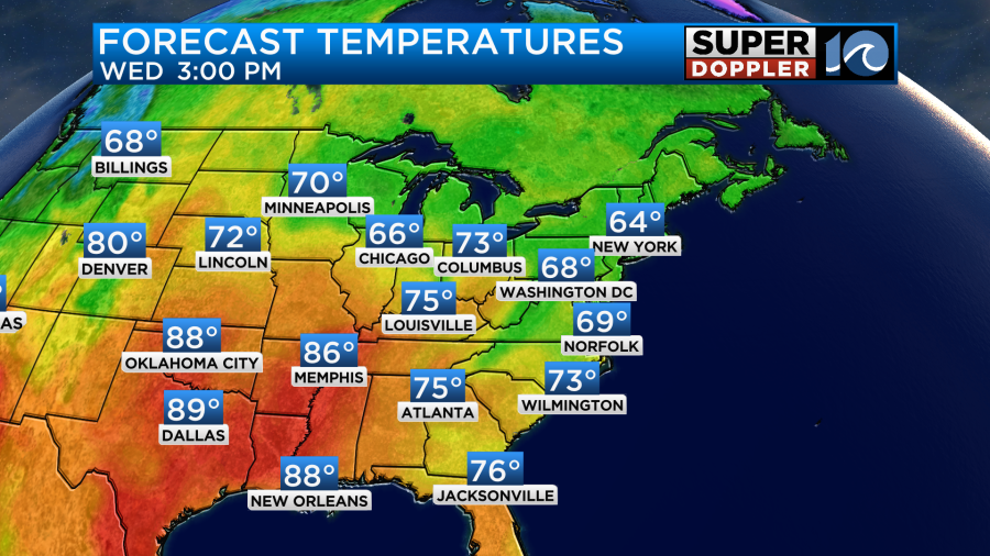
High temps will be cooler than yesterday. They will only be in the upper 60s with some low 70s to the south.
The precip shouldn’t add up to much. It will probably only be a couple hundredths of an inch. Tomorrow we’ll have similar weather. Clouds and drizzle will continue with some scattered showers at times. High temps will be in the low 70s with upper 60s north of the metro. The northeast breeze will also continue. By Friday we may see a little more sunshine, but overall the clouds and some drizzle will stick around. Highs will be in the 70s.
For now I have Saturday as a mix of sun and clouds with some isolated showers only. I’m thinking overall it will be a nice day, but it could be fairly gray at times. We’ll see. High temps will be in the 70s. Sunday is looking very good. The latest forecast is mostly sunny with highs in the upper 70s. It also looks nice into early next week.
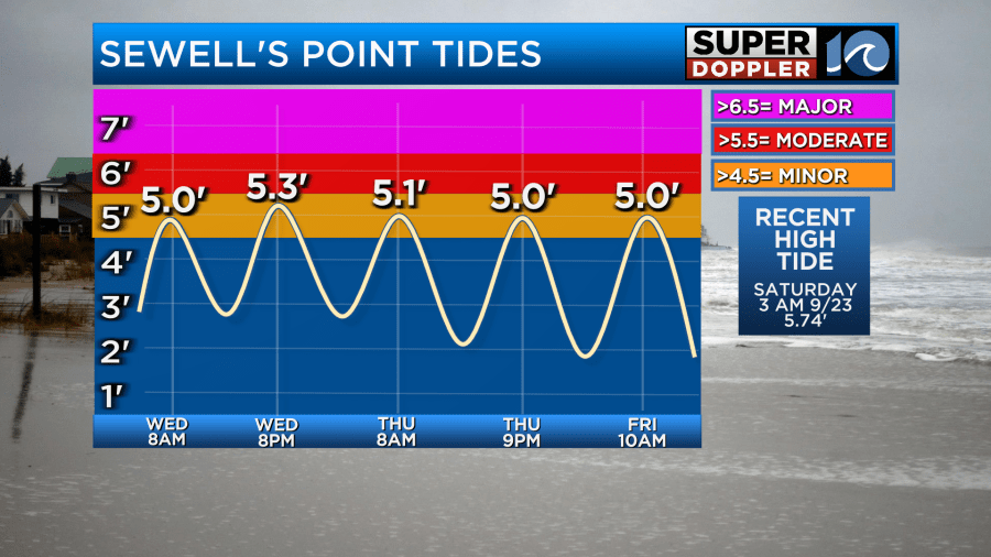
With the persistent northeast breeze we will have some tidal flooding. However, it doesn’t look bad at all. This morning’s high tide came in under-forecast. We topped off just under 5ft at Sewell’s Point, but yesterday’s forecast was 5.6ft for this morning. The wind was overforecast from yesterday until this morning by the models. Gusts were barely up to 20mph over the last 5 hours. So I’m hopeful that the next high tide will also be a bit lower. Here is my latest forecast for the tides:
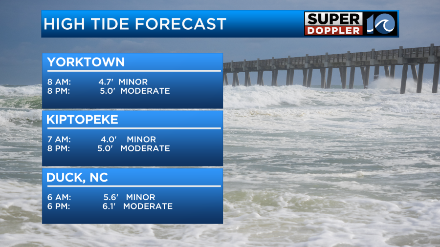
There may be some ocean overwash along the Outer Banks this evening, but it won’t be as bad as last weekend. Most locations should be fine, but you may have to move your vehicle if you are prone to tidal flooding.
Meanwhile tropical storm Philippe remains weak this morning.
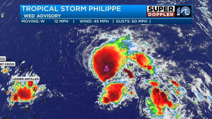
It has sustained winds of 45mph. It is currently experiencing some decent wind shear, and dry air continues to try and wrap into the system. So despite being over warm water, the system is forecast to stay weak and even fall apart in the next 3-4 days.
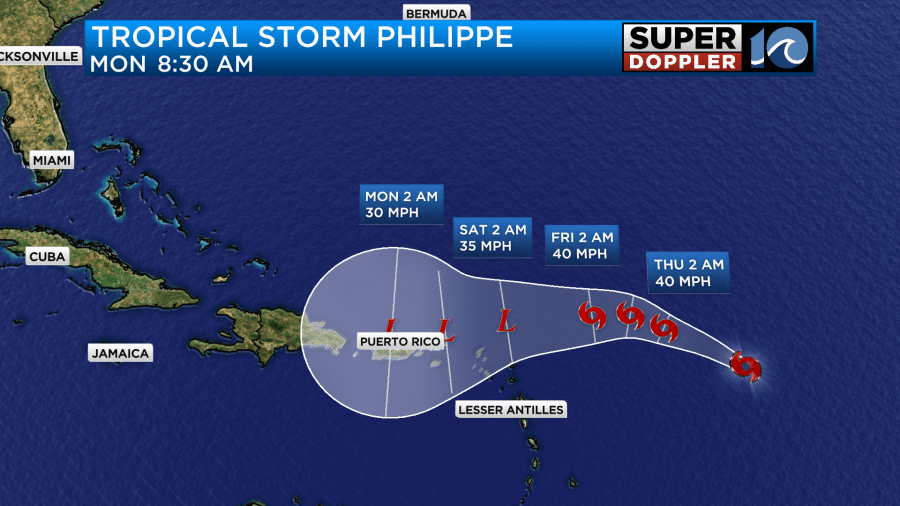
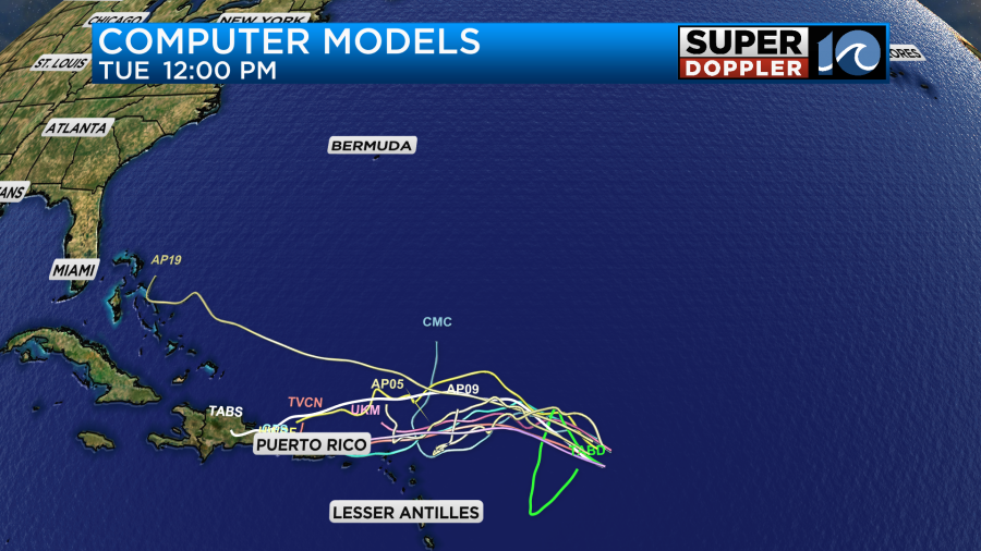
It may remain as an area of low pressure around Puerto Rico, but it should be pretty weak. The models are in good agreement in the short term. At least in terms of the track.
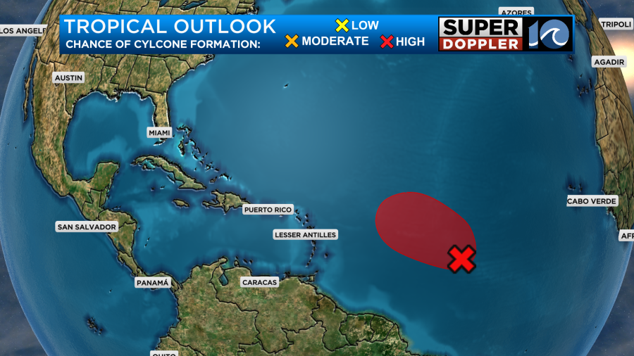
We are still watching the disturbance in the central Atlantic. It has a high chance of formation over the next couple of days, but it will also be moving into the area of moderate to high shear that is impacting Philippe. So it may remain weak. Hopefully, it will stay out to sea anyway.
We’ll keep an eye on all of this, and keep you updated.
In world news…It’s official. Several scientists and groups have claimed that the world just had the hottest Summer on record. However, just recently NASA also came out and stated that fact. We were 0.41 degree F above the warmest Summer on record, and we were well above the average. Here is the article with more information: NASA hottest Summer on record.
On that same note…Many recent articles have been posted about the record low amount of sea ice around Antarctica. It is Winter down there, but ice is at a record low for this time of year. Here is the article about that feature. Record low sea ice around Antarctica.
Meteorologist: Jeremy Wheeler


