This weekend looks pretty wet for many of our local events. However, it will not be a washout. I’m hoping there are some decent breaks in the rain when you can get outside. Today is the definitely the best day of the 3. Let’s talk about it.
Yesterday, there was an area of low pressure rolling across Texas and Louisiana. This created a large swath of wind damage, severe weather, and flooding.
This low will stay to our southwest today. However, it is going to pass to our south tomorrow. This will be the main cause of the wet weekend. In the meantime we have a small area of high pressure over our area.
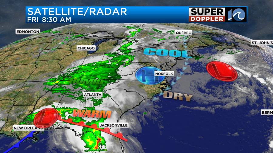
There is another area of low pressure offshore. Between that low and the high overhead there is a steady north/northeast breeze. This will be a cooling wind today. It will run at 10-15mph with some gusts to 20 near the shore. High temps will be in the low-mid 70s.

We’ll have a mix of sun and clouds through the day. We had a large pocket of clouds this morning coming off of the Bay. We should have some clearing between the mid-morning and early afternoon. There may be some isolated showers to the west, but most of the region should miss out on them. We have pretty low humidity. Dew points are in the 50s.
Tomorrow the low will be passing just to our south. It will be steadily moving to the east. We’ll be on the cooler and more stable side of the system. So we are only looking at scattered showers and possibly some isolated thunderstorms in our region. Having said that, there will be scattered rain showers Saturday morning.
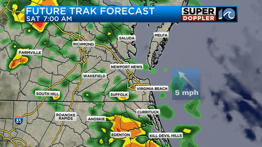
There will be some decent coverage early, but it should taper off some by midday. There will be some more scattered showers with a few isolated thunderstorms in the afternoon.

Some of the other models have a lot of coverage in the afternoon still. This includes the GFS and 3km NAM.
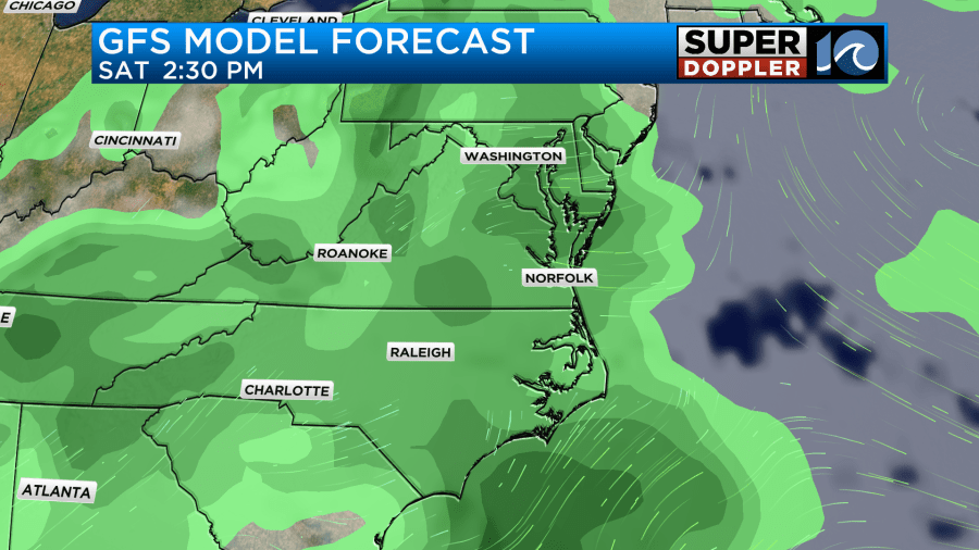
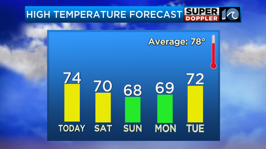
At least it won’t be too windy, but there will be an easterly breeze at 10-15mph. Temps will struggle to reach 70 degrees. If we’re lucky then maybe we’ll make it to the low-mid 70s. We’ll be even cooler Sunday into Monday with high temps only in the upper 60s.
The area of low pressure will start sliding offshore by Sunday morning. There will still be some scattered light showers and drizzle early on.
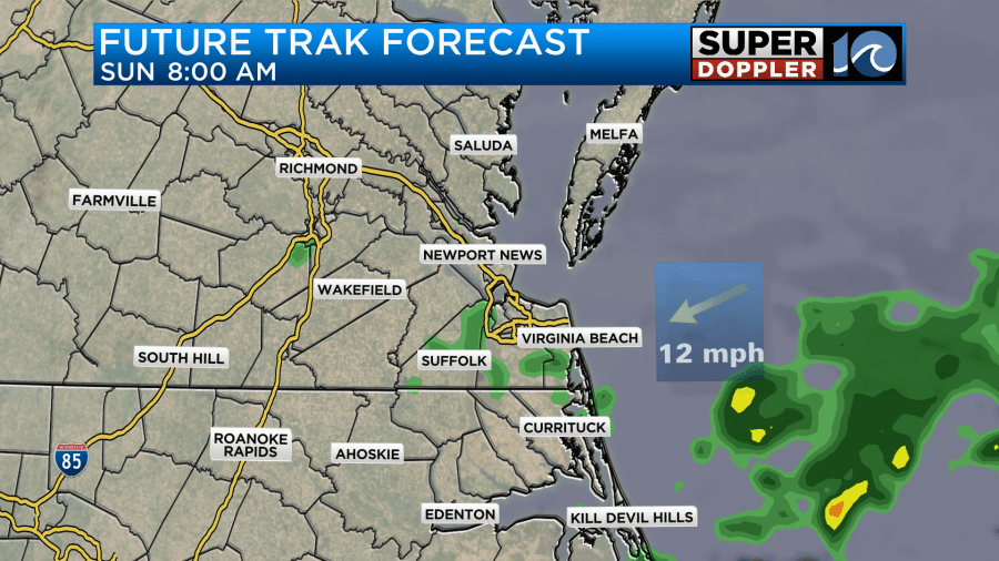
As we head into the afternoon the low will be moving farther offshore. There will be some wrap around moisture though. So we’ll hold onto a lot of the clouds, but the rain showers should really decrease.
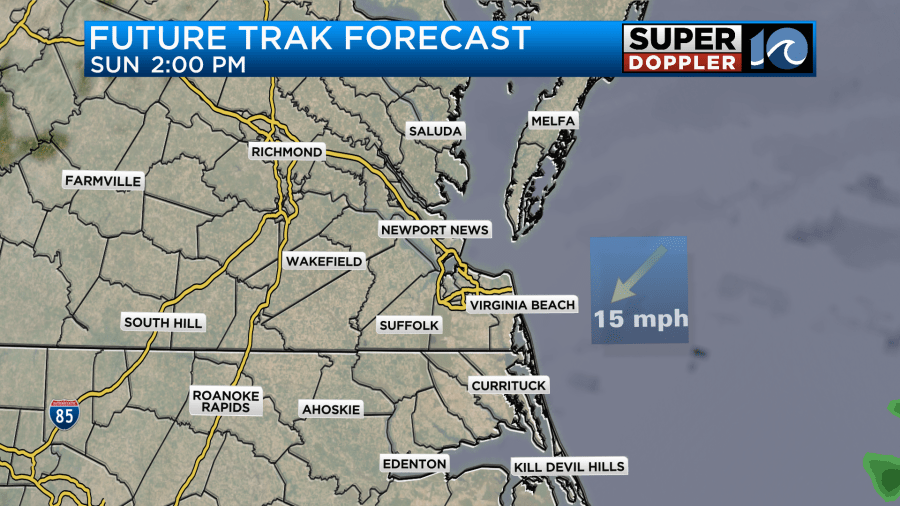
I’m thinking there will be some isolated showers and a little drizzle, but I’m also thinking that this could be a decent time to head to some of the outdoor events. It’s too early to have a lot of confidence though. So check back for updates on that. Either way we will be even cooler with highs temps only in the upper 60s. We’ll stay cool and dry early next week. Highs will only be in the upper 60s. However, we should warm up later next week. I wish I could say that we’ll be warm next weekend for the Memorial Day Weekend. However, early models runs are showing some cool-mild weather. It’s still TOO EARLY for a good forecast. We’ll have that forecast over the next few days.
As far as rainfall goes… Here are 4 models that we use.
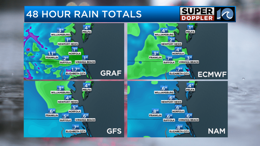
Our Future Trak (GRAF model) is the driest of the 4. I think that is because it has less that then others during Saturday afternoon. For now I am siding with the wetter models which have about a half an inch.
Meteorologist: Jeremy Wheeler


