8:30 p.m. update
HAMPTON ROADS, Va. (WAVY) — Rain and strong wind gusts continue to push through our area. At this point the weather is following the prediction nicely with no surprises. The threat for tornadoes does increase overnight and persists tomorrow. Watch the video forecast for the latest outlook.
The impacts of Tropical Storm Ophelia will be felt across our area tonight. Rain will increase through the overnight hours with heavy rain at times. We will also expect the wind to increase, with very gusty conditions overnight.
VIEW CURRENT CONDITIONS INCLUDING RECENT WIND GUSTS HERE
RAIN
Rain showers will increase in coverage overnight. At times, heavy rain can be expected. The rain will be coming down heavy enough at times overnight that we could see some street flooding in poor drainage areas. Especially around high tide which is around 3 to 4 a.m.
We can’t rule out an isolated tornado overnight or Saturday morning with the bands of rain. Make sure you keep your phone on, charged and your sound on.
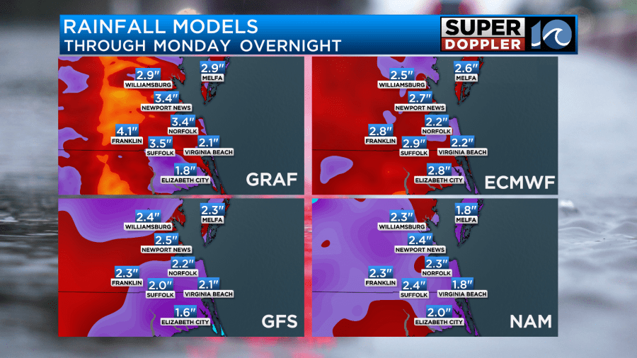
Rainfall totals will generally be around 2 to 4 inches with some amounts of 5 to 6 inches possible, mainly inland areas. That’s where the heavier rain may be focused on Saturday as the center pulls north. A flood watch is in effect for the region through Saturday.

WIND
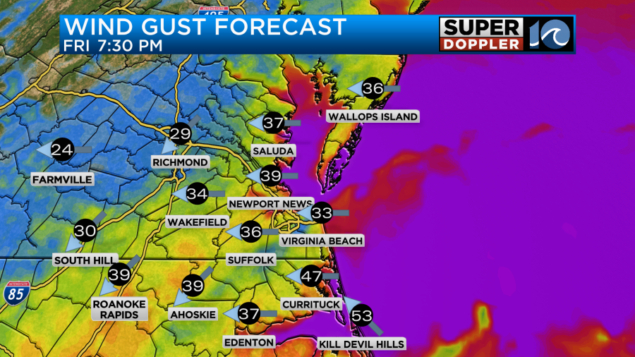
The winds will be something you notice overnight and Saturday. It will be quite gusty with gusts of 30 to 45 mph frequently across Hampton Roads and Eastern Virginia. I would not be surprised to see some higher gusts in Virginia Beach or in the Outer Banks. For Virginia Beach, a gust to 55 mph would not surprise me and in the Outer Banks, we could see some gusts to 60 mph.
TIDAL FLOODING
The official forecast for Sewell’s Point is for 6.4 feet. I will say some guidance has us a little lower, with tides coming in just under or around 6 feet. So I wouldn’t be surprised if that happens, but either way, it looks like a solid moderate flood stage. That’ll cause some problems.

Below are some other high tide times and forecasts.


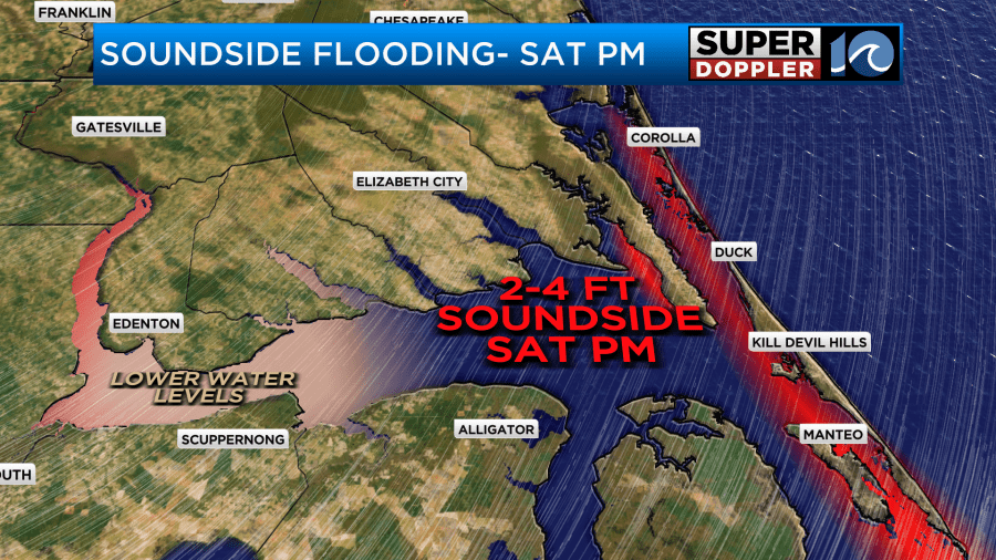
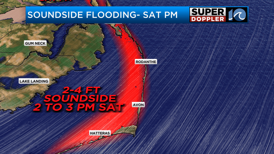
For the Outer Banks, keep in mind we’ll see some oceanside flooding tonight and then some soundside flooding Saturday afternoon. We could see a negative surge on parts of the Albemarle Sound towards Edenton as the wind blows the water out Saturday afternoon.
Saturday, things will improve throughout the day. I expect some morning rain, then things should improve as we head towards the evening hours. Sunday looks nice with just a spotty shower early and breezy conditions.
Overall, a windy, rainy night for most of us. If you live along a tidal creek or along the shoreline, make sure you watch the tides tonight. Move your cars!
Don’t forget you can send us pictures and videos by emailing them to reportit@wavy.com.


