After highs today hit 60° Old Man Winter makes it’s triumphant return tonight as a cold front sweeps through the region. Unfortunately this time around, it’s not just the cold we’ll deal with on Monday morning but a breeze as well.
Clouds continue to pass through the area tonight before skies turn mostly clear by dawn. That’s when temperatures will drop into the 30s. The breeze developing out of the north-northwest should pick up between 10-15mph with the occasional gust to over 20mph. This should make temperatures feel like the upper 20s for many of us.
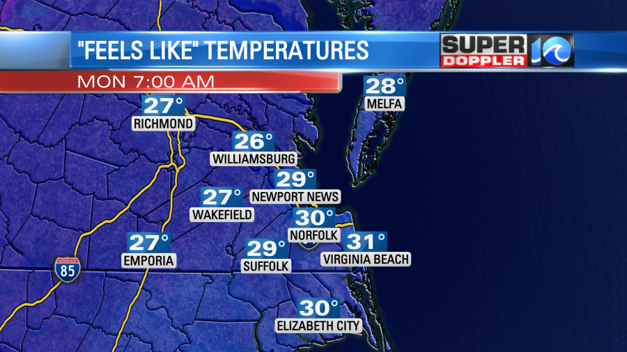
The ‘wind chill’ factor works when a solid breeze whisks away the small layer of moisture & warmth that sits on the surface of our skin. As that gets blown away the air feels colder to our exposed skin. The wind chill is not a factor for plants, pipes and inanimate objects. But for our pets it is!
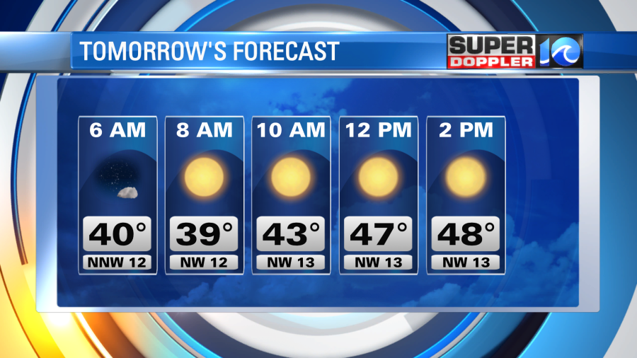
More often than not this time of year cold shots of air are not only cold but dry. So typically the chilly days feature bright sunshine and that’s what we’ll have Monday. Even still, highs in the afternoon should hold in the 40s.
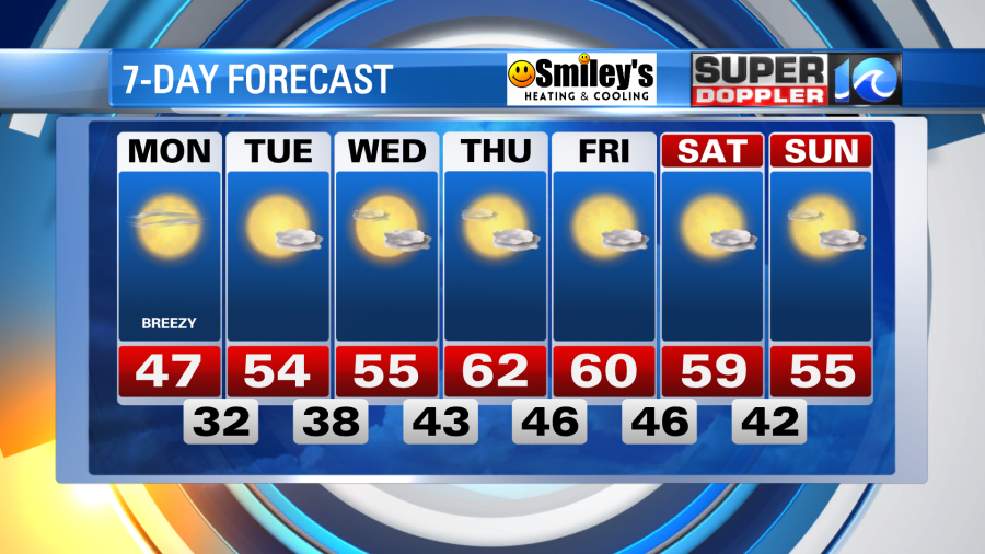
Monday night into Tuesday will be another cold night as lows should fall into the upper 20s & low 30s. A quiet, pleasant weather pattern takes shape this week allowing temperatures to slowly rebound. Look for highs back in the 50s Tuesday and Wednesday, with afternoons near 60° by the end of the week. All coming plenty of sunshine. As of now, there are no significant or notable rain chances over the next six to seven days. Which in a way is a bummer as we’re running nearly two inches behind our normal rainfall.

Drought conditions are expected to continue through the end of the month and into the start of meteorological winter.
Bundle up, grab the extra coffee and enjoy a cold Monday morning!
Meteorologist Steve Fundaro