PORTSMOUTH, Va. (WAVY) — Living in Hampton Roads, the tides play a big role in our lives. From tidal flooding over roadways, to how much sand is at the beach when you go lay out in the sun, the tide level can impact our lives in many ways.
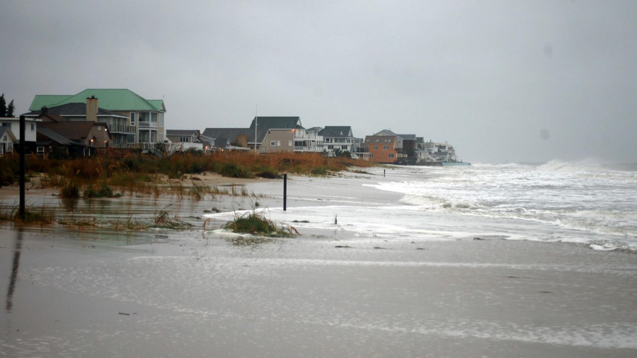
As our tides rise, monitiring it is important to understanding the impacts now and in the future.
The goal of the “Catch the King” program is to analyze the tidal levels to validate predictions and improve models. During the October 29 event, volunteers collect flooding data from the Perigean tides, which are higher than normal tides which occur as the moon exerts a more powerful gravitational pull on the water. This often happens during a new or full moon.
The program involves several local groups and universities, such as VIMS and ODU.
If you’d like to participate in this weekend’s event, you can sign up to be a volunteer on the Wetlands Watch website or join the Facebook group. Then, simply download the app for your phone and head to a site to look at the tide level during high tide! The more reports the better!
Wetlands Watch has provided maps which show some of the best places to head to and log data.
Download the Sea Level Rise app on iPhone
Download the Sea Level Rise app for Android