HAMPTON ROADS, Va. (WAVY) — Hurricane season starts June 1, which will be here sooner than we think. To make sure information is communicated in the best possible manner, the National Hurricane Center is making some changes to their products for this year.
New in 2024, the NHC will issue more products in Spanish. This includes the Tropical Weather Outlook, which will be issued daily starting in mid-May. This product discusses any possible areas of tropical development in the Atlantic Basin. The new product should help communicate hurricane threats to more people.
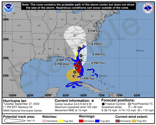
The NHC said that “the experimental graphic may not be available as soon as the current cone graphic due to the time needed to compile complete inland watch and warning information, but it should generally be available within 30 minutes of the advisory release.”
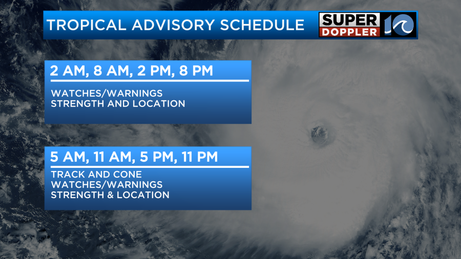
The National Hurricane Center will also be able to issue watches and warnings with their intermediate advisories. Previously, we only got these with full forecast packages at 5 p.m. and 11 p.m. Now, we can get them at 2 p.m. and 8 p.m. if necessary. Forecast tracks will only come out at 5 p.m. and 11 p.m., still.

Another change: the NHC will issue an experimental forecast cone graphic on its website. We know that hurricane winds can often extend inland, away from the coast. The new cone will include inland watches and warnings plotted on the map when they are in effect.

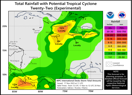
The Weather Prediction Center, in partnership with the NHC, will issue an experimental rainfall graphic for the Caribbean and Central America during the 2024 hurricane season.
This graphic provides a display of forecast rainfall totals associated with a tropical cyclone or disturbance for a specified time period, based on forecaster discretion. The graphic will allow for enhanced communication of the expected rainfall to external partners, media, and the general public.
The product will be publicly available via hurricanes.gov whenever there is an active tropical cyclone or potential tropical cyclone in the region with a rainfall statement in the Public Advisory.

Finally, the NHC will issue day four and day five tropical wind probability maps. These were previously only available for day one, two and three.


