Despite running 15°+ cooler compared to Saturday, the strong spring sunshine today was unparalleled. Temperatures are set to quickly rebound to above average standards going into the workweek.
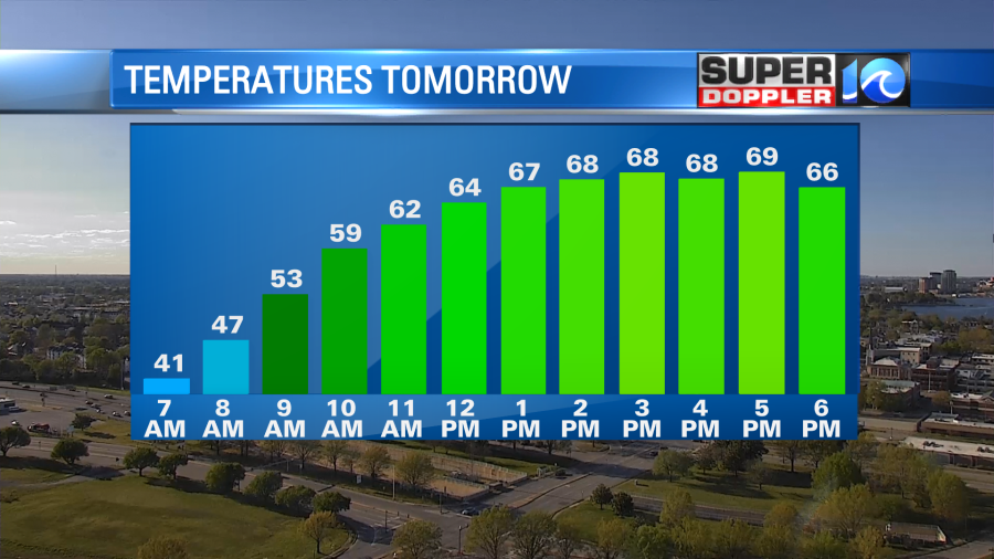
Under clear skies tonight temperatures will drop into the low 40s, with a few upper 30s possible for inland locations. So a little brisk to start our Monday morning, but the wind gently flips out of the south to help bring back the warmth. We’ll see our afternoon highs inch closer to 70° as a few clouds trickle into the region.
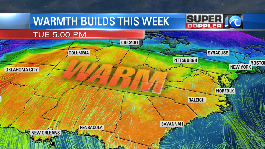
As the warmer air mass moves into Hampton Roads, some areas of fog could develop by early Tuesday morning, this will also go along with a passing shower or two. No worries, however, as rain chances remain limited and afternoon sunshine will boost high temperatures into the 70s.
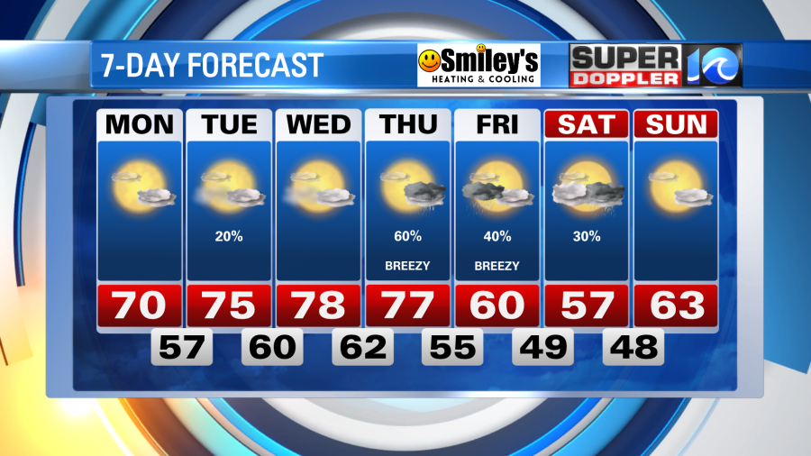
Expect upper 70s by Wednesday and Thursday ahead of our next weather maker. A developing cold front is set to move into Hampton Roads sometime later Thursday into Friday. For now, rainfall isn’t set to arrive until after dark Thursday, so it remains a warm and breezy day. Cool air will move in for Friday and the weekend. Stay tuned for updates as this forecast is subject to change!
Enjoy this early April warmth, no April fools jokes about it!
Meteorologist Steve Fundaro