Ol’ man winter is truly showing his face, the winter wonderland Thursday, bone-chilling breeze Friday, and the cold sunshine Saturday. Well, there’s another trick up his sleeve for Sunday. A warm front is going to lift through the area, slowly settling in warmer air. But since the cold air is in place, we’ll go from some snow at first, to a wintry mix, to a soaking rain that washes it all away.
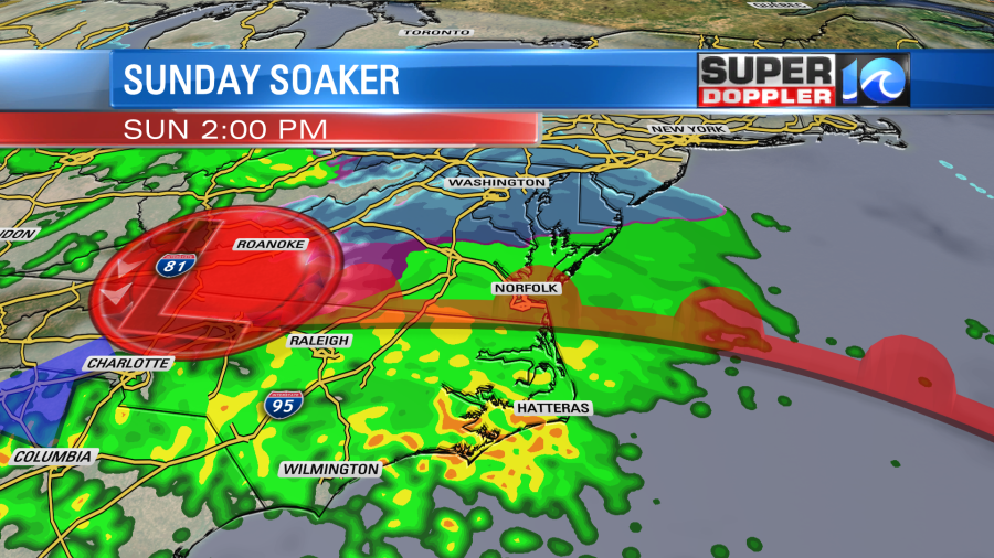
Saturday night, the clouds are thickening up as the cold air is in place. The 30s from this afternoon will drop into the mid to upper 20s. A brief snow shower or two is possible overnight, but most precipitation shouldn’t build into the area until sunrise or so.
By then we’ll be dealing with snow blending into a wintry mix. Mid to late morning is the trickiest part of this forecast; it’s when the wintry weather slowly begins to transition over to rain. Some sleet and freezing rain are likely to blend in – this will be a brief window, two hours or so – but enough to cause slick roadways so use extra caution. Then by midday, it should all flip to rain and we get soaked.
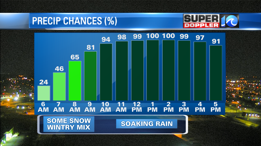
A Winter Weather Advisory is up for locations north and west of the Peninsula through noon Sunday. These locations, essentially from Southampton through Williamsburg and up to the Northern Neck, will be riding the rain/snow line for the first half of the day. Therefore the snow will likely persist longer into the morning, taking its sweet time transitioning to rain.
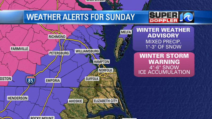
Now, this won’t be a lovely, picturesque morning like Thursday’s winter wonderland was. If anything, by the end of the day Sunday any and all snow/ice that makes it to the ground will get washed away by the anticipating soaking rain. In fact, most of us from the Southside down through North Carolina will be dealing with just rain. And a rain that should last all the way through the evening. Once the winter weather north of the Peninsula flips to rain, it’s on through the evening as well.
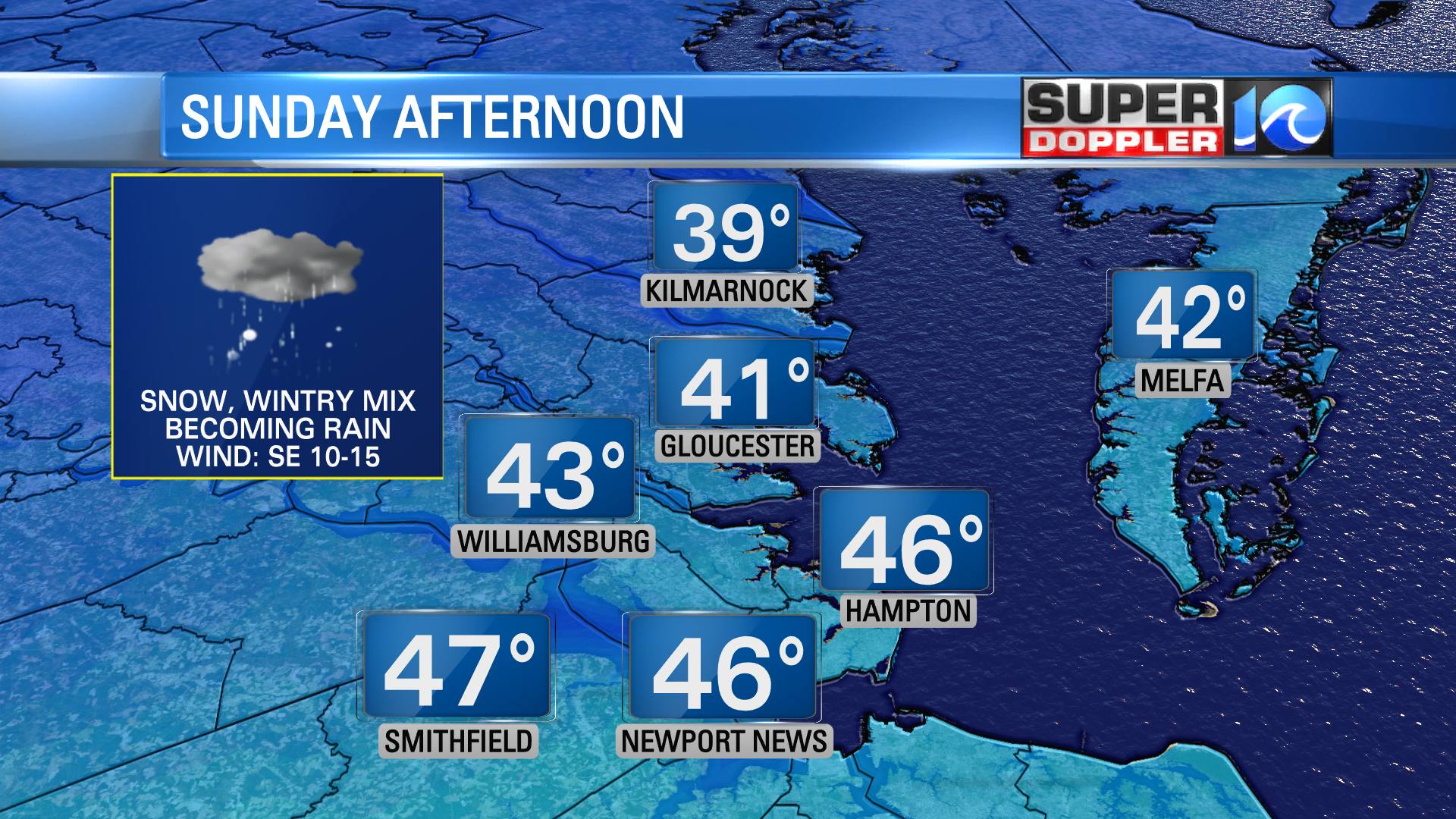
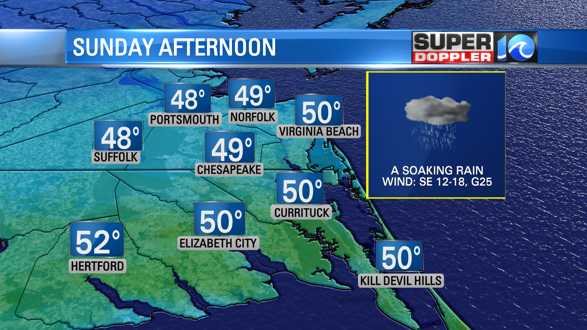
Also, notice these temperatures; we’ll start near the freezing mark in the morning since the cold air is in place, but then once the warm air settles in we could near 50°(!) by the end of the day. This will set up a much more mild night, so after nearly three-quarters of an inch to an inch of rain falls, there is no concern of any ice/re-freezing overnight.
As this big ol’ system pulls away offshore, it’ll leave some lingering rain showers into Monday morning. Clouds should be stubborn and a chilly breeze will help dry us out as highs should hold in the 40s We’ll hang onto that breeze into Tuesday but will see some more sunshine. This upcoming week gets funky too, quiet & calm weather should take us to near 60° by next Friday or Saturday!
Before I get ahead of myself – my advice for Sunday morning? Hit the snooze button a few times and sleep in, so by the time you really start your day, most of any/all wintry precipitation will be flipping to rain that takes us into the night.
Stay stoked! – Meteorologist Steve Fundaro


