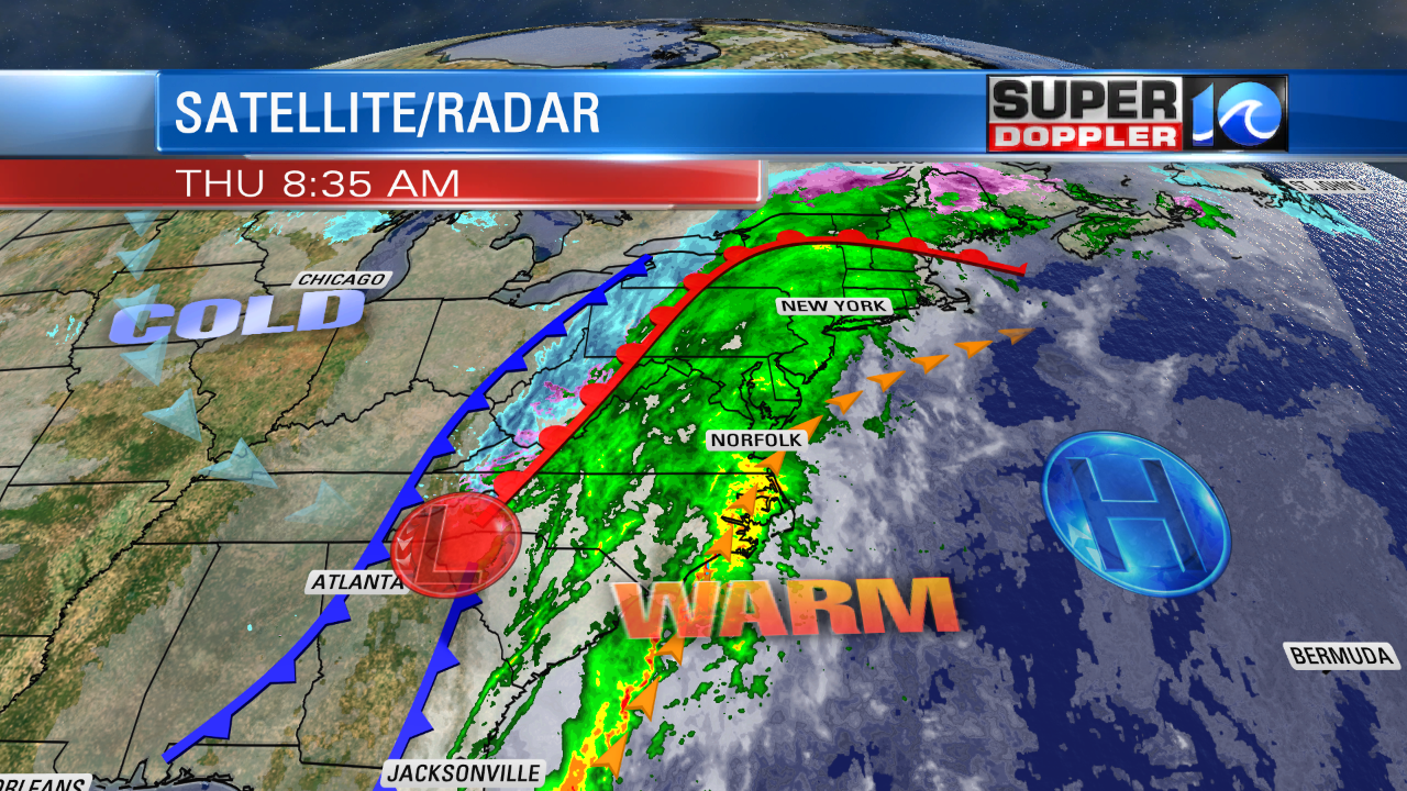
We kicked off the morning with temperatures in the 60s, increasing rain showers, and wind gusts to 30 mph. We are in the warm zone, as a warm front is to our north and west. However, a cold front is steadily moving toward us from the west.
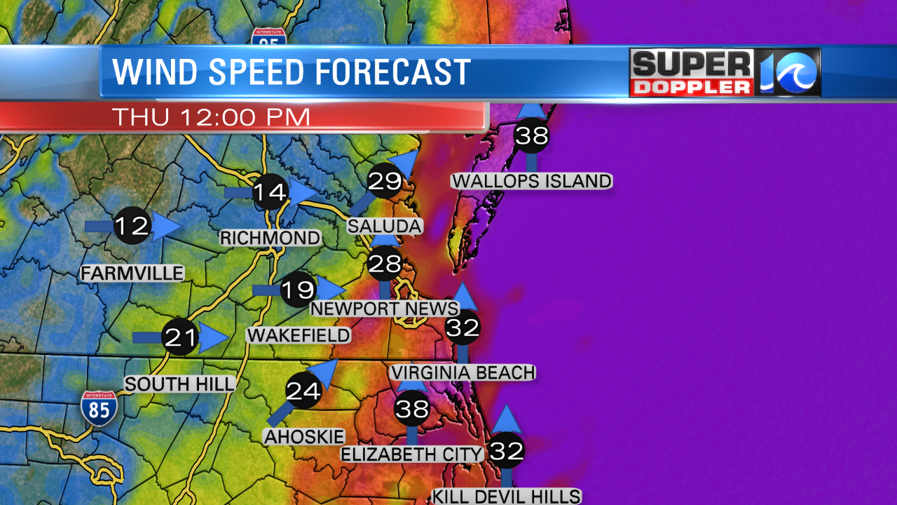
As we go through the morning, the winds will increase a little more. They could gust up to 40 mph for a time.
This will drive temperatures into the mid-upper 60s despite lots of clouds and widespread rain. Rain may be heavy at times until around midday.
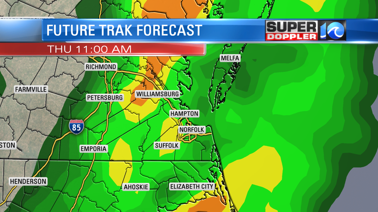
There may even be a few thunderstorms. By midday the cold front will be slowly marching in from the west. Unlike the last event temperatures won’t crash. Rather, they will steadily fall through the afternoon. We’ll probably drop to the upper 50s by the late afternoon. Winds will be out of the west. They will decrease through the afternoon into the evening.
Showers will become isolated between 2 and 4 p.m. We should be pretty dry for the evening commute. We could pick up about a half inch up to an inch of rain in the region. Though I think it will be closer to a half an inch for most.
By tonight we’ll clear out. Temps will fall down to the low-mid 30s. That will be a big fall from the daytime high. Tomorrow we’ll have a lot of sunshine. High temps will be knocked down to the 40s. Skies will be partly cloudy. We’ll be in the 40s and dry for Saturday. Then we’ll be in the 50s and partly cloudy on Sunday. I still can’t rule out a sprinkle or a flurry over the weekend with a pocket of upper level energy scooting through, but we should be pretty dry. So it’s a very low chance.
Our next best chance for precipitation will be on Wednesday. There may be a wintry mix for a time after some scattered rain showers. It’s pretty far out. So there’s plenty of time for updates.
Meteorologist: Jeremy Wheeler


