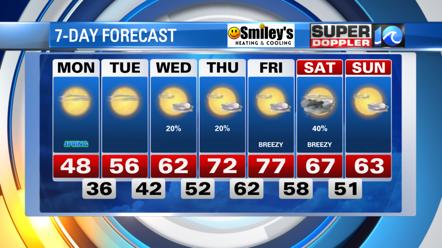
As we welcome the spring season our temperatures will be taking a page out of January’s playbook, so grab those sweaters! Fortunately, the cold won’t hold for long, and our weekly warm up could bring 80° weather to a few locations by the end of the week.

Tonight the cold air settling in will drop our temperatures into the 30s and we’ll likely wake up with temperatures on either side of 32°. Highs will hold in the 40s for most of the day (the average January high is around 50°) under bright March sunshine. A few clouds stream in for those along the Outer Banks where a stray shower is possible.
High pressure building overheard will keep the sunshine around for most of the week and allow a steady warm up each day. We’ll reach the 50s on Tuesday after a chilly morning, then the 60s by Wednesday, 70s by Thursday and Friday and with the warm breeze Friday a few spots could hit 80°.

Rain chances will be pretty slim this week, there’s a shot at a few isolated showers between Wednesday and Thursday, but any solid chance of rain holds off until the weekend when temperatures return to March standards.
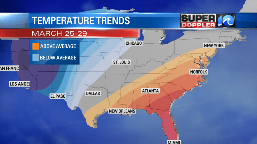
As March has proven a pretty cool month so far, there are trends and indications that some warmer weather could take us through the end of the month (or at least the likelihood of temperatures reach above average standards).
We’ll likely start that trend at the end of this workweek!
Meteorologist Steve Fundaro


