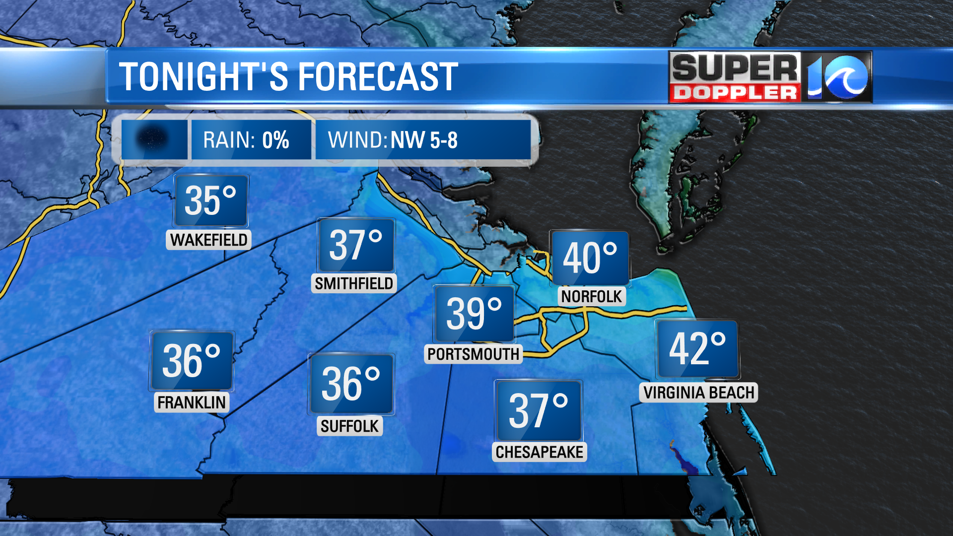
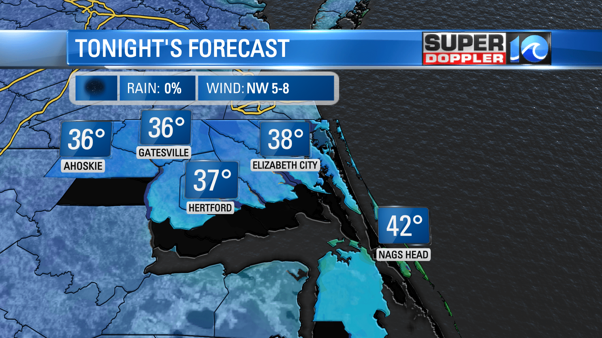
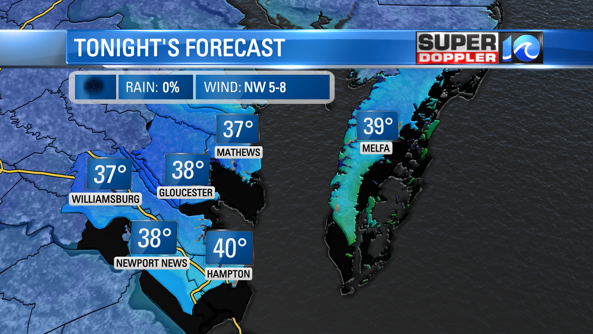
PORTSMOUTH, Va. (WAVY) – The potent cold front that punched through Hampton Roads Monday night means business. It’s sticking true to its name, bringing the cold tonight. Temperatures are set to drop into the 30s by dawn on Wednesday, prompting frost in a few locations across the area.
Frost Advisories have been posted for inland locations, including Chesapeake, Suffolk, Isle of White, James City County. As well as Camden, Pasquotank, Perquimans, Chowan & Gates Counties.

“It’s gonna get cold” – Don Slater, sometime during the 4 p.m. newscast Monday. Low temperatures tonight are set to drop into the 30s with a few locations near 40°(closer to the waterways).
Monday evening’s cold front also brought a bout of severe weather for parts of Hampton Roads in the form of hail! An interesting type of precipitation, hail is specific to thunderstorms and while it’s ice, it is not a winter precipitation.
Hail forms from the rising air within a thunderstorm (updrafts) suspending the rain within the cloud. When the thunderstorm is strong enough, it’ll lift the water particles above the freezing level, freezing the rain drop into ice. Periodically, the bit of ice (hail) will fall below the freezing level and the outer layers will melt a little before getting lifted back to the cold air to refreeze.
This process repeats and the bit of hail grows larger in size until it weighs too much for the rising air to keep it suspended. At this point, the hail will fall through the thunderstorm and down to the ground.
It is easier for hail to form when cold air is more accessible in the upper levels of the atmosphere, which was the case Monday evening. Now, that cold air has made it to the surface and we’ll get a taste of winter come dawn.
Meteorologist Steve Fundaro