
When we look back at 2022 we will likely remember a lot of dry spells. 2021 was a dry year, and we finished out about 9 inches below average. 2022 is also running well behind the average. We are currently down about 10 inches below the annual average rainfall.
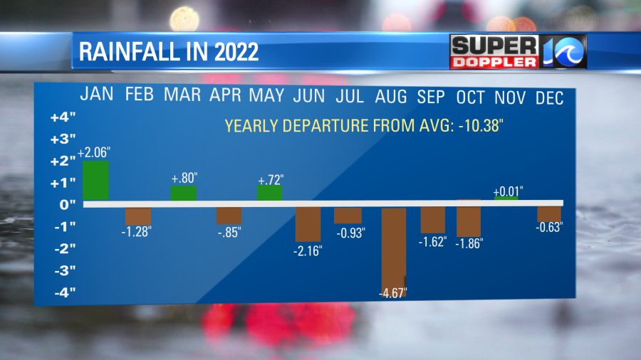
We were downright parched in August, and there were a few months that were 1-2″ below average. There’s not much rain expected over the next few days, but we may see some later next week.
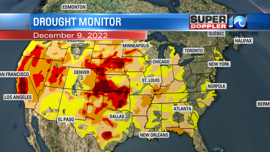
We are not alone. There is a big chunk of the country in at least some level of drought. Take a look at the latest U.S. Drought Monitor:
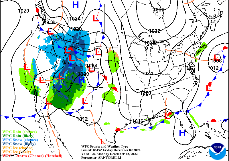
There will be a big weather system that will bring lots of snow and rain to the west between Sunday and Monday. That should help a bit.
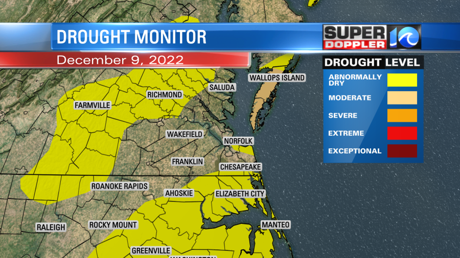
We have some areas locally that are abnormally dry (level 1 out of 5). The Eastern Shore is in a moderate drought.
Last night we had what looked like scattered rain showers on the radar. However, a lot of what was on the screen was not reaching the ground.
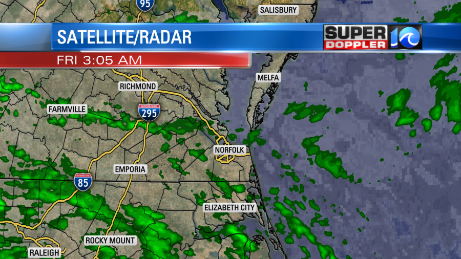
When you have very dry air at the surface sometimes the precip will evaporate before it hits the ground.

We know this because we can see the dry ground when we go out, or we can see the lack of rain on our tower and traffic cameras. Surface reports also help to tell the story. So there is some moisture aloft with dry air at the surface. High pressure is to the north with a stationary front to our south.
We’ve already had some clearing this morning in the metro. We’ll have clearing for most of the region through noon. However, high temps will be held down this afternoon due to the persistent northeast breeze. We’ll be in the low 50s this afternoon with a few mid 50s to the south.
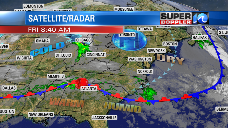
It will actually be seasonably mild to our west and southwest over the next couple of days. Even the Midwest will be above average.
Our temps will stay steady-Eddy over the weekend. Highs will be in the low-mid 50s both days. We’ll be pretty dry overall, but some isolated showers will be possible on Sunday. We’ll be cool and dry early next week. So no help for the long-term drought there. However, we may see a high chance of rain and maybe some storms later next week. Stay tuned for updates on that.
That area of low pressure over the central Atlantic no longer has a chance at becoming tropical or subtropical. It’s now over cooler water.
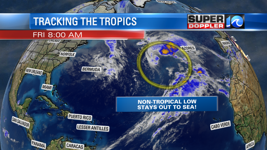
However, despite not becoming tropical, it will still send us some waves along the east coast. Waves this weekend could be over 6ft at the oceanfront. It could be near 10ft along the Outer Banks. At least near the shore.
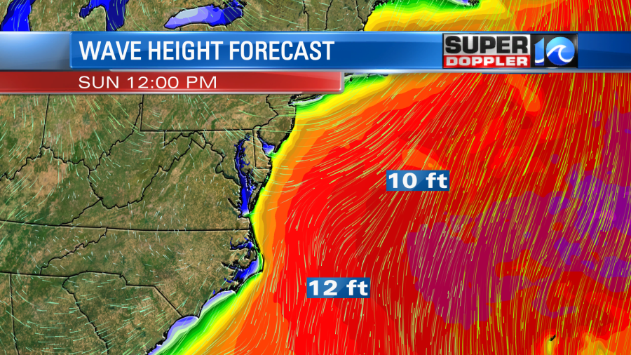
There could be some ocean overwash during high tide along the Outer Banks. Other than that the region should be fine.
Meteorologist: Jeremy Wheeler


