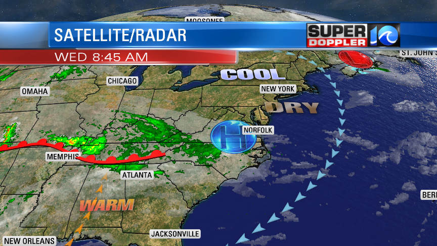
Things are looking good for our region again today. We do have an area of high pressure overhead. However, if you look at the satellite/radar, then you’ll notice that there are clouds and some showers pushing into that system from the southwest.

Basically there is some warmer/more humid air to the west, and it’s trying to push northeast into the cooler/drier air mass. Luckily we’ll be on the cool/dry side of the high, but we will still catch some high/thin clouds through the day. High temps will be in the upper 60s. There is a light northeast wind. So it will be a little cooler near the shore. However, I think we will hit some 70s inland and south.
Tomorrow the high will nudge offshore. We’ll have increasing temps and moisture as winds turn more southerly. Skies will be partly cloudy, but our model is suggesting that we’ll be between partly and mostly cloudy. There may be some isolated showers, but it’s a low chance (20%). Overall, it will be a nice day. High temps will rise to the mid 70s. We’ll have a light southwest wind. It will be cooler near the shore.
On Friday we’ll have some great weather. We’ll be partly cloudy with highs in the low-mid 80s. Humidity still won’t be too bad. We’ll have similar weather on Saturday, but there will be more humidity, more clouds, and some isolated showers.
We’ll be mostly cloudy on Sunday with scattered rain showers. High temps will cool a bit into the 70s.
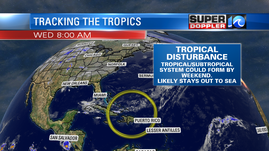
We are watching the tropics. The computer models are forecasting a weak area of low pressure to form near the Bahamas over the next couple of days.

They have it strengthening a bit, and then moving to the north/northeast. So far the models keep it well out to sea. It may become tropical or subtropical, but it will definitely move over cooler waters as it tracks north. So I’m not too concerned about it right now. However, we will watch it closely just in case. Maybe it will bring us some nice surf in a few days. Stay tuned for updates.
Meteorologist: Jeremy Wheeler


