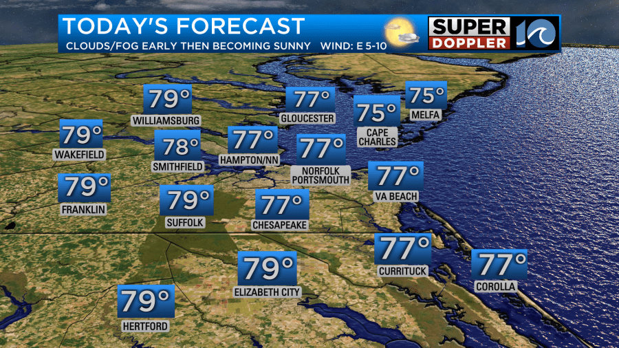
Temperatures Sunday will be very comfortable, with temperatures this afternoon in the upper 70s. We’ll see a bit of morning fog in spots before mostly sunny skies develop in the afternoon.
Overnight, temperatures once again will drop into the upper 50s (inland) to low 60s (coastal areas). Expect a few clouds, but overall mainly clear skies.
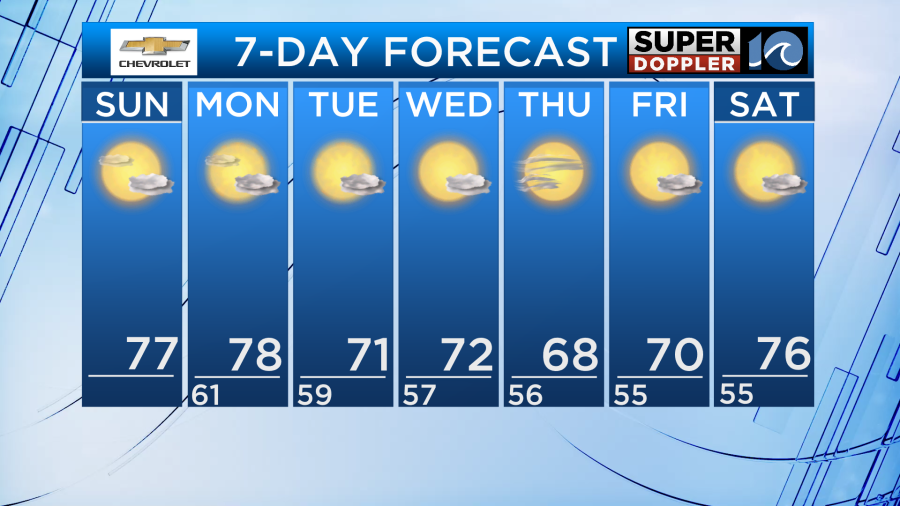
A cool front drops into the area Monday. This brings just a tiny chance of a rain shower on Monday, and a bit of a breeze. The more noticible thing will be the drop in temperatures and humidity on Tuesday in the wake of this front. Tuesday-end of the week temperatures will be in the low 70s, even upper 60s some days. Overnight lows in the 50s.
A dry stretch of weather is expected through much of the next 7 days.
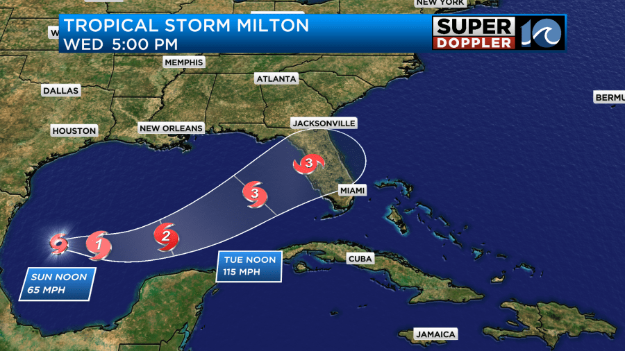
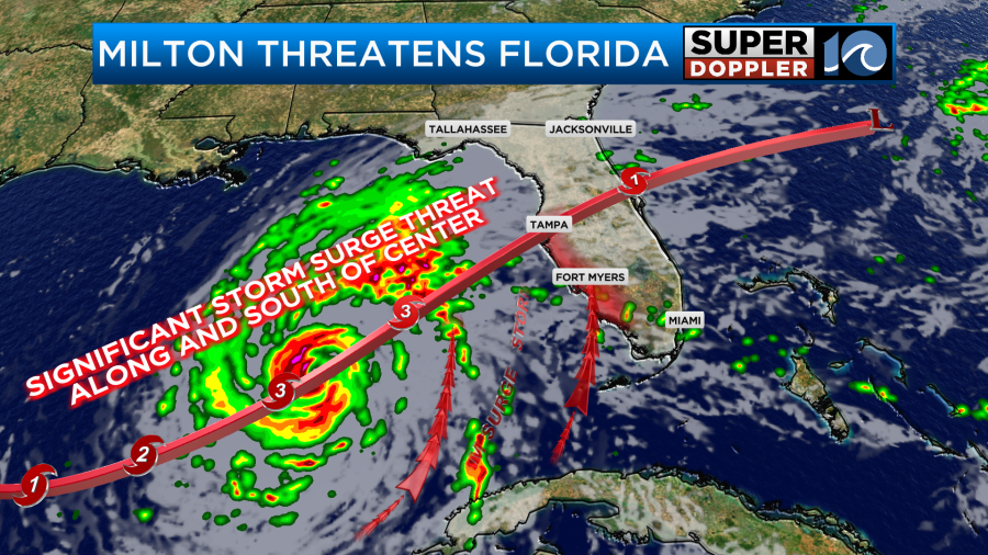
In the tropics, things remain quite active. On Saturday, Milton formed and is currently as of Sunday morning in the far SW Gulf of Mexico. The system is expected to become a major hurricane for the Florida Peninsula midweek! The exact landfall spot for Milton on the west/gulf coast of Florida remains highly uncertain, but it’s not likely to come anywhere near us. That autumnal cool front on the way keeps that activity to our south. For anyone with interests or family in Florida, especially near and south of Tampa – make sure you stay updated on Milton! The Tampa area is especially vulnerable to storm surge, and with this storm coming in from the SW it could be a very bad situation if the eye/center goes near or north of Tampa.

Something else to note, there will be some increased swell and rip current risks at the coast through the early part of this week – thanks to the waves from Hurricane Kirk even though it’s hundreds of miles to our east. Powerful hurricanes can produce swells and currents that extend out hundreds of miles – so be wary of that if you’re entering the water.
Hope you have a great Sunday!
Meteorologist Ricky Matthews
Follow Ricky on Facebook and Twitter


