The quiet weather that we’ve enjoyed recently (at least locally) is coming to an end soon. High pressure is moving away from the region, and moisture is quickly streaming in behind it from the south.
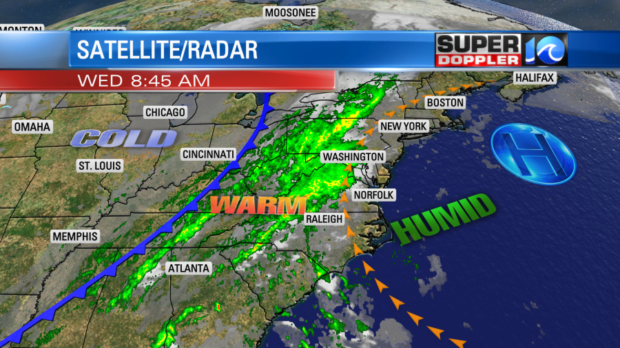
As we go through the day the moisture will increase at all levels. At the surface the dew point is going to rise to near 70. This is some tropical humidity, and it will definitely make it an unseasonably warm and humid day. High temperatures will rise to the low 80s. This will likely break the current record of 80 degrees (2002). The humidity will make it feel like the mid-upper 80s. Clouds will increase through midday. This should cap the temps a bit. Rain chances will steadily increase through the day.
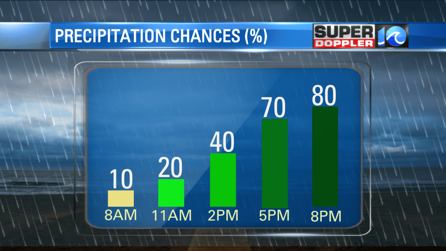
The widespread rain will stay off to our west through the mid afternoon. We’ll have a few scattered showers during the afternoon. However, we’ll see quite a bit of rain by the evening.
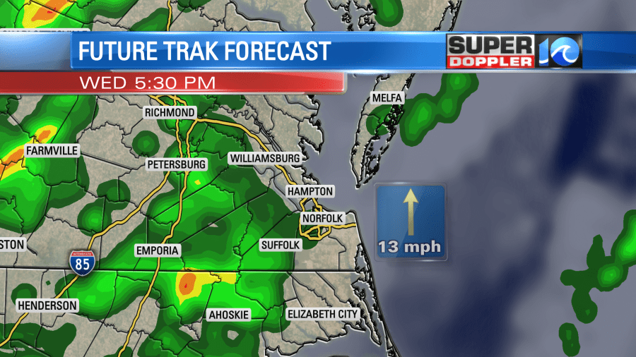
Overnight we’ll have widespread rain. There will be a few heavy downpours. The heavier rain will happen in larger pockets tomorrow morning and through the day Thursday.
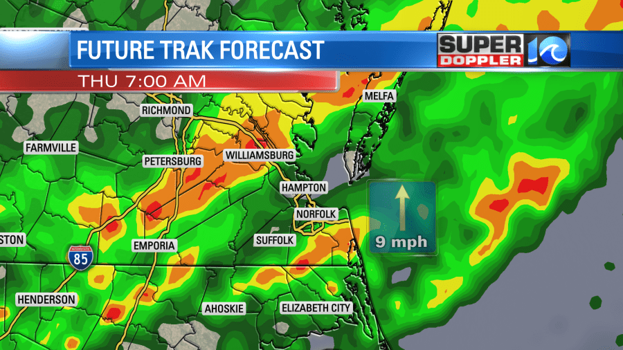
The cold front will slowly drop into the region. It will run into the tropical moisture that is in place.
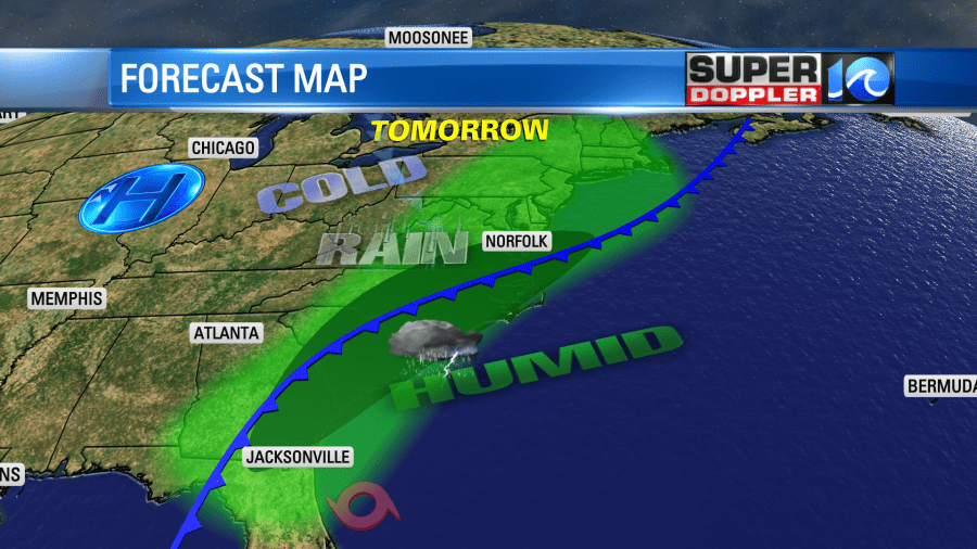
This deep moisture isn’t directly from Eta. It will actually fall apart to our south tomorrow into early Friday. (more on that in a moment). However, the moisture will make a strong push north of the system. This will enhance the rainfall in our area. The front will pass south of Hampton Roads during the afternoon. This will push the heaviest rain south into North Carolina.
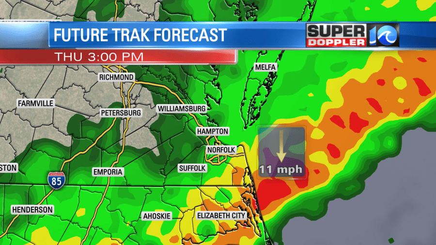
High temps will get knocked down into the low 70s Thursday. Rain will taper off during the evening. The cold front will drop to our south on Friday, but a few showers will linger behind the front. Then we’ll dry out on Saturday. High temps will be in the upper 60s Friday and low 60s on Saturday.
The heavy rain will create at least some localized flooding if not regional. The latest models are suggesting we will see a solid 2-4″. Some locations could see 5-6″.
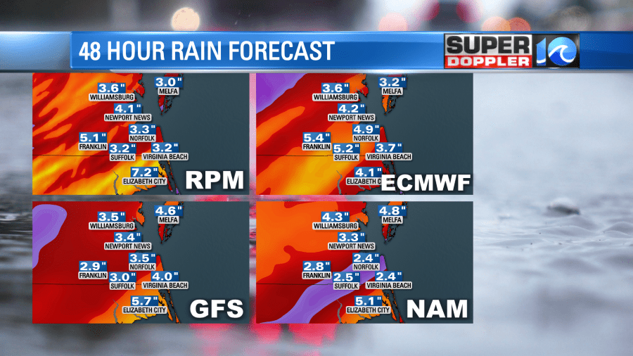
Most of this will be spread out over time, but the pockets of heavy downpours tomorrow will create that threat for flooding. I wouldn’t be surprised to see a Flood or Flash Flood Watch get posted by the National Weather Service, but there wasn’t one as of this writing.
Update: There is a Flash Flood Watch in effect now through Thursday evening.
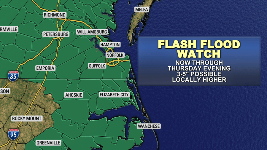
At least the wind doesn’t look too bad. It will be out of the south today at 5-15mph, and out of the north tomorrow at 5-15mph. So at least we won’t have to worry about tidal flooding and wind damage. A few thunderstorms will be possible late today and again tomorrow.
Now onto the tropics. Eta has been steadily moving north. It did gain some more strength since yesterday. So it did become a hurricane this morning. That is interesting because a lot of the tall thunderstorms around the storm have decreased in the last few hours.
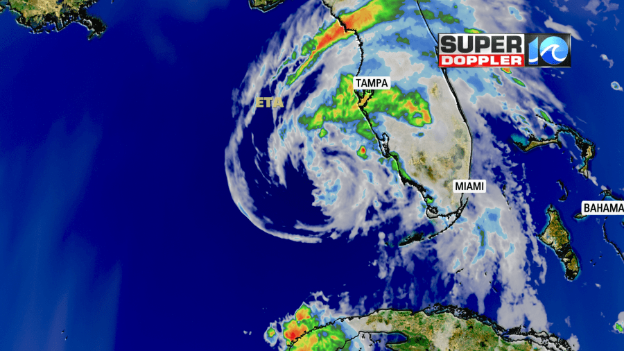
As Eta moves to the northeast it will start to encounter stronger wind shear and cooler water temps. so it is expected to weaken to a tropical storm before making landfall. The latest models now take it up through northern Florida and to the northeast.
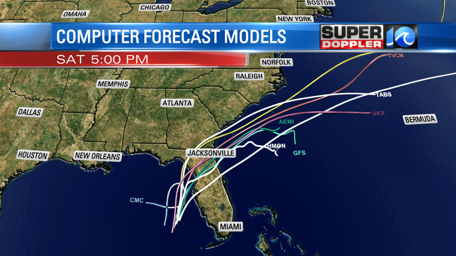
Eta will likely track past Jacksonville and then move offshore. By Friday it will get wrapped up into the cold front (mentioned above), and it will fall apart.
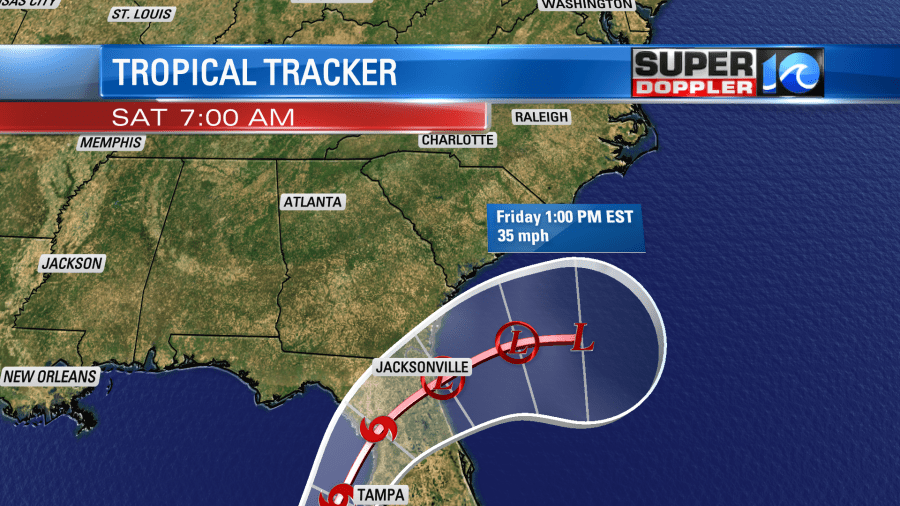
So again…The moisture will move north of the system, and that is why we are expecting flooding. It’s not directly from Eta itself.
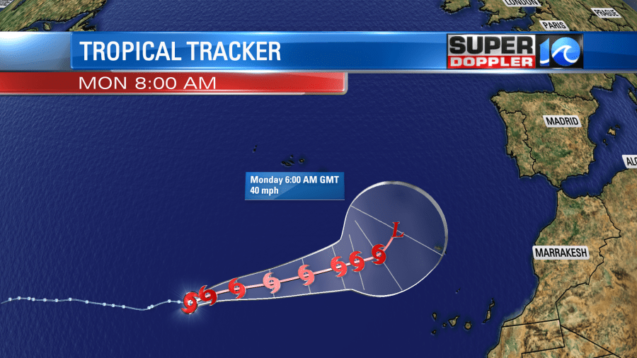
Meanwhile tropical storm Theta is in the eastern Atlantic. It did weaken a bit this morning. It is forecast to stay far from here, and it could become extra-tropical by Monday.
Finally, there is a weak tropical disturbance in the eastern Caribbean. It is moving west. It has a low chance of formation in the short-term, but a high chance of formation in the long-term. Could we have 3 simultaneous tropical systems in the Atlantic basin soon? I don’t think that’s ever happened in November, but it’s been that kind of year.
Stay tuned for updates on the potential for flooding. We’ll have them throughout the day.
Meteorologist: Jeremy Wheeler


